Gunma 群馬県
Gunma 群馬県
Maebashi 前橋市
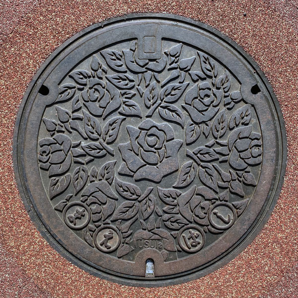
A manhole cover featuring the city flower, the rose.
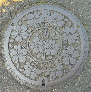
Design featuring the city flower, the azalea. The words "Maebashi" and "Gate Valve" are inscribed. The frame has a square pattern.
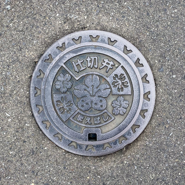
A valve cover decorated with azalea flowers.
Ogo 大胡町
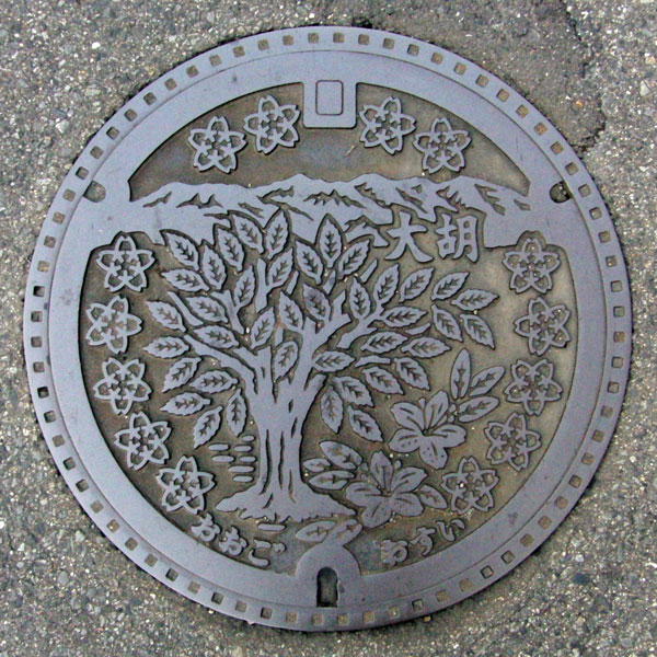
The manhole cover features a design of the town's tree, the zelkova, and its flower, the azalea, against the backdrop of the Akagi Mountains.
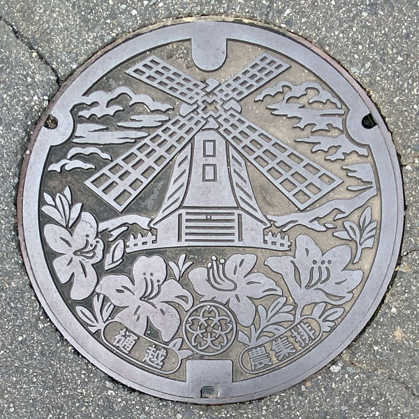
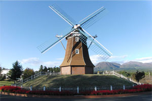
A manhole cover for agricultural wastewater in the Higoshi district, depicting a Dutch-style windmill at the "Green Flower Ranch Ogo" roadside station and the town flower, the azalea.
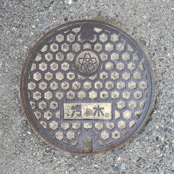
A small sewage manhole cover with a tortoiseshell pattern. The Ogo town emblem is on the top. There were several similar covers in the surrounding area, but the area where the town emblem should have been was blank; this was the only one with the emblem.
Miyagi 宮城村
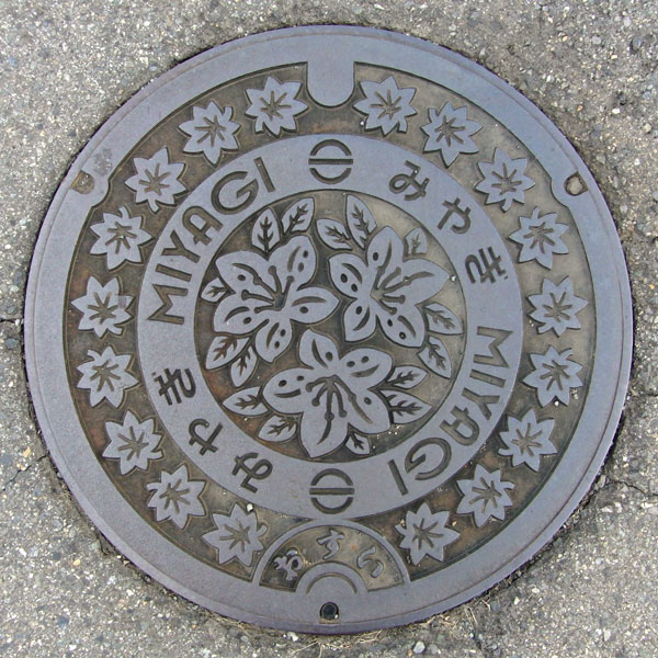
The manhole cover features the village tree, the "maple," around the perimeter, and the village flower, the "azalea," in the center.
Kasukawa 粕川村
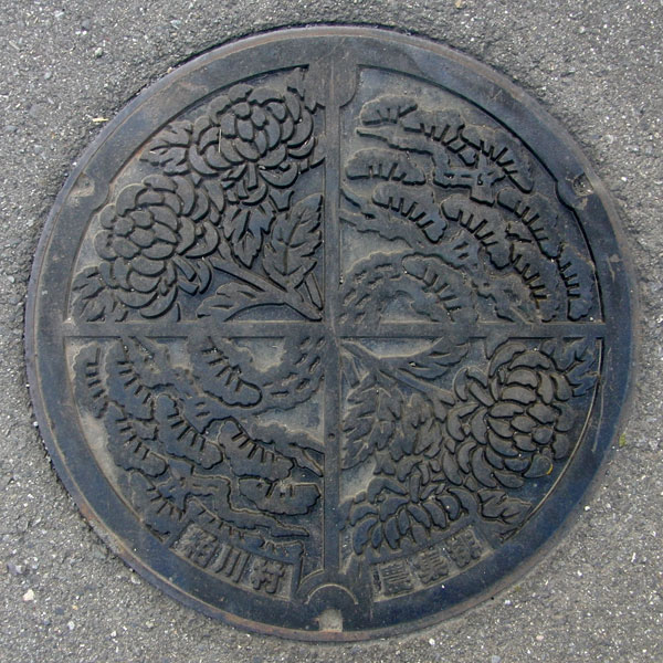
A manhole cover for agricultural wastewater featuring the village flower, the chrysanthemum, and the village tree, the pine.
Fujimi 富士見村
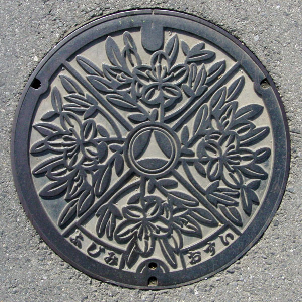
The village flower, the Rhododendron molle, is depicted. The village emblem is in the center.
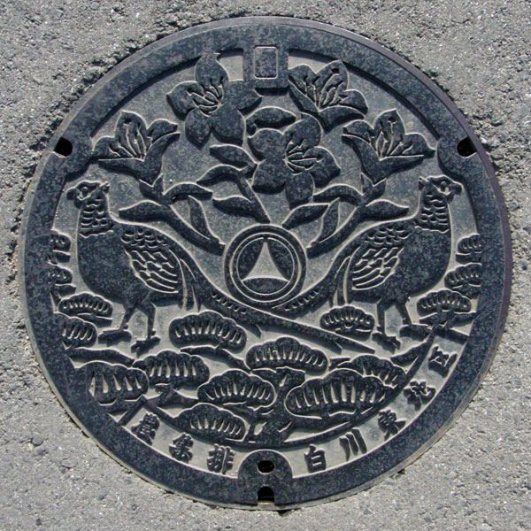
A manhole cover for agricultural wastewater treatment plants in the Shirakawa Higashi district, depicting the village flower "Rhododendron molle," the village tree "Japanese black pine," and the village bird "pheasant." The village emblem is in the center.
Numata 沼田市
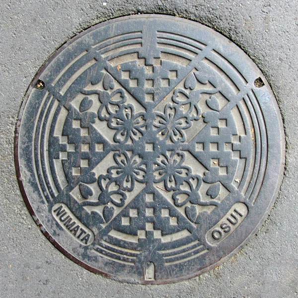
A manhole cover for sewage, depicting the city flower, the cherry blossom.
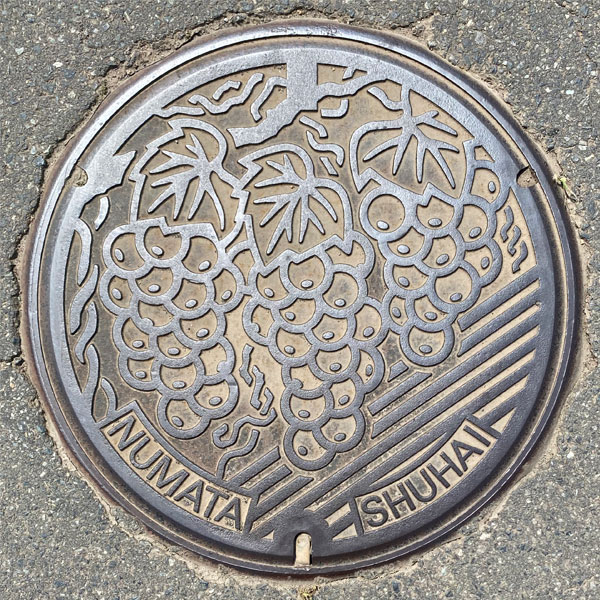
A manhole cover from the Nara district's agricultural wastewater system, depicting the area's specialty, grapes. Signs for vineyards and farms lined both sides of the road.
Shirasawa 白沢村
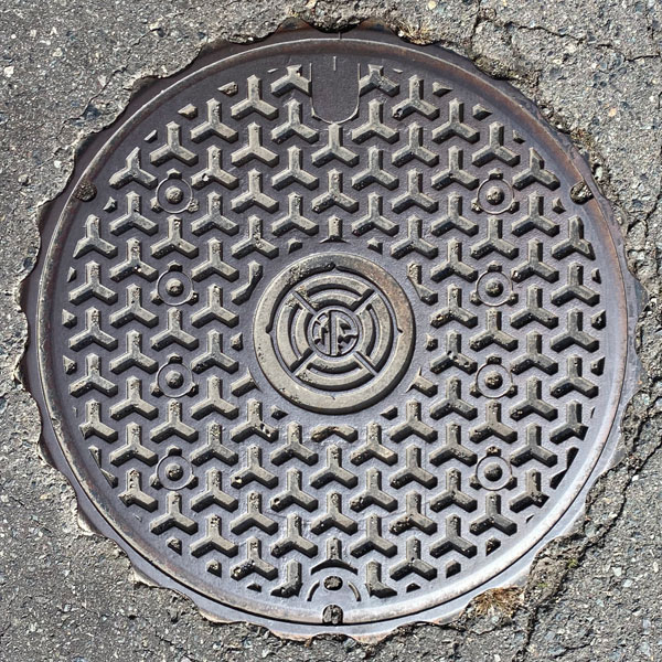
Manhole cover for agricultural wastewater treatment in the Hiraide district.
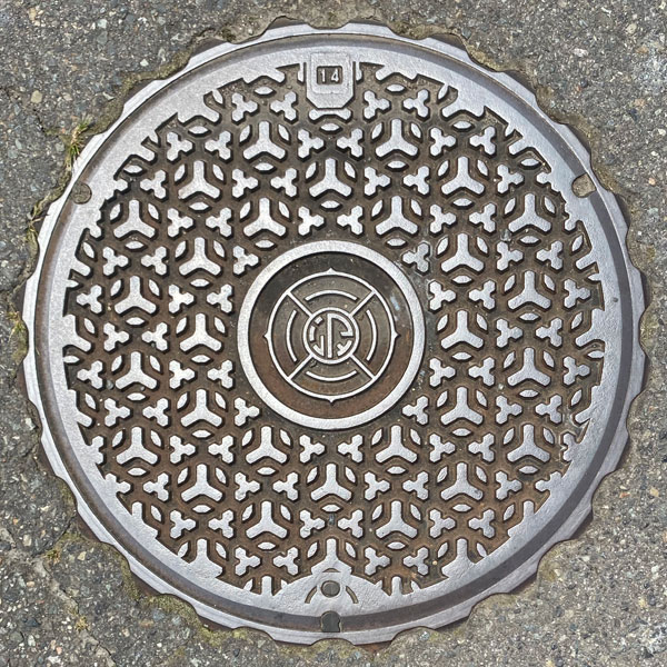
A cover for the Special Environmental Protection Public Sewerage System (Tokukan) in the Shirasawa treatment area.
Tone 利根村
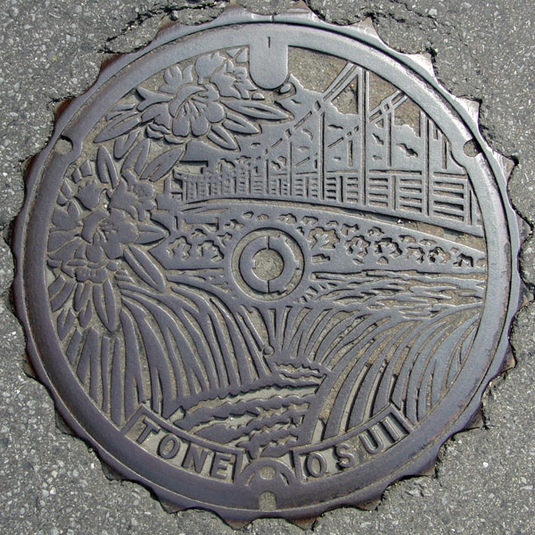
A special environmental manhole cover in the Tone River treatment area. The design depicts the "Fukiware Falls" on the Katashina River, the "Ukishima Bridge" upstream, and the village flower, the "rhododendron."
Midori みどり市
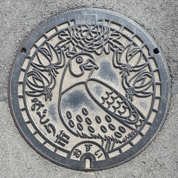
A manhole cover for sewage, depicting the city's flowers (chrysanthemum and dogtooth violet) and bird (pheasant).
Kasakake 笠懸町
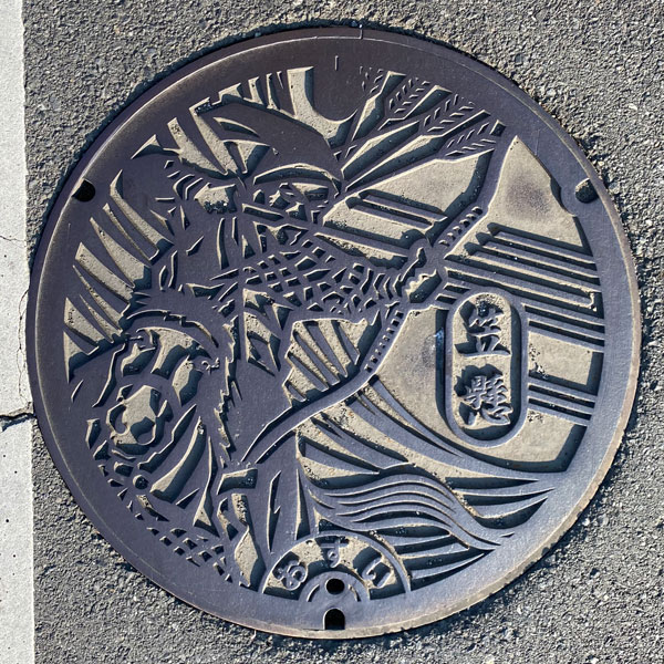
The design depicts "Kasagake," a form of mounted archery where archers shoot whistling arrows at targets from horseback while galloping. It is considered one of the three major mounted archery disciplines, alongside Yabusame and Inuoumono. It is the origin of the town's name.
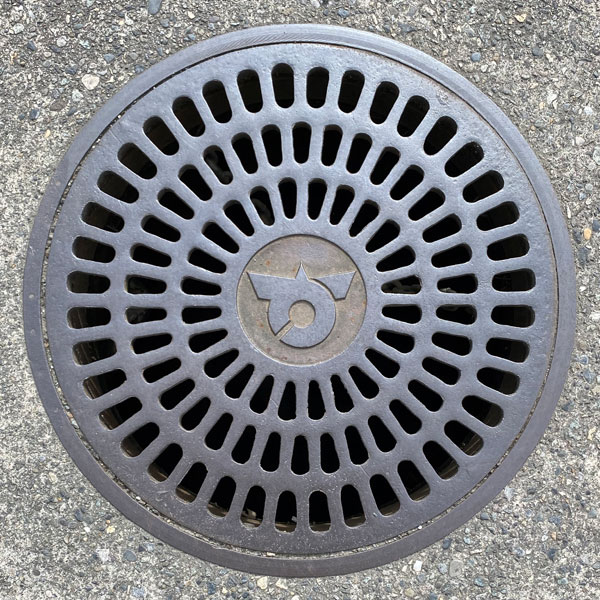
A manhole cover with the town emblem in the center. It's for rainwater, and you can see the water through the gaps.
Omama 大間々町
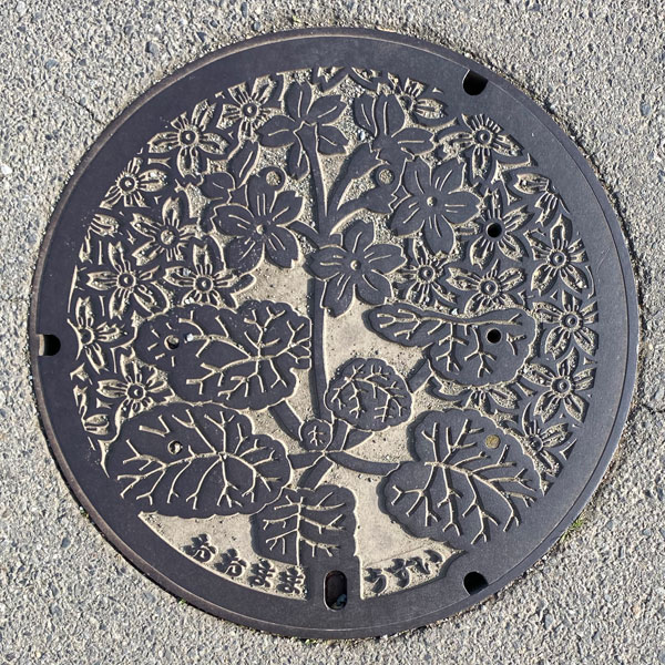
A manhole cover featuring the town's official flower, the primrose.
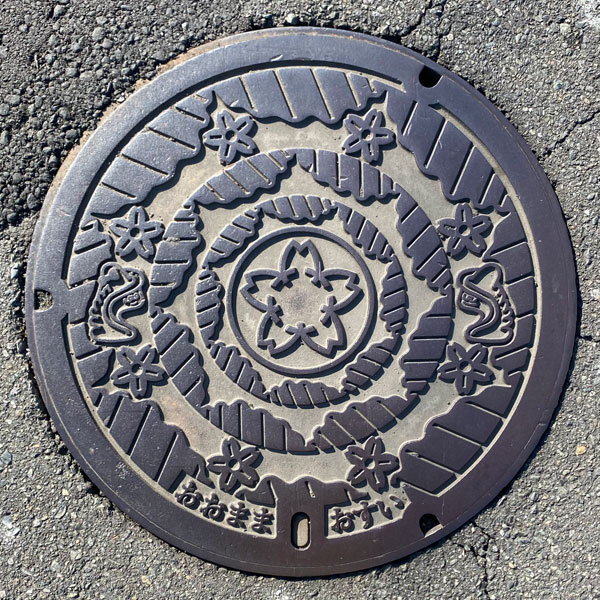
Similar to the one above, this is a manhole cover with a primrose design, but the specifications of the opening/closing mechanism holes are different, and the word "Usui" is written to the right.
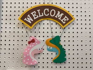
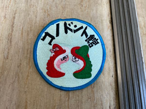
On the top lid are the Omama Museum's mascot characters, "Konoko-chan" (left) and "Dont-kun" (right).
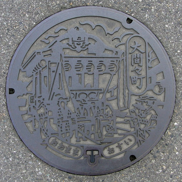
The Omama Gion Festival, affectionately known as "Ogyon," boasts a history of over 370 years and is counted among the three major Gion festivals of Joshu (Gunma Prefecture). It features traditional events such as float processions, folk dances, and the galloping of sacred horses.
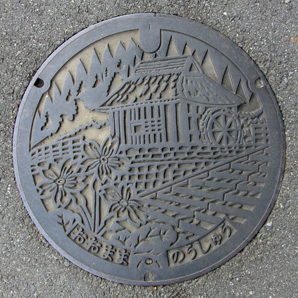
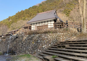
Further along Prefectural Road 334, you'll find the "Kodaira Limestone Cave," and beyond that, the "Kodaira Waterfront Park." In one corner of the park is the "Noguchi Waterwheel Preservation Museum." The waterwheel is said to still be in operation. This is a manhole cover for agricultural wastewater in the Fukuoka Central district.
Shibukawa 渋川市
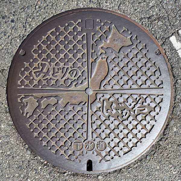
A manhole showing the coordinates.
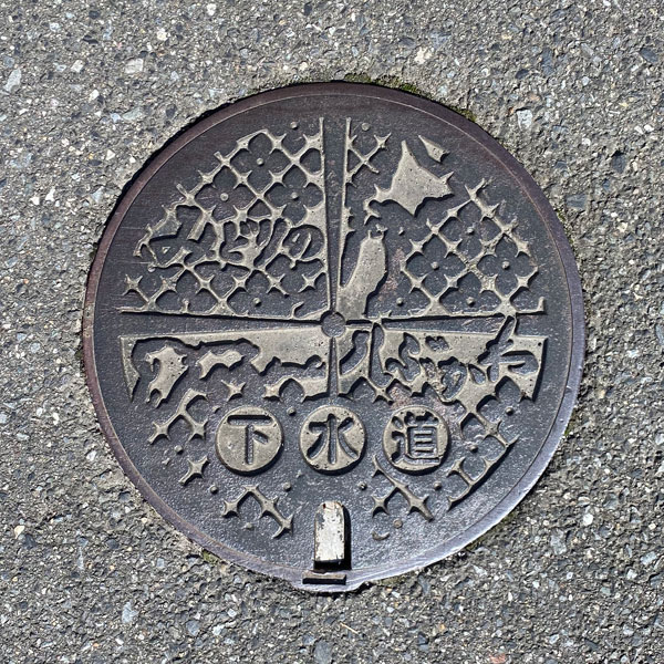
A smaller version with the same design as above.
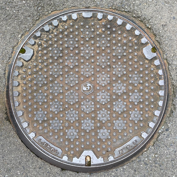
The cover has many sharp protrusions, like spikes. The new city emblem, featuring an "S" motif, is in the center.
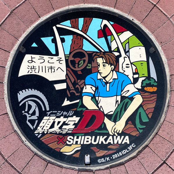
The manhole cover depicts Takumi Fujiwara and his AE86 with Shibukawa Station Plaza in the background. It is featured on a manhole cover card.
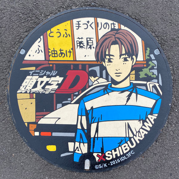
Takumi Fujiwara and his AE86 parked in front of Fujiwara Tofu Shop. His father, Bunta, is not visible.
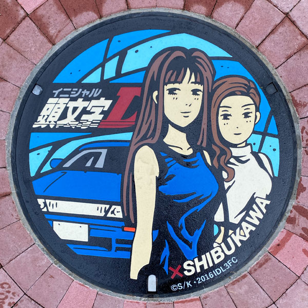
The impactful blue of Usui Pass, Mako Sato and Sayuki in a SilEighty (a vehicle with the front of a Silvia attached to the body of a Nissan 180SX).
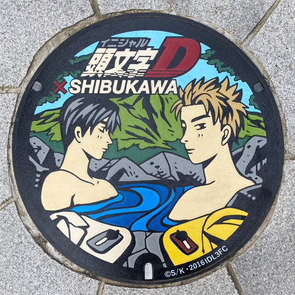
The Takahashi brothers (Ryosuke and Keisuke) soaking in a hot spring. If we're talking bathing scenes, Mako and Sayuki would be better... Climbing these stairs was tough.
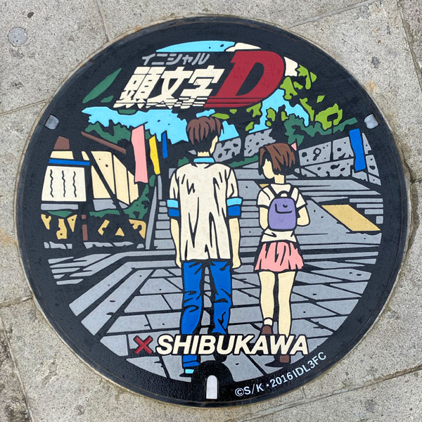
Takumi Fujiwara and Natsuki Mogi are walking in Ishidanshita Plaza. The manhole cover is located around where the two are standing.
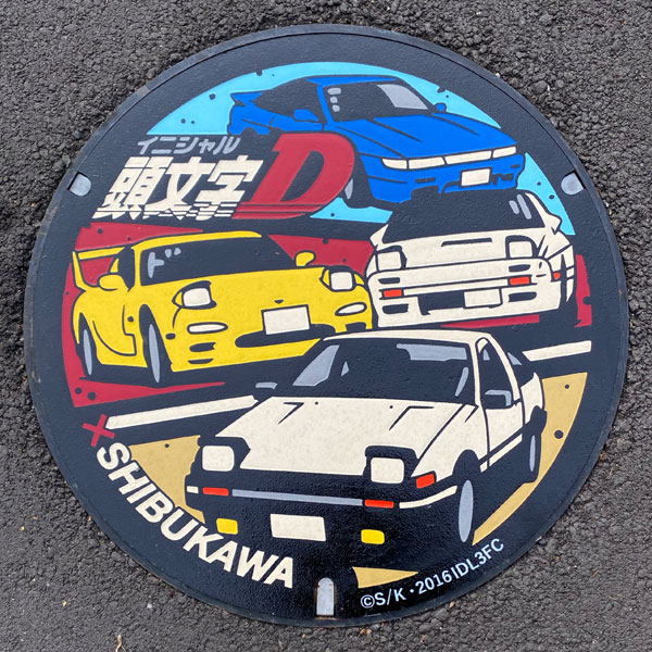
From top to bottom: Sileighty, FD (RX-7) and FC (RX-7), and AE86. I parked my car in this parking lot and drove around the hot spring town looking for manhole covers.
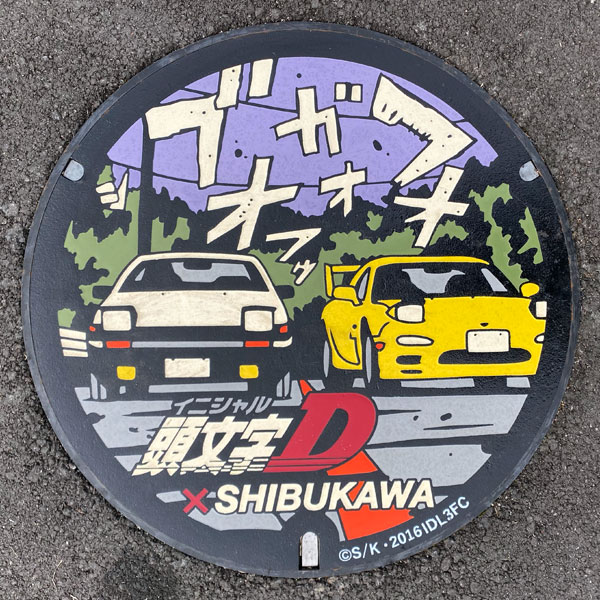
The AE86 and FD (RX-7) just before starting at Yaseone Pass. They are about 8km away from the cover shown above.
Shibukawa 渋川市
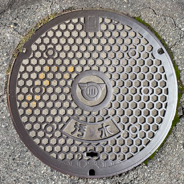
A manhole cover for sewage with a tortoiseshell pattern. The former Shibukawa City emblem is in the center.
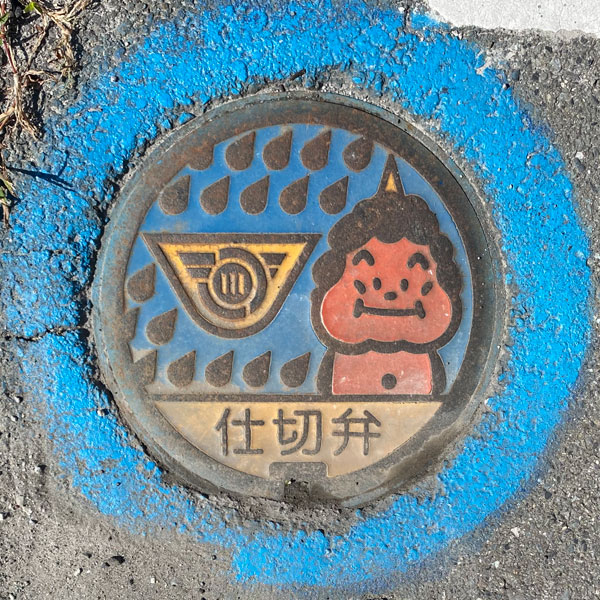
A gate valve cover bearing the former Shibukawa City emblem.
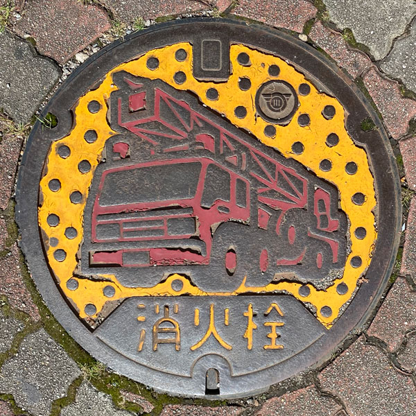
A fire hydrant cover depicting a fire truck. It features a yellow background with scattered small circular protrusions. The former Shibukawa City emblem is in the upper right corner.
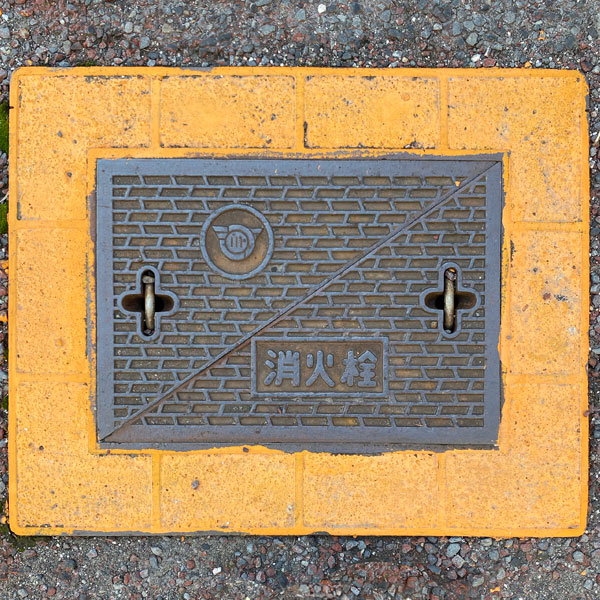
A square fire hydrant cover with a pattern resembling a sideways lottery drawing and featuring the former Shibukawa City emblem. The yellow area around it also has a textured surface.
Ikaho 伊香保町
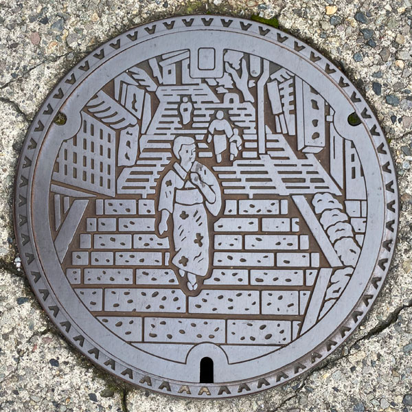
This is a manhole cover showcasing the iconic "Stone Staircase Street" of Ikaho.
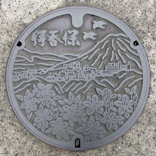
It depicts the Ikaho Onsen hot spring resort at the foot of Mt. Haruna and the town flower, the azalea.
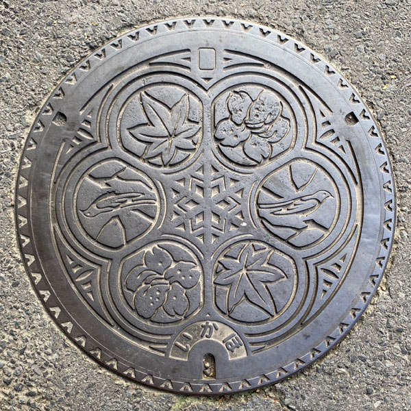
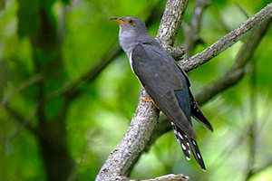
The former town of Ikaho had its town tree, the maple, its town flower, the azalea, and its town bird, the cuckoo.
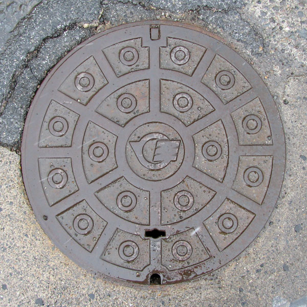
A miniature manhole cover featuring the former town emblem of Ikaho, which is a stylized version of the cursive character "伊".
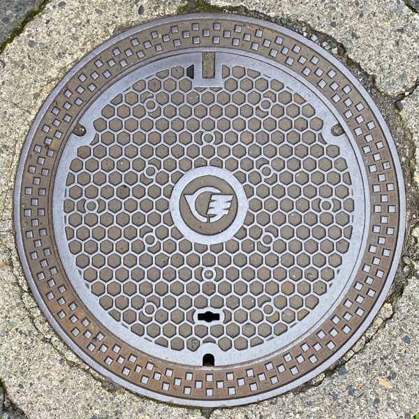
The town emblem of Ikaho is in the center of a delicate tortoiseshell pattern. It comes with a wide frame.
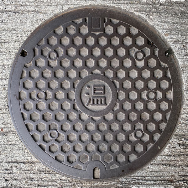
The character "温" (on, meaning "warmth") is written in a circle in the center of a thick, tortoise-shell pattern. It is unclear whether it is a hot spring or wastewater being discharged.
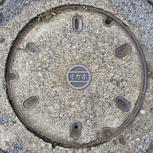
"Ikaho" is written in a circle in the center of the concrete area.
Onogami 小野上村
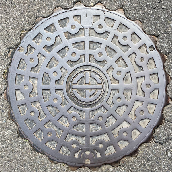
A manhole cover with a standard pattern design. The village emblem is in the center.
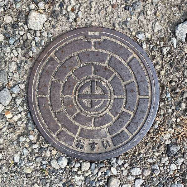
A manhole cover with the village emblem in the center. The word "sewage" is written at the bottom.
Komochi 子持村
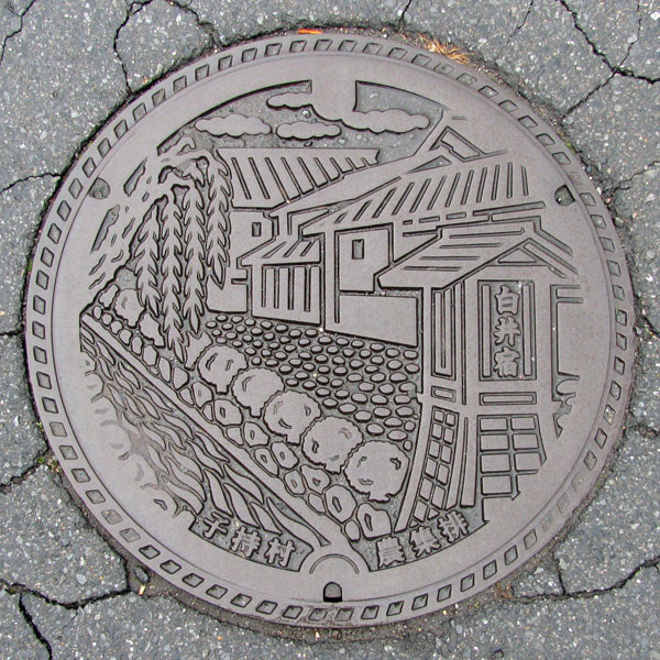
A manhole cover for agricultural wastewater in the "Shirai-Fukiya area."
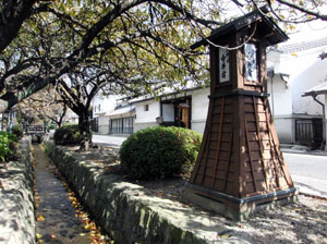
National Route 17 branches off into the Mikuni Kaido and the Koizawa Bypass in Shibukawa City. About 2 km along the Koizawa Bypass is the "Komochi" roadside station, and behind it is "Shirai-juku." Although called a "post town," it was apparently a castle town of Shirai Castle from the 15th to 17th centuries. It gained attention in the mid-1970s for its charm and was renovated as part of a "village revitalization" project.
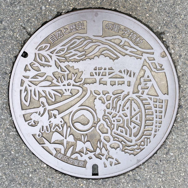
This is a manhole cover for the designated environmentally protected public sewer system in the "Koizawa/Fukiyahara area."
The image depicts a scene with a clear stream flowing with Mount Komochi in the background, and a parent and child strolling beside a watermill. The words "Komochi Village, a Village of Nature and History" are at the top, and "Koizawa/Fukiyahara" at the bottom. Koizawa is located west of Shirai-juku, and Fukiyahara is to the north. The image likely depicts a view from this area.
Slightly below the center is the former Komochi Village emblem. The emblem is shaped like the Japanese character "Ko" (コ) from Komochi Village, with the circle representing the village's harmony, and the inside representing Mount Komochi and the confluence of the Tone River and Agatsuma River in the southern part of Komochi Village.
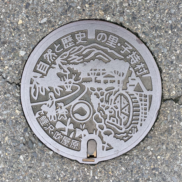
A smaller version with the same design as above. Some parts are hidden to ensure sufficient font size, but it largely maintains the design of the standard size.
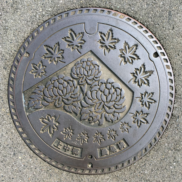
This is a manhole cover for the agricultural wastewater treatment plant in the Kaminakago district.
While the village tree, the maple, and the village flower, the chrysanthemum, are prominent, the entire design actually incorporates the village emblem. The words "Kaminakago" and "Agricultural Wastewater Treatment Plant" are at the bottom. The design is the same as that of the Shimonakago district.
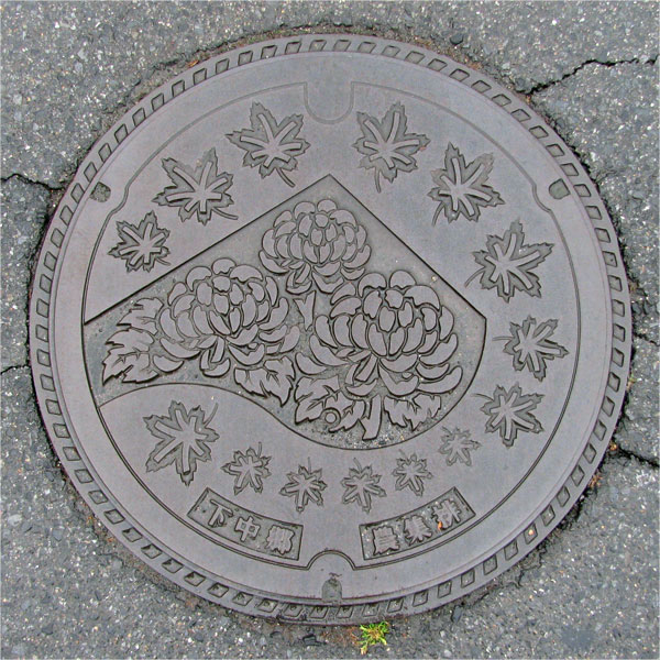
This is a manhole cover for the agricultural wastewater treatment plant in the Shimonakago district.
While the village tree, the maple, and the village flower, the chrysanthemum, are prominent, the entire design actually incorporates the village emblem. The words "Shimonakago" and "Agricultural Wastewater Treatment Plant" are inscribed at the bottom. The design is the same as that of the Kaminakago district.
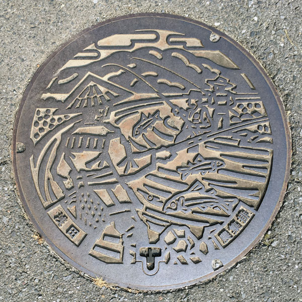
This is a manhole cover from the Asada district depicting a fisherman fishing for ayu (sweetfish) in the Tone River with Mount Komochi in the background.
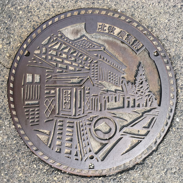
A manhole cover for agricultural wastewater in the "Kitamaki" area.
The image depicts the scenery of "Kitamaki-juku" on the old Mikuni Highway. The words "Kitamaki Agricultural Wastewater" are at the top. The Shibukawa City Komochi Chamber of Commerce website states that it is located at "Kitamaki Kawara, where the old Mikuni Highway and National Route 353 intersect."
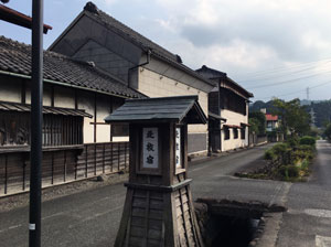
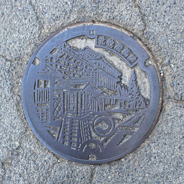
A smaller version of the Kitamaki district agricultural wastewater treatment panel, with the same design as above.
Akagi 赤城村
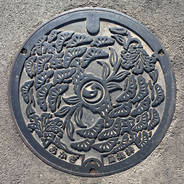
Designed with the former Akagi Village tree "pine" and village flower "mountain lily." The Shibukawa City emblem has been replaced in the center of this agricultural drainage manhole cover.
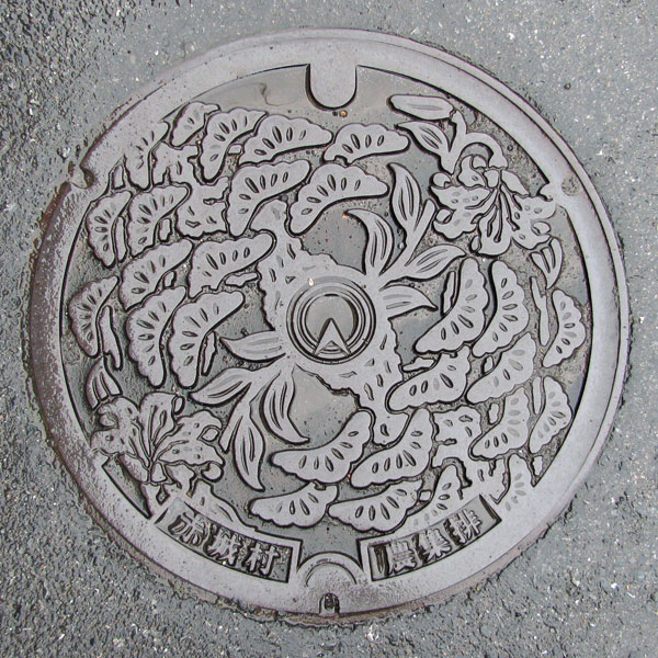
Designed with the former Akagi Village's tree, the pine, and its flower, the mountain lily. The former village emblem, a stylized "A" representing the initials of Akagi Village, is in the center.
Kitatachibana 北橘村
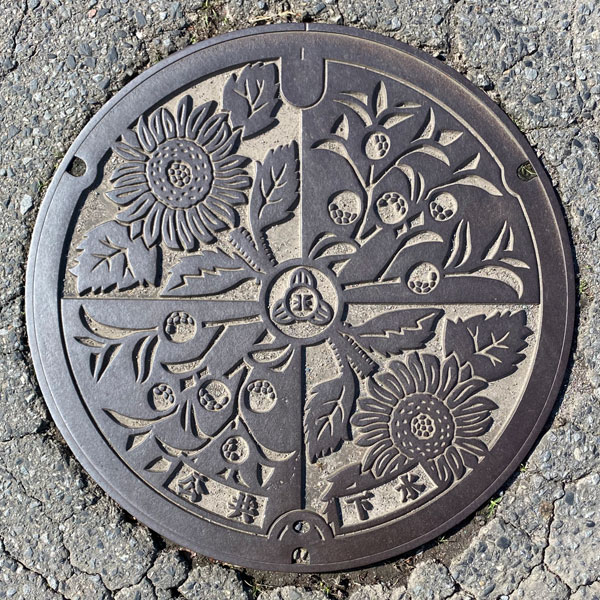
This is a manhole cover of the Kitatachibana Village type, depicting the village tree "Nippon Tachibana" and the village flower "Sunflower."
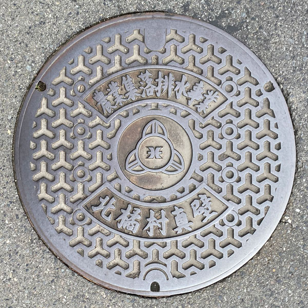
This is a manhole cover for agricultural wastewater treatment in the Makabe district. It features the former Kitatachibana Village emblem in the center of a Bishamon tortoise shell pattern, with the words "Agricultural Community Wastewater Treatment Project" and "Makabe, Kitatachibana Village" above and below it.
Takasaki 高崎市
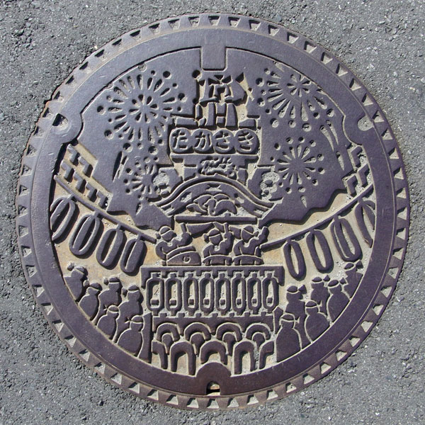
A manhole cover depicting a Takasaki Festival float.
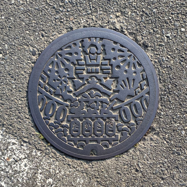
A simplified version of the above design, a lid sized for a handhole.
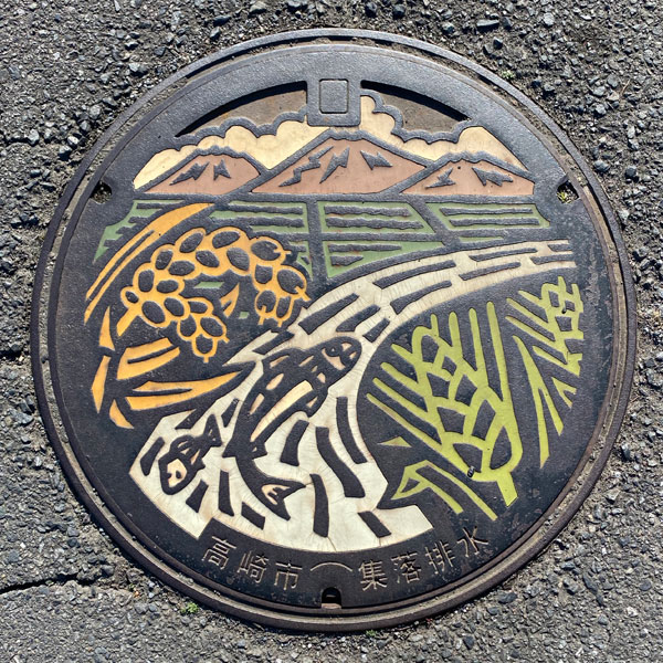
Manhole for the Rakuma Gyōriki settlement wastewater treatment.
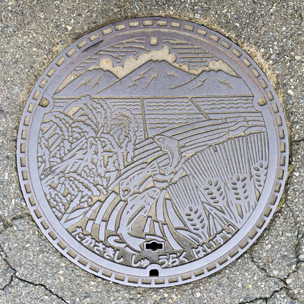
This is a manhole cover for the Hamakawa settlement's drainage system.
If it follows the design of Gunma Prefecture's manhole covers, the distant view is likely the Jomo Three Mountains. The design depicts a rural landscape with fish leaping from a river, rice fields on the left, and wheat on the right.
Misato 箕郷町
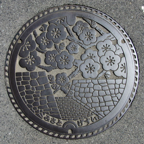
The lid depicts the stone walls of the ruins of Minowa Castle, one of Japan's 100 most famous castles, and the plum blossoms of the Minowa Plum Grove.
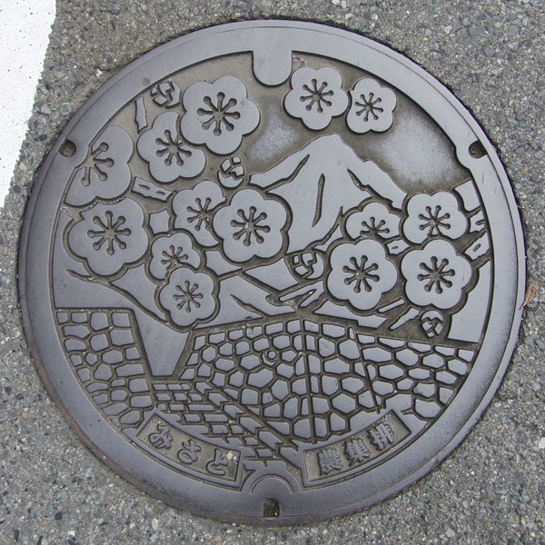
A manhole cover for the Zenchi settlement's drainage system. It has the same motif as the cover above, but with the addition of Mount Haruna. Prefectural Road 126 is located west of the Minowa Castle ruins and connects Minosato and Mount Haruna.
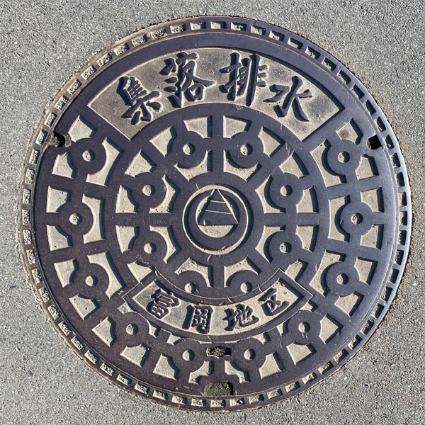
This is a manhole cover for agricultural drainage in the Tomioka district, featuring the Misato town emblem in the center of a standard pattern. The words "Community Drainage" are prominently displayed at the top, and "Tomioka District" is written below the town emblem.
Gunma 群馬町
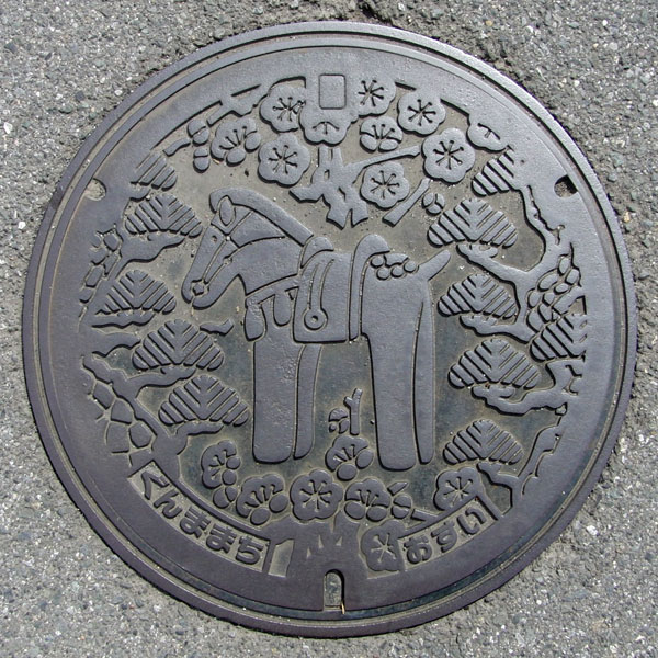
The design features the town's flower, the plum tree, the pine tree, and a horse-shaped haniwa clay figure. Three statues were placed in front of the branch office.
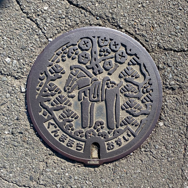
A small, handhole-sized drain for wastewater, with the same design as above.
Shin 新町
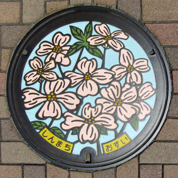
A manhole cover featuring the town's official tree, the dogwood.
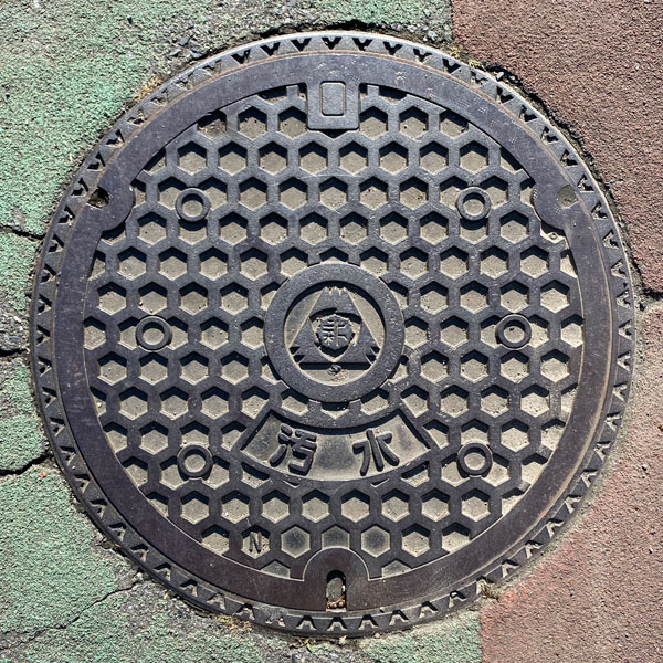
A manhole cover for sewage with a tortoiseshell pattern. The old town emblem is in the center.
Haruna 榛名町
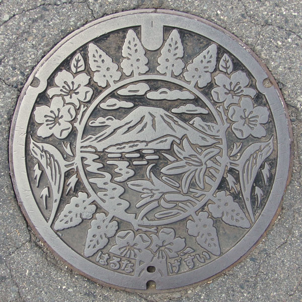
The manhole cover depicts Haruna Fuji, the central crater cone of Mount Haruna, the town flower "dayflower," the town flower "pear," the town tree "cedar," and, though difficult to see without paint, a wagtail (yellow wagtail).
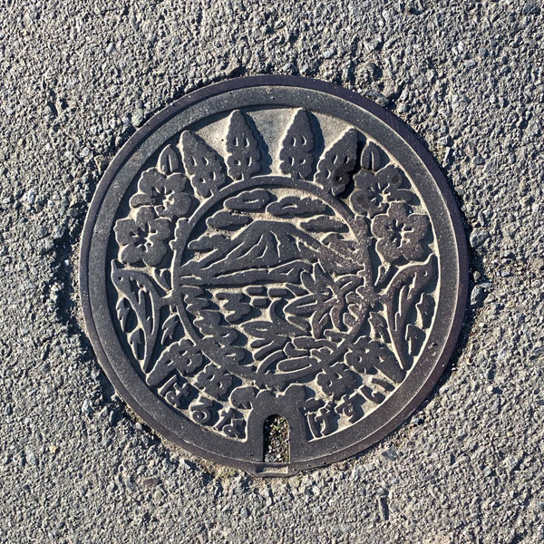
A smaller version with the same design as above.
Yoshi 吉井町
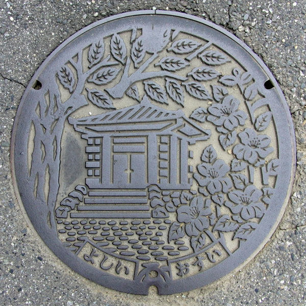
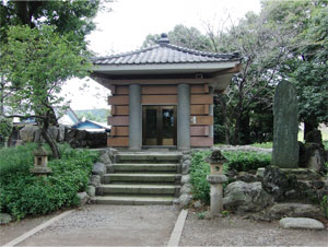
This manhole cover depicts the protective structure housing the "Tago Monument," an ancient monument (epigrapha) believed to have been erected in the late 8th century, along with the town's tree, the zelkova, and its town flower, the camellia.
Kiryu 桐生市
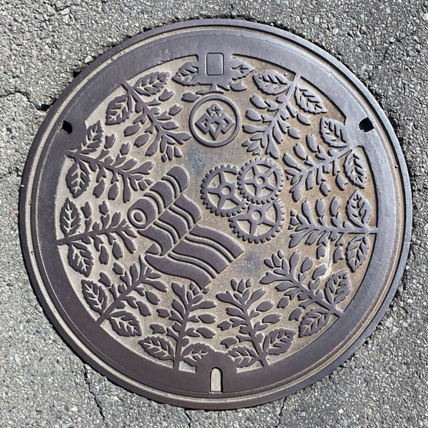
Kiryu City is known for its thriving textile and machinery/metalworking industries. The image depicts bolts of cloth, gears, and the city flower, salvia. The city emblem is located in the upper center.
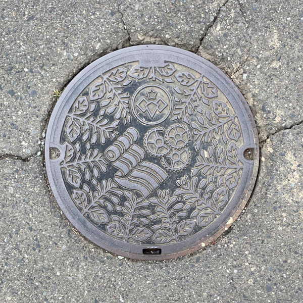
A smaller version of the same design as above.
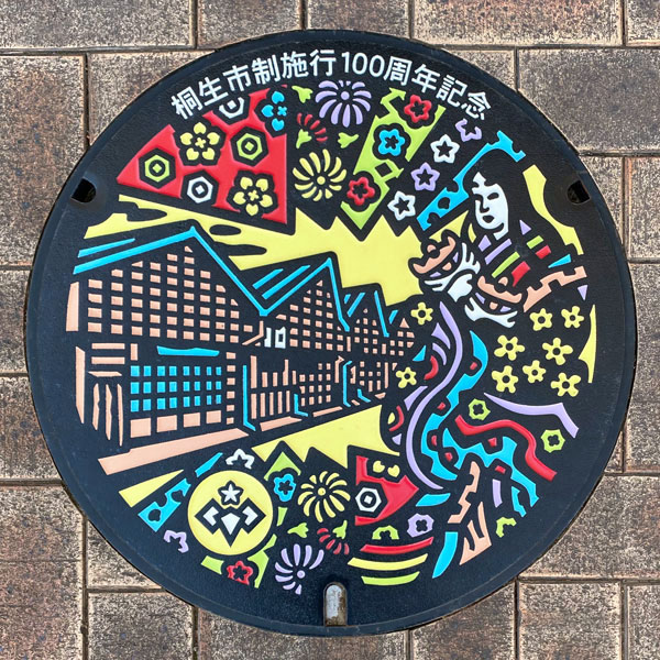
This manhole cover commemorates the 100th anniversary of the city's incorporation and is designed with motifs from the "Shiratakihime Legend," which says that silk weaving techniques were introduced from the Yamato region, and the "Sawtooth Roof Factory," a symbolic building of Kiryu textiles.
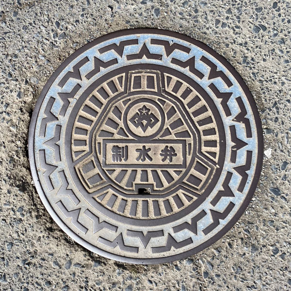
A water control valve cover bearing the city emblem.
Niisato 新里村
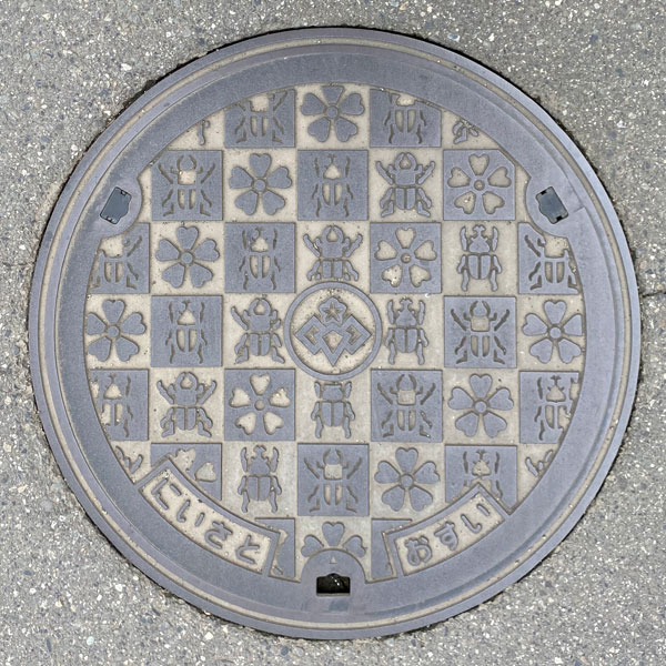
This manhole cover features an insect design from the former Niisato Village, with the village emblem replaced by the Kiryu City emblem.
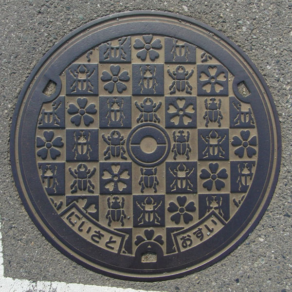
The lid is decorated with illustrations of rhinoceros beetles, stag beetles, and the village flower, the primrose. The Niisato district is home to the Gunma Prefectural Insect Forest, which opened on August 1, 2005. The former Niisato Village emblem is in the center.
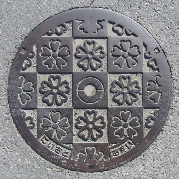
The village flower, the primrose, is depicted. The former Niisato Village emblem is in the center.
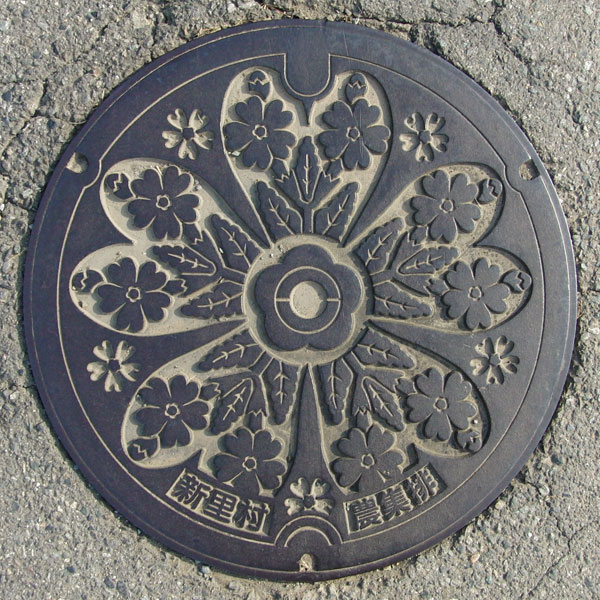
A manhole cover for agricultural wastewater treatment facilities at the Jusanzuka Drainage Treatment Facility (Shinkawa and Takei districts), depicting the village flower, the primrose. The bifurcated circle within the central petal represents the village emblem, a stylized representation of the Japanese character "二" (ni).
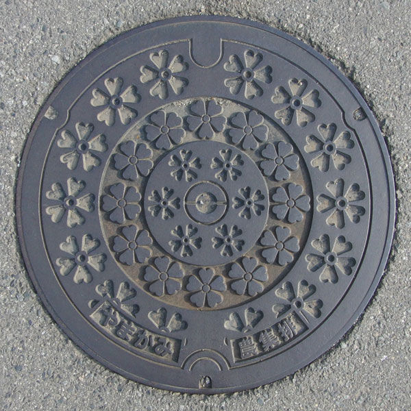
This is also a manhole cover from the Yamagami wastewater treatment facility, featuring the village flower, the primrose, as its motif. This particular manhole cover has a triple layer of primrose flowers depicted on it.
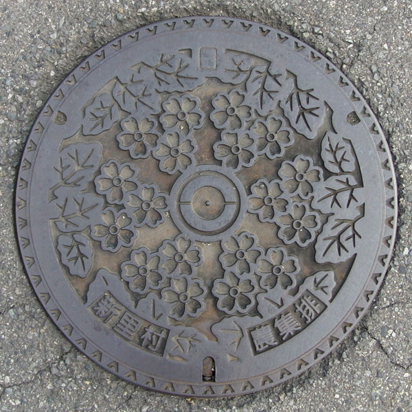
This one also features a design of "primroses." The manhole cover for the "Seki-Okubo" treatment area has six primrose plants depicted facing inward.
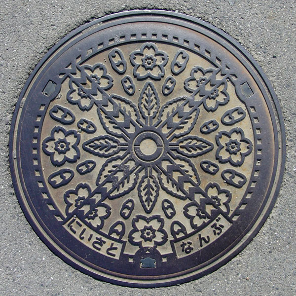
This is also a manhole cover from the Niisato Southern Drainage Treatment Facility, featuring a design of primroses.
Annaka 安中市
Annaka 安中市
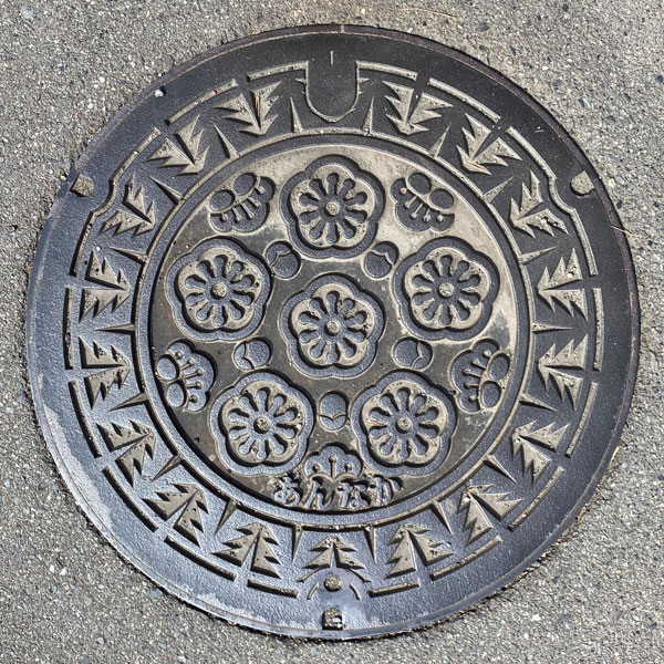
A manhole cover depicting the city flower, the plum blossom, and the city tree, the cedar.
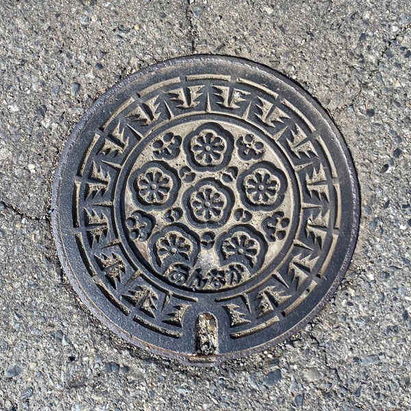
A smaller version of the above design. The number of cedar trees is reduced, and the number of stamens is also fewer.
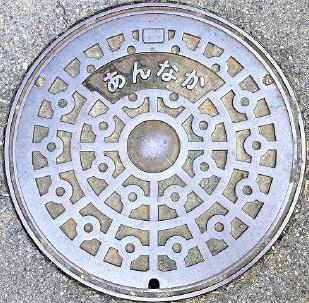
This is a JIS-compliant manhole cover with the word "Annaka" written above the center.
Matsuida 松井田町
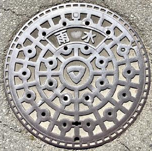
JIS standard perforated manhole cover, with the town emblem in the center and the word "Rainwater" above.
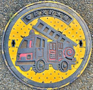
A cartoonish design of a fire truck, with the town emblem and the words "Firefighting Water Tank" at the top.
Isesaki 伊勢崎市
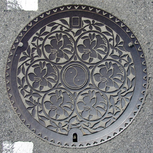
The design features the city flower, the azalea. The city emblem consists of two magatama (comma-shaped beads) combined in the center to form the Japanese character "i".
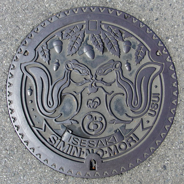
This is a rainwater manhole cover at Isesaki Citizens' Forest Park. It depicts acorns, squirrels, and mushrooms.
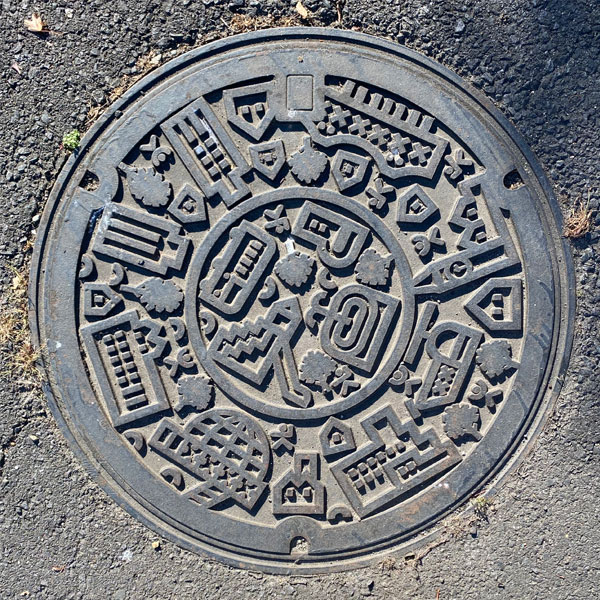
Manhole cover in an industrial park.
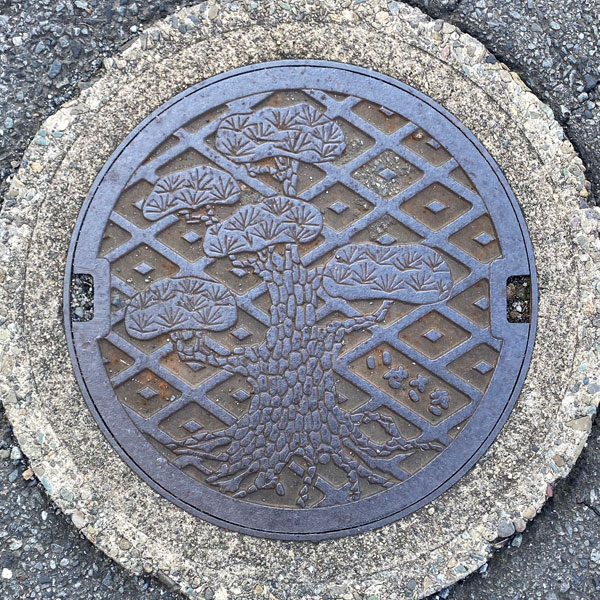
A manhole cover for sewage, featuring a background pattern of diagonal lattices interspersed with diamond shapes, and depicting the city's official tree, the pine.
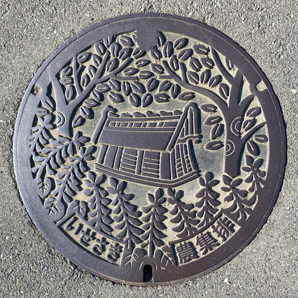
This is a manhole cover for agricultural wastewater treatment plants, featuring a design from the former Akabori town, but the text on the lower left reads "Isesaki".
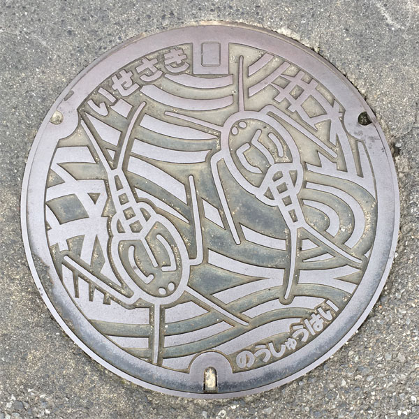
The manhole cover for the agricultural community drainage system in the Misato district features a tadpole shrimp design, and the frame has a V-shaped pattern.
Sakai 境町
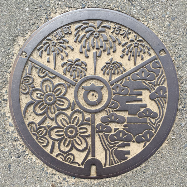
In the center is the former town emblem of Sakai Town. The upper part, which is divided into three sections, depicts fireworks and the words "Sakai Town" and "Sewage," the lower left shows the town flower "Daffodil," and the lower right shows the town tree "Japanese Black Pine."
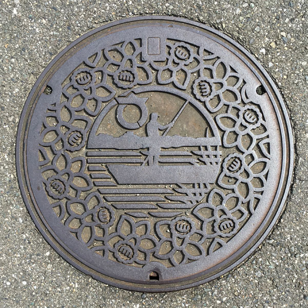
The former Sakai town emblem and ferry boat are depicted in the center, surrounded by the town flower, the daffodil.
Azuma 東村
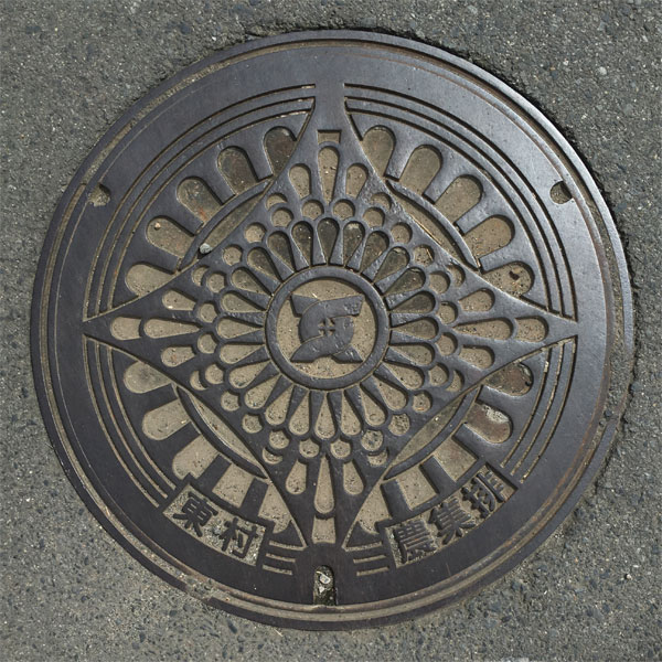
This is a manhole cover for the agricultural community drainage system in the eastern part of Azuma district, featuring the former Higashimura village emblem in the center.
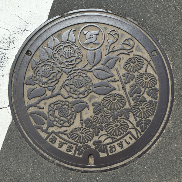
This is a manhole cover for agricultural settlement drainage in the Azuma National District, featuring the former Higashimura village emblem at the top center. The village tree, the camellia, is depicted in the upper left, and the village flower, the chrysanthemum, is depicted in the lower right.
Akabori 赤堀町
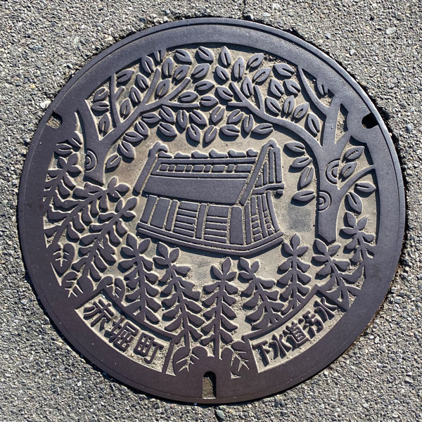
This is a manhole cover for public sewage, depicting the town's tree, the zelkova, at the top, the town's flower, the salvia, at the bottom, and a house-shaped haniwa (clay figure) in the center. The house-shaped haniwa was excavated from the Akabori Chausuyama Kofun (ancient burial mound) in Akabori Imai-cho 2-chome.
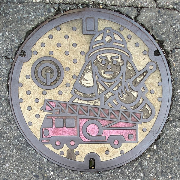
A fire hydrant cover featuring the old Akabori town emblem, which looks like an inverted power symbol. It's actually a stylized version of the Japanese katakana character "ア".
Ota 太田市
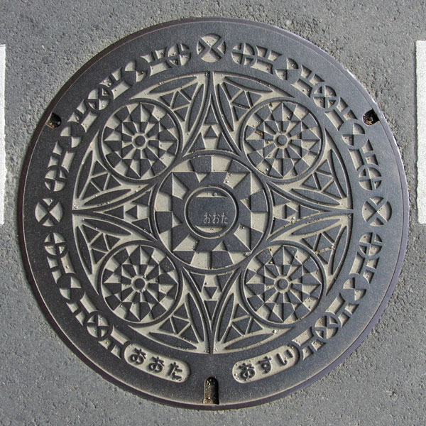
The manhole cover has the same design as the one used in the former Ota City, but the new Ota City emblem has the word "Ota" in the center.
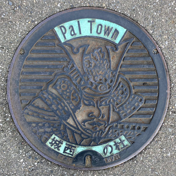
This is a manhole cover for sewage at the community plant of "Pal Town Jōsai no Mori," a housing complex built in Jōsai-chō, Ota City.
The front of the cover depicts Nitta Yoshisada, who overthrew the Kamakura Shogunate. The green section contains the words "Pal Town" and "Jōsai no Mori," and the bottom is inscribed with the words "Ōta" and "Osui" (sewage).
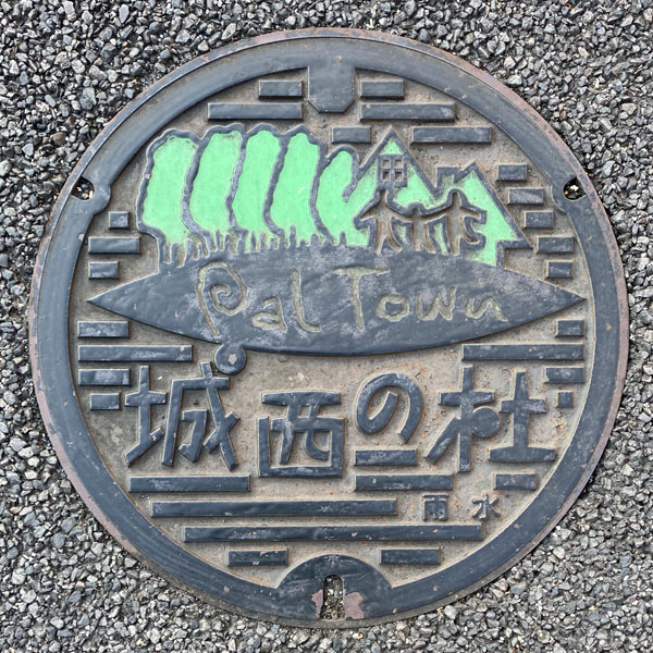
This is a rainwater manhole cover from the community plant of "Pal Town Jōsai no Mori," a housing complex built in Jōsai-chō, Ota City.
The words "Pal Town" are engraved on a hill-like area with trees, and there are three figures that appear to be a family. Below them, "Jōsai no Mori" is written in large letters. This may be a symbol mark. The word "Rainwater" is written in the lower right corner.
Ota 太田市
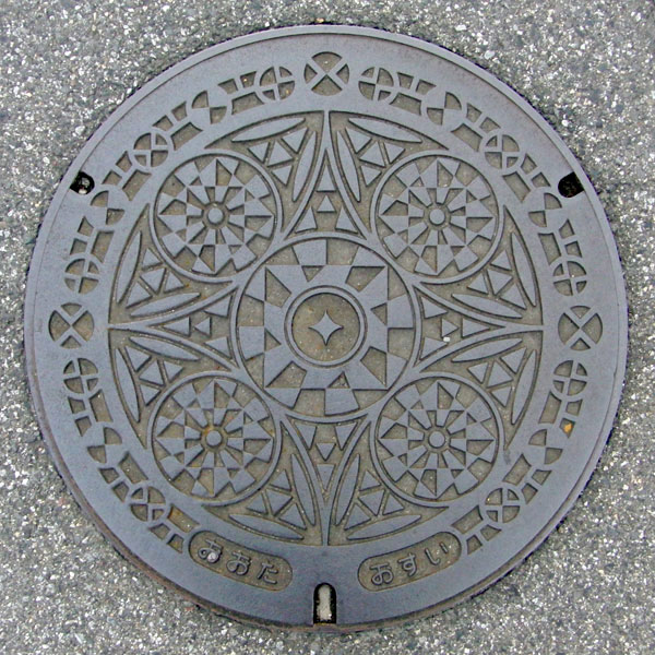
This appears to be a typical design for Ota City, with the city emblem in the center and a geometric pattern of the same shape surrounding it. The city flower, the chrysanthemum, seems to be incorporated into the geometric pattern.
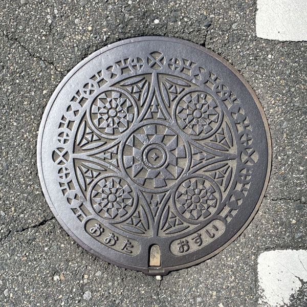
A smaller version with the same design as above.
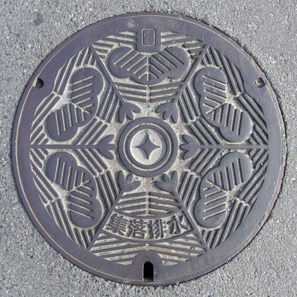
This is a common drainage system for community wastewater in Ota City. It features a pine tree, the city's symbol.
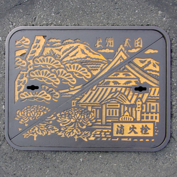
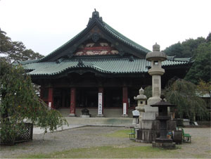
A water control valve cover. It depicts the city tree "pine," the city flower "chrysanthemum," and "Daikoin Temple" against the backdrop of Mount Akagi.
Ojima 尾島町
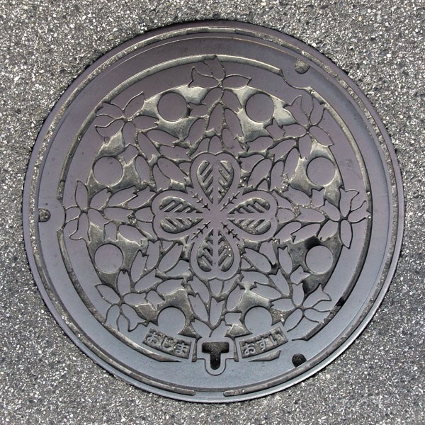
A manhole cover for sewage, featuring the town flower, salvia, in its design. The words "Ojima" and "Osui" (sewage) are written at the bottom.
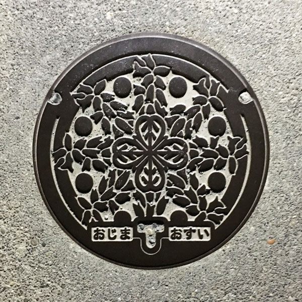
A medium-sized manhole cover for sewage, featuring the town flower, salvia, in its design. The words "Ojima" and "Sewage" are written at the bottom.
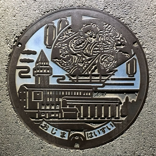
The building is the Ojima Town Hall (former town office), and the image above depicts the "Ojima Neputa" float.
The official name of the "Ojima Neputa" is the "Ota City Ojima Neputa Festival." The first lord of the Hirosaki domain received an increase in his territory after his achievements in the Battle of Sekigahara, and because of this connection, the former Ojima town established a friendship city relationship with Hirosaki city, starting the Ojima Neputa festival in 1986. The float lanterns on the cover appear to be the same "fan shape" as those in the original Hirosaki city.
Niita 新田町
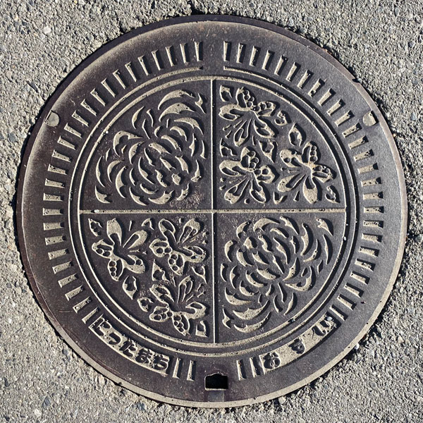
A manhole cover for sewage, depicting chrysanthemum and azalea flowers. The words "Nitta-machi" and "sewage" are written at the bottom.
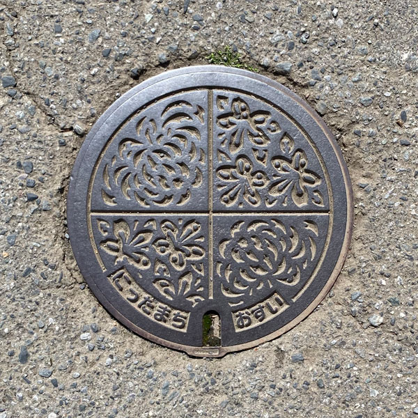
A small, handhole-sized panel that uses only the design from the inside of the top lid.
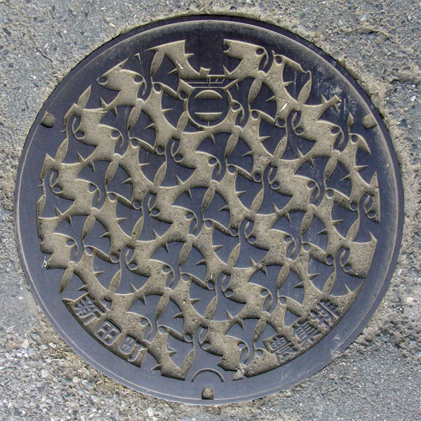
This agricultural waste bin features a design of ginkgo leaves, the town's official tree. It also includes the town emblem, which is a stylized representation of the "Nitta" logo.
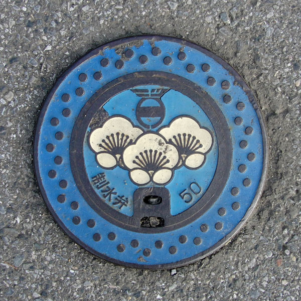
A water control valve containing flowers from the town's official tree, the plum blossom.
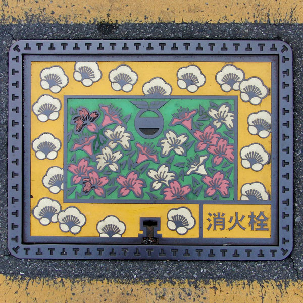
A fire hydrant featuring the town's flower, the azalea, in addition to the plum blossom.
Yabuzukahon 藪塚本町
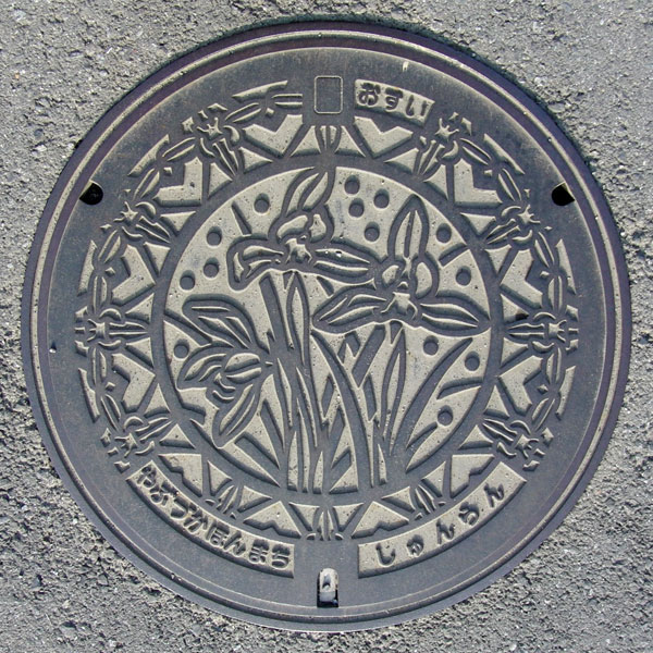
The town's official flower, the "Cymbidium goeringii," is featured in the design.
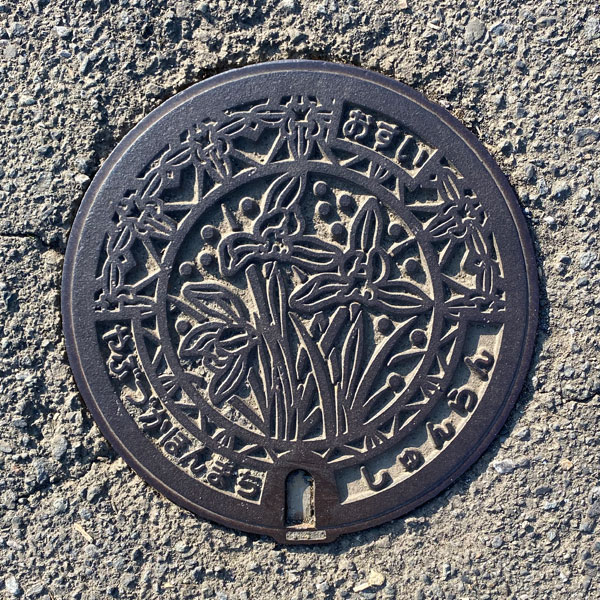
A smaller version with the same design as above.
Tomioka 富岡市
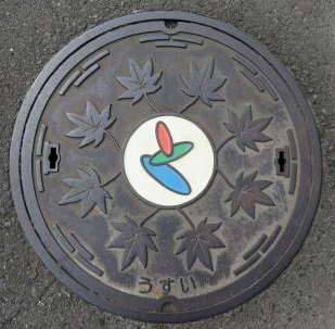
The maple leaves are depicted in a circle, and what is the mark in the center that looks like the Japanese character "to" in three colors? I don't know. Perhaps it's modeled after the "to" in Tomioka, representing the green and red maple leaves and the park's pond. The word "usui" is written at the bottom.
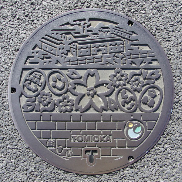
A manhole cover featuring the new Tomioka City emblem, a combination of the "Sun," "Kaburagawa River," and "Myogi Mountain."
The top depicts the Tomioka Silk Mill, which was registered as a World Heritage Site on June 21, 2014. In the center are the city flower, the "Sakura," and a "Cocoon" with an expressive face. Below is the "French bond brickwork" of the Tomioka Silk Mill.
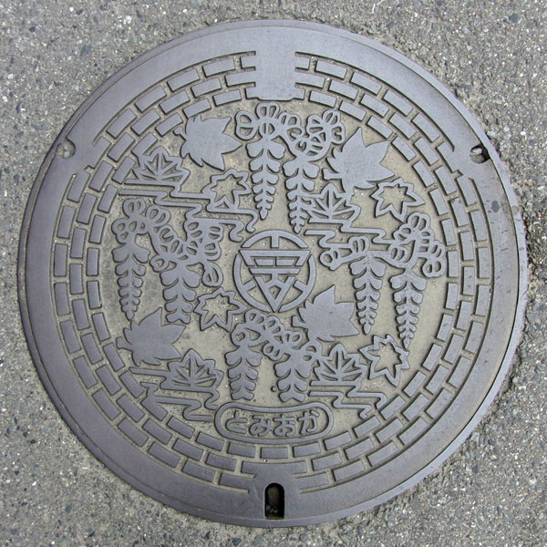
A colorful manhole cover featuring the city's tree, the maple, and the city's flower, the wisteria. The surrounding area is made of bricks from the former Tomioka Silk Mill. The curved lines might represent the Kaburagawa River.
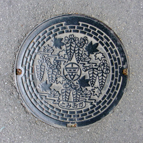
A smaller version with the same design as above.
Fujioka 藤岡市
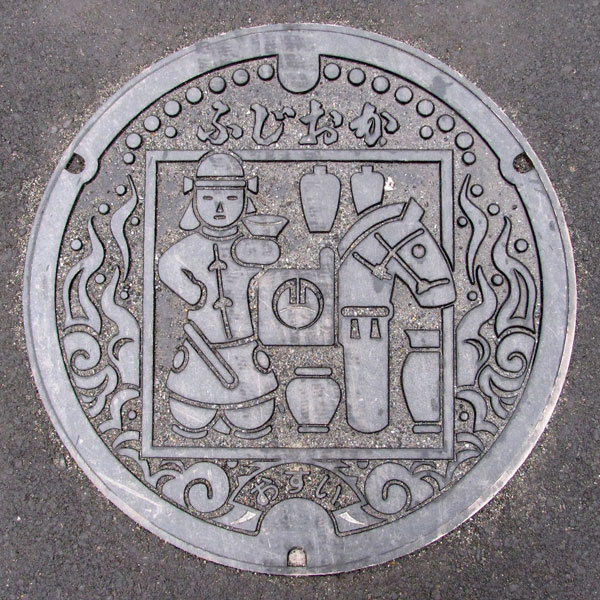
Gunma Prefecture has two regions known for producing Haniwa (clay figures): the Ota region and the Fujioka region. The Fujioka region has two Haniwa kiln sites: the Hongō Haniwa kiln site in the Kannagawa River basin and the Saruta Haniwa kiln site in the Ayukawa River basin. The Kobayashi district, where this lid was found, is home to the Kobayashi Kofun (ancient burial mounds), suggesting that Haniwa were supplied from the Hongō Haniwa kiln.
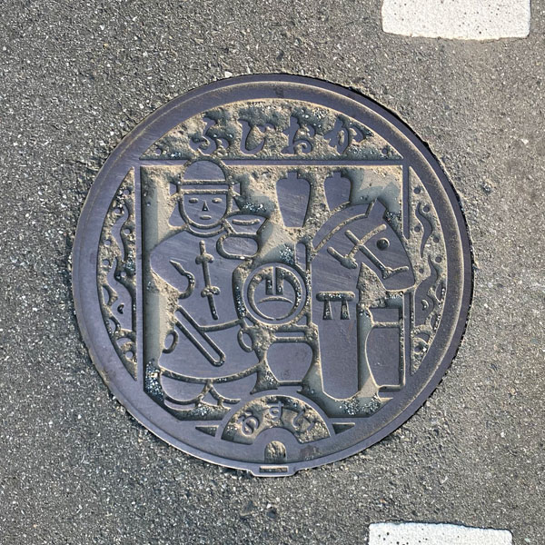
A small wastewater drain with the same design as above.
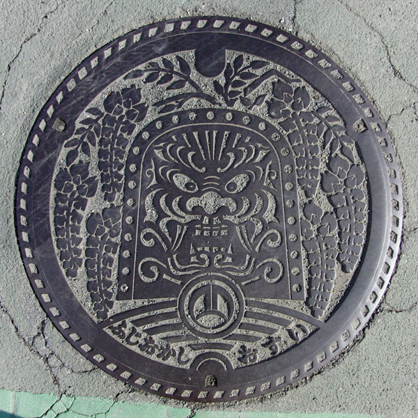
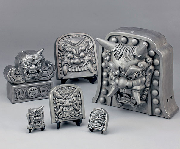
Features the Fujioka City specialty "Fujioka Onimen tile" design and the city flower "wisteria."
At the bottom center is the city emblem, a combination of two katakana characters "フ" (fu) representing a hill. Below that are the words "Fujioka City" and "Sewage."
Tatebayashi 館林市
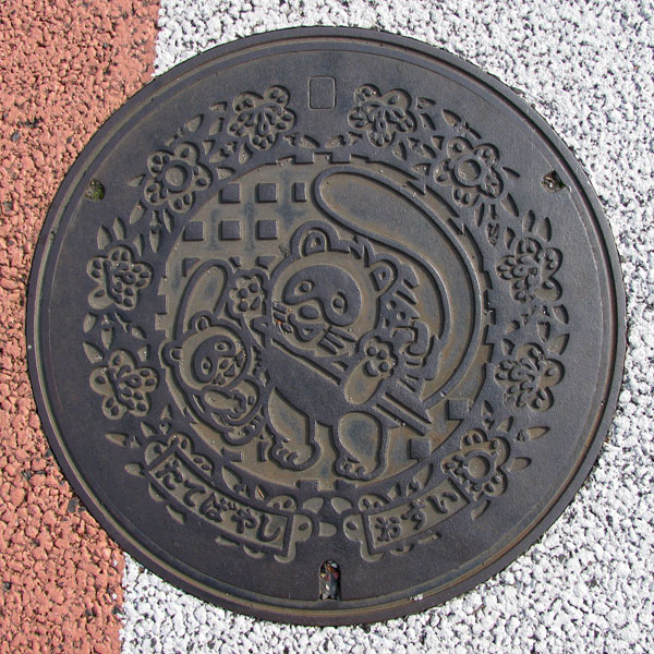
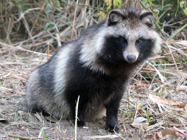
Tatebayashi is known for its scenic Tsujigaoka Park and Morinji Temple, famous for the Bunbuku Chagama legend. These are depicted directly on the manhole cover.
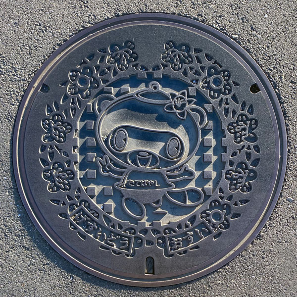
The motif is the same as before, with the city flower of Tatebayashi, the "mountain azalea," depicted around the perimeter (this part of the design is almost identical to the previous one). However, the Bunbuku Chagama (a legendary tea kettle) on the inside has been replaced with "Pon-chan," the city's tourism ambassador.
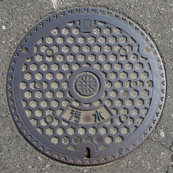
A sewage manhole cover with a tortoiseshell pattern. The city emblem, a stylized representation of "Tatebayashi," is in the center. (Tatebayashi was formerly known as Tatenogahara and was called Tatebayashi.)
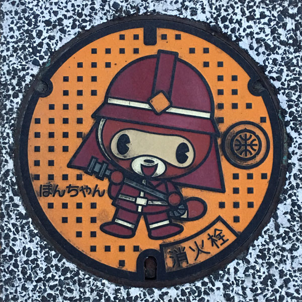
This is a fire hydrant cover featuring "Pon-chan," Tatebayashi City's tourism ambassador, dressed as a firefighter and holding a hose. The city emblem is also depicted on the side.
Minakami みなかみ町
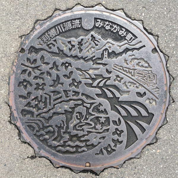
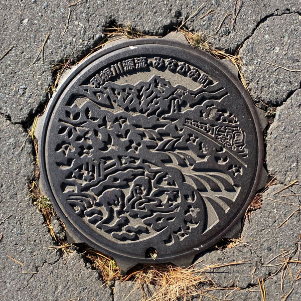
The words "Tone River Headwaters" and "Minakami Town" are inscribed at the top. The inscription "Minakami Town" indicates that this is a manhole cover from after the town merger.
The Tone River is a major river boasting the largest drainage basin and second longest course in Japan. Its source is at Mt. Ominakami, the northernmost point of Minakami Town.
The manhole cover depicts Mt. Tanigawa, the flow of the Tone River, and Minakami Onsen, and the SL Okutone steam locomotive is also visible. As can be seen more clearly in the color version, the town flower "Yamabuki" (Japanese kerria) and town bird "Uguisu" (Japanese bush warbler) are also included.
A smaller cover with the same design as above.
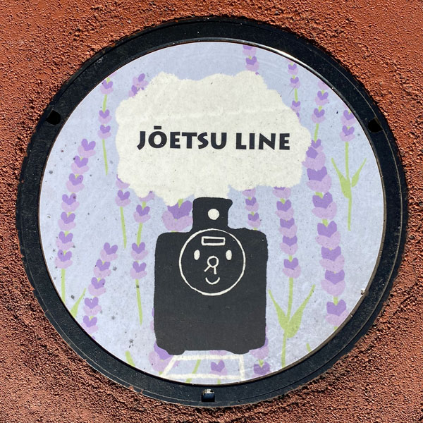
The manhole cover features the words "JOETSU LINE" and a steam locomotive. The background is wisteria flowers.
It appears to be themed after the "SL Gunma Minakami" steam locomotive operated by JR East. It's located on the red-paved walkway leading from Minakami Station to the Minakami Station SL turntable plaza. Its purpose is unknown.
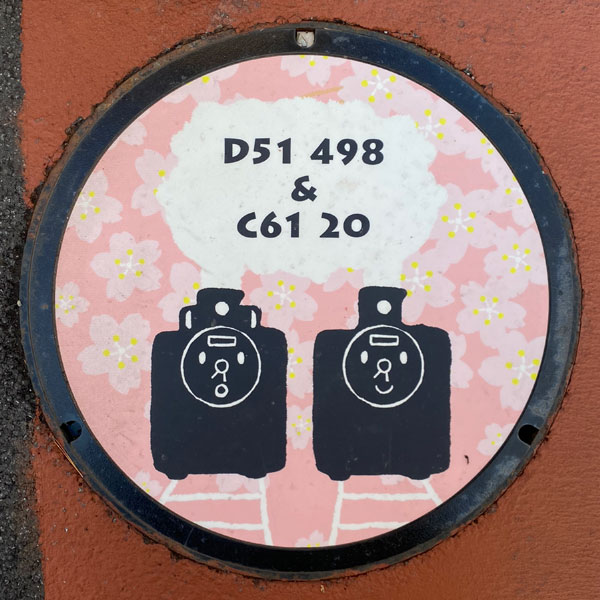
The manhole cover features the words "D51 498 & C61 20" and depicts two steam locomotives. The background is cherry blossoms.
The steam locomotives appear to be "D51 498" on the left and "C61 20" on the right.
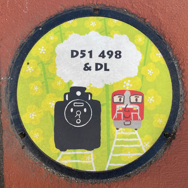
A manhole cover bearing the words "D51 498 & DL" and depicting a steam locomotive and a diesel locomotive. The background is rapeseed flowers.
Minakami 水上町
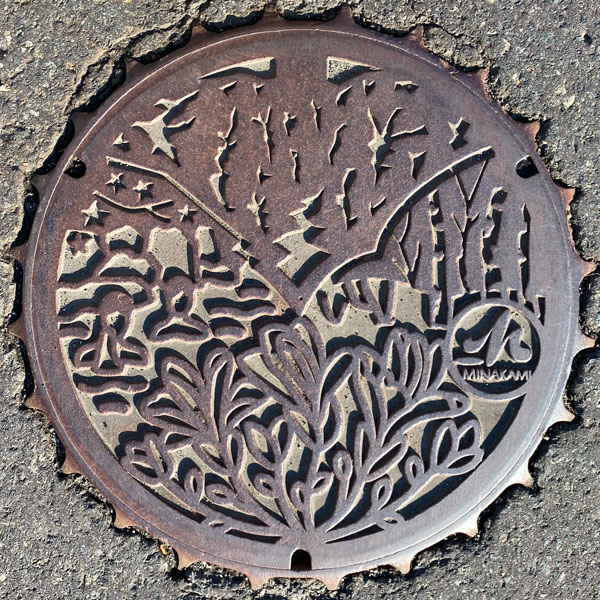
A colorful manhole cover featuring Mount Tanigawa and the Tone River at the top, a hot spring on the left, the town's official tree "birch" on the right, and the town's official flower "magnolia" at the bottom.
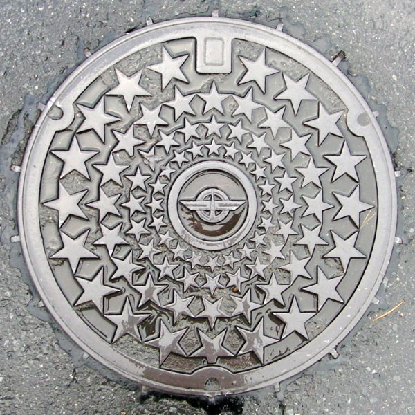
Lots of stars. The town emblem in the center.
Tsukiyono 月夜野町
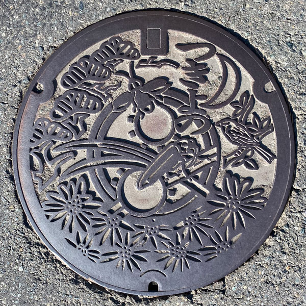
The artwork depicts a firefly at the center of the town's tree ("pine"), flower ("chrysanthemum"), and bird ("Japanese bush warbler").
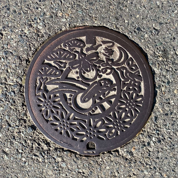
A small plate with a design resembling a miniature manhole cover.
Niiharu 新治村
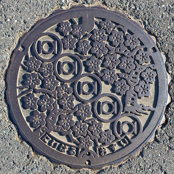
This is a manhole cover for a designated environmentally protected public sewer system, featuring the village flower, the Ooyamazakura cherry blossom, with five village emblems arranged in a sash-like pattern.
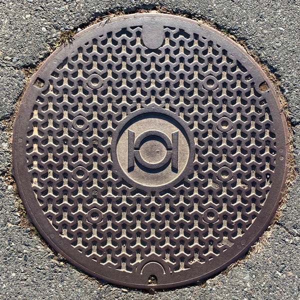
A manhole cover for sewage, featuring the village emblem in the center of a Bishamon tortoise shell pattern background.
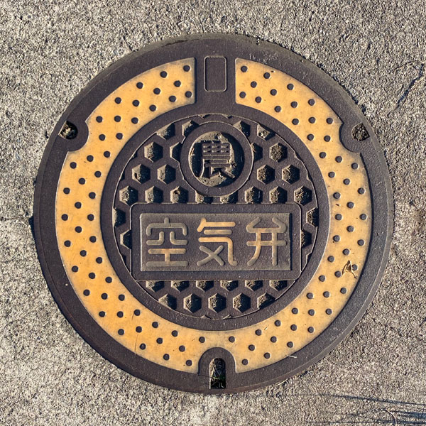
The cover of an air valve for agricultural water.
Nakanojo 中之条町
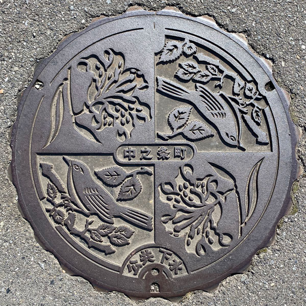
A manhole cover for the public sewer system depicting the town flower, the "mountain lily," and the town bird, the "Japanese bush warbler." The bush warbler is perched on the town tree, the "zelkova tree."
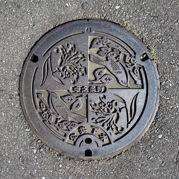
A small public sewer panel with the same design as above.
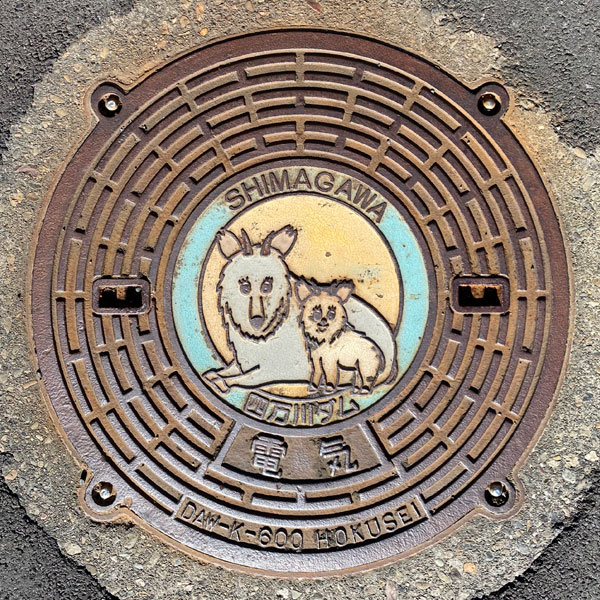
The manhole cover of Shimagawa Dam depicts a mother and baby serow. The words "SHIMAGAWA" and "Shimagawa Dam" are above and below the serow. Below that is the word "Electricity." At the very bottom is the symbol "DAW-K-600 HOKUSEI."
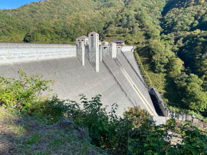
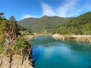
Shimagawa Dam is under the jurisdiction of the Gunma Prefectural Land Development Department. The artificial lake created by the dam, Okushima Lake, holds cobalt blue water similar to Goshikinuma in Urabandai. It is said to be highly acidic, and there are no fish.
Kusatsu 草津町
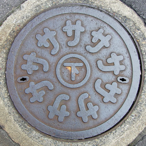
Nine "sa" characters spell "kusa". Where is the "tsu"? Incidentally, the town emblem also has nine "sa" characters, but there are three vertical lines at the top center.
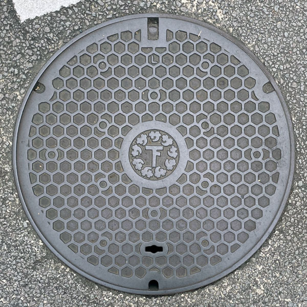
The lid has a thin, tortoise-shell pattern in the center that resembles the lid on top.
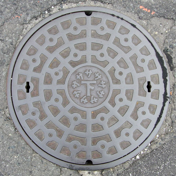
The center of the lid conforming to JIS standards is similar to the top lid, but the font of the character "サ" is different.
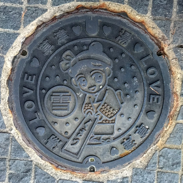
A manhole cover featured on a manhole card. This is a new version of the cover featuring "Yumomi-chan," the Kusatsu town tourism ambassador, performing the Kusatsu specialty, Yumomi (hot spring water stirring). It has the same mark as the center of the cover shown above.
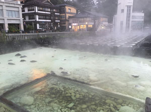
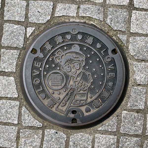
This is a smaller version of the manhole cover shown above.
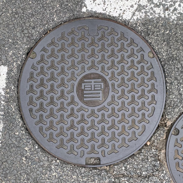
The word "snow" is placed in the center of a background with a Bishamon tortoise shell pattern.
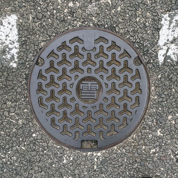
This is a smaller version of the manhole cover shown above.
Naganohara 長野原町
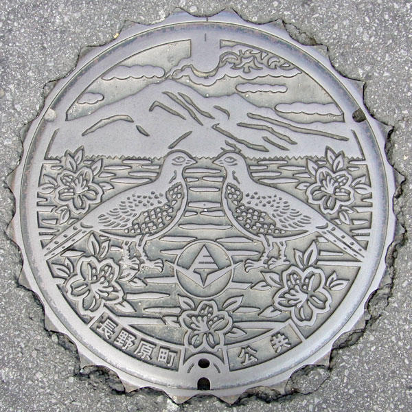
This manhole cover depicts the town's flower, the purple azalea, and the town's bird, the Japanese pheasant, with Mount Asama in the background. While the summit of Mount Asama is in Tsumagoi Village, Kitakaruizawa, located at its base, belongs to Naganohara Town. In Gunma Prefecture, only Tsumagoi Village and Naganohara Town have manhole covers depicting Mount Asama.
Higashiagatsuma 東吾妻町
Agatsuma 吾妻町
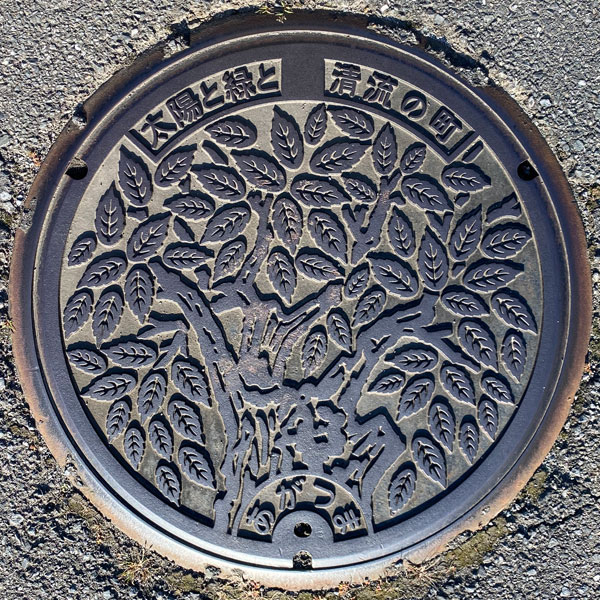
The design features the town's official tree, the zelkova tree. At the top are the words, "A town of sun, greenery, and clear streams."
Azuma 東村
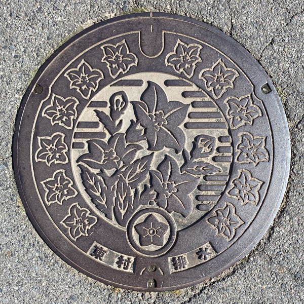
This is a manhole cover from the agricultural wastewater treatment plant in the Okazaki district of Hakoshima.
The village has since ceased to exist due to mergers, and details about the former village emblem are unknown. However, it clearly appears to be based on a bellflower. While bellflowers typically have five stamens and five pistils, the six lines inside the emblem might represent "East." The central image is a bellflower, and the surrounding area is also entirely bellflower-themed.
Yoshioka 吉岡町
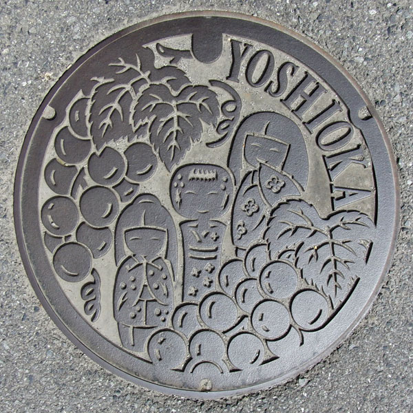
This manhole cover depicts kokeshi dolls and grapes, a local specialty.
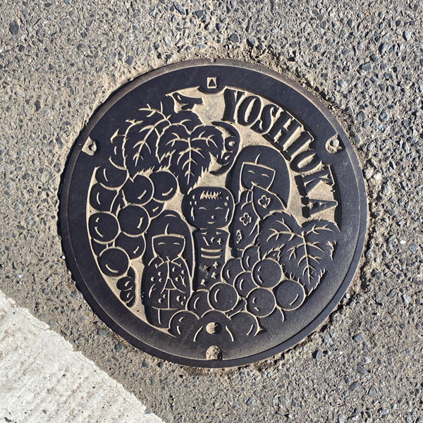
A smaller version with the same design as above.
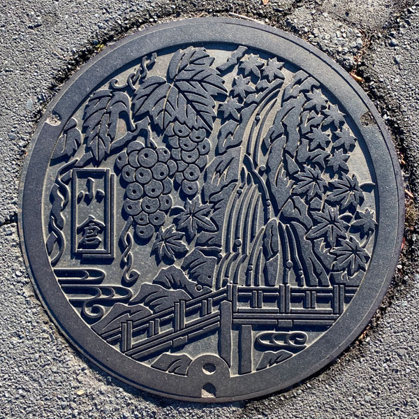
This is a manhole cover for an agricultural wastewater discharge in the Ogura district. There are 23 vineyards in the "Ogura Grape Village." The waterfall is located at the uppermost reaches of the Takizawa River, which flows south of the Ogura district, at the northwestern end of Funaoyama, Uenoda, Yoshioka Town. It is believed to be the "Funao Falls," which plunges down a cliff over 60 meters high.
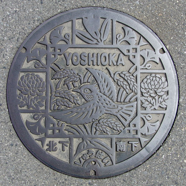
Manhole covers for agricultural drainage systems in the Kitashimo and Minamishimo districts depict the town's official tree, the ginkgo, its official flower, the chrysanthemum, and its official bird, the skylark. Rice plants are also depicted.
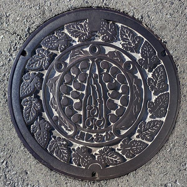
This is a manhole cover from an agricultural wastewater treatment plant in the Kaminoda area. The central circle depicts "Funao Falls," the outer circle shows "Mt. Haruna, Mt. Onoko, Mt. Komochi, and Mt. Akagi," and the outer edge appears to be decorated with mulberry leaves.
A small agricultural wastewater disposal panel with the town emblem in the center.
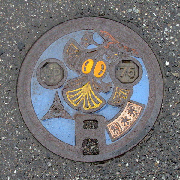
A water control valve bearing the town emblem of Yoshioka Town. The town's official tree is the ginkgo, and the design depicts ginkgo leaves and fruit.
Tamamura 玉村町
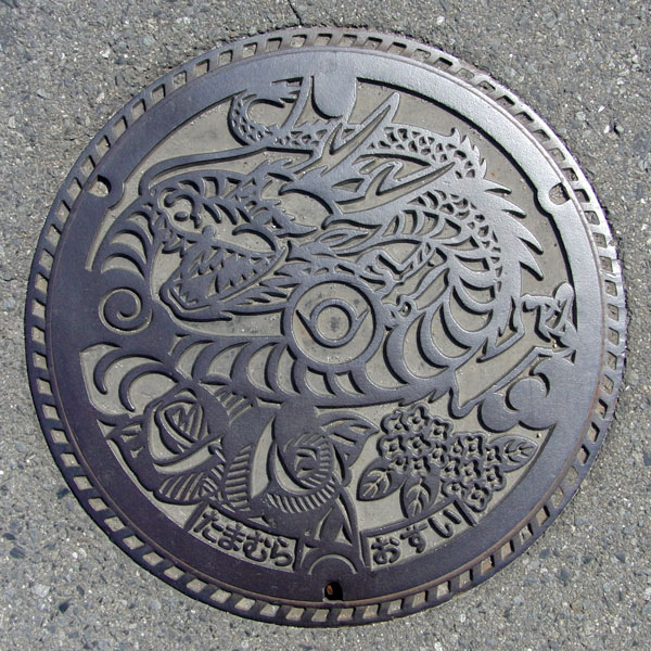
The design features a dragon, the town flower "rose," and the town tree "osmanthus." The town emblem is in the center.
A manhole cover with a "dragon" is always associated with a legend. Just as in Sakae Town, Chiba Prefecture, Tamamura Town also has one. A girl who was about to become a concubine of Taira no Masakado drowned herself in the Yagawa River, and her lover followed suit. Afterwards, two jasper jewels that floated in the Yagawa River were enshrined at Chikato Daimyojin Shrine, but a dragon god appeared during a great flood of the Tone River and stole one of the jewels. The remaining jewel was then enshrined at Manpuku-ji Temple—this is the "Legend of the Dragon's Jewel." The name of Tamamura, the predecessor of Tamamura Town, seems to have originated from this legend.
Shimonita 下仁田町
A blue manhole cover with a polka-dot pattern, featuring the town emblem and the words "Water Control Valve".
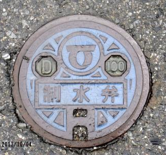
A small water valve cover with a light blue background, featuring the town emblem at the top with the letters "D" and "100" on either side, the words "Water Control Valve" in the center, and a keyhole at the bottom.
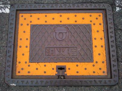
A square fire hydrant cover with a diagonal grid pattern, the town emblem, and the words "Fire Hydrant," surrounded by a yellow background with polka dots. The frame has a "T" pattern.
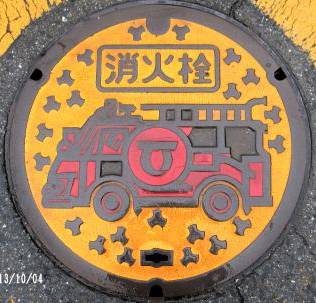
Circular fire hydrant cover. The position of the hole near the bottom and the single tetrapod above the keyhole are different from the one shown above.
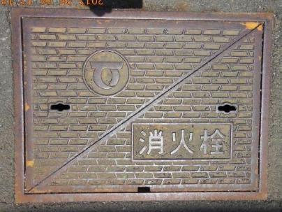
Features a block-like pattern, with the town emblem and the words "Fire Hydrant." Two-piece, square-shaped fire hydrant cover.
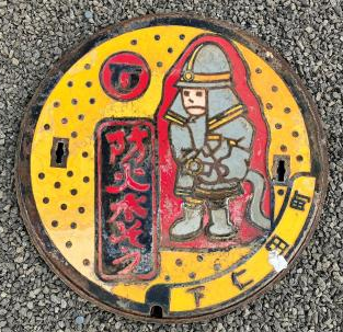
A yellow background with polka dots, featuring a design of a firefighter with a hose in his hand and a worried expression, next to which the words "Firefighting Water Tank" are written vertically. The town emblem is in the upper left, and the words "Shimonita Town" are in the lower right.
Kanra 甘楽町
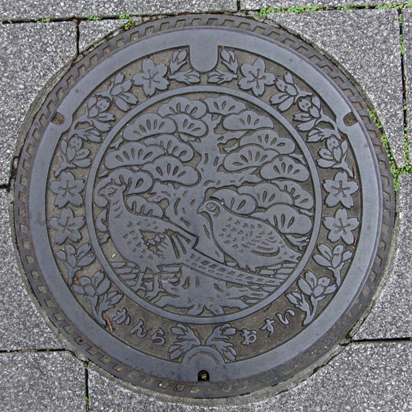
The inside of the manhole cover depicts the town's tree, the Japanese red pine, and the town's bird, the pheasant, while the outside depicts the town's flower, the Somei Yoshino cherry blossom.
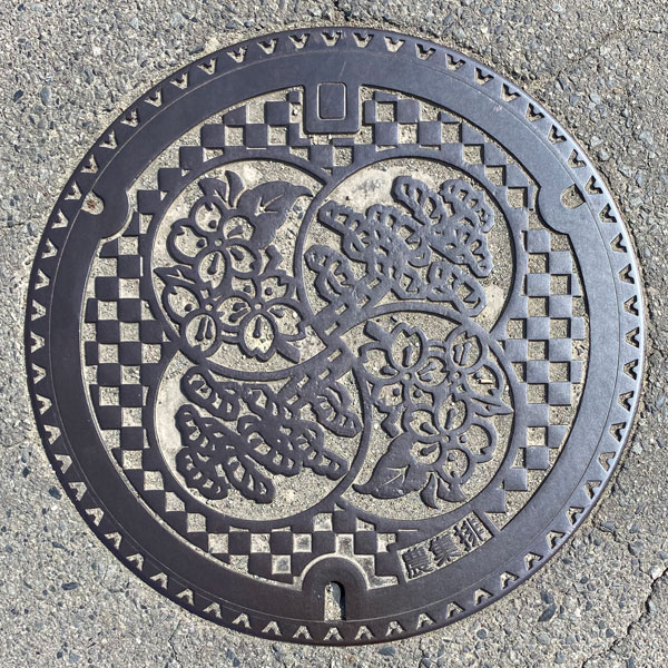
This is a manhole cover for the agricultural settlement drainage system in the Jonan Ueno district, featuring the town's tree, the Japanese red pine, and the town's flower, the Somei Yoshino cherry blossom.
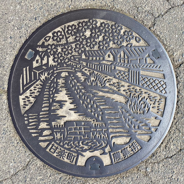
A farm drainage manhole cover in the Zenkeiji/Kunimine area, depicting the scenery around the "Ogawa Weir."
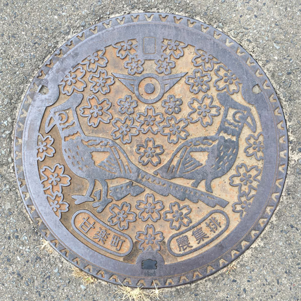
A manhole cover for agricultural wastewater in the Amabiki district, depicting the town flower "Somei Yoshino cherry blossom" and the town bird "pheasant." The town emblem is at the top.
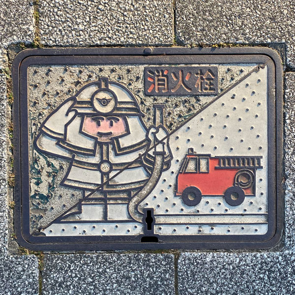
A rare, whitish fire hydrant cover.
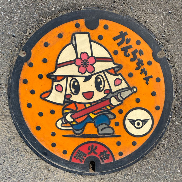
A fire hydrant cover featuring Kanra Town's character, "Kanra-chan."
Oizumi 大泉町
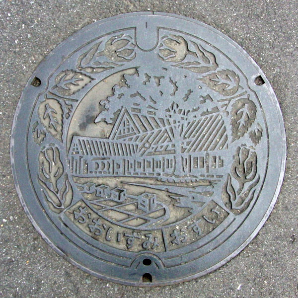
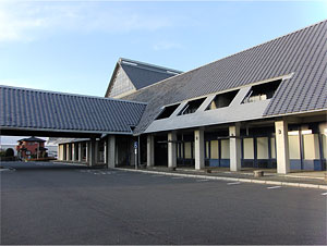
The leaves of the town's official tree, the zelkova, are sandwiched between the tulips. The tulip is the town's official flower. In the center are the large hall of the "Cultural Village," built in 1991, and the zelkova tree. In reality, the zelkova tree is not located at this spot.
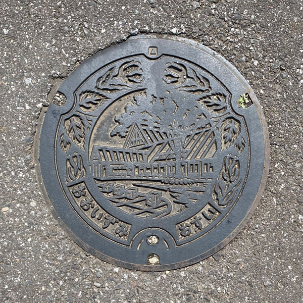
A smaller version with the same design as above.
Ora 邑楽町
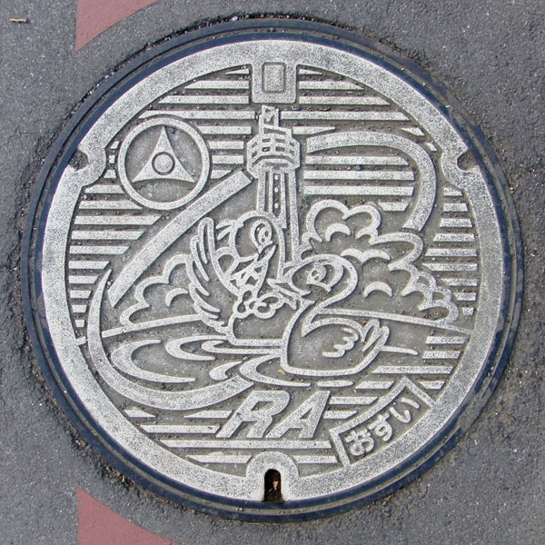
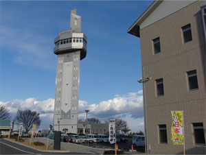
The town's website describes it as "a town of flatland forests and swans." It's hard to see, but what you see behind the "swans" isn't clouds, but "flatland forests." The tower rising from the forest is the town hall's symbol tower, "MiRAi." It's 60 meters tall, and from the observation deck, you can see the three mountains of Joshu, Mount Tsukuba, and even Mount Fuji. The town emblem and the letters "ORA" are also included.
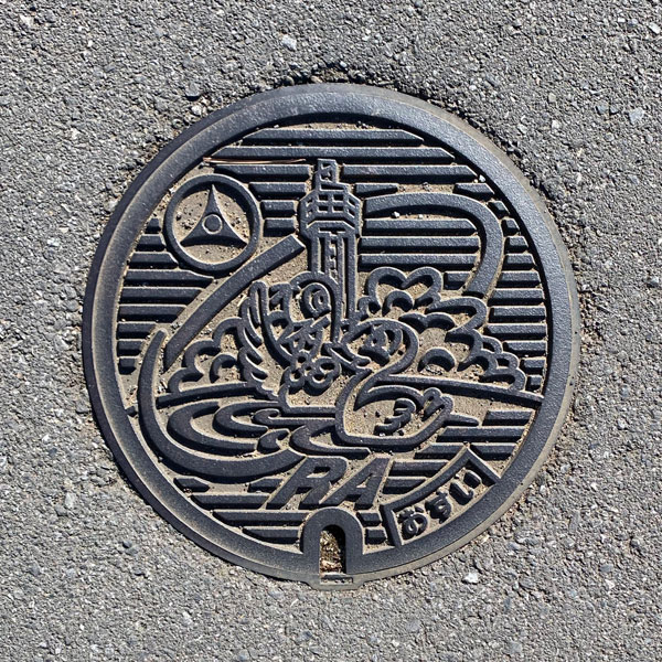
A smaller version with the same design as above.
Chiyoda 千代田町
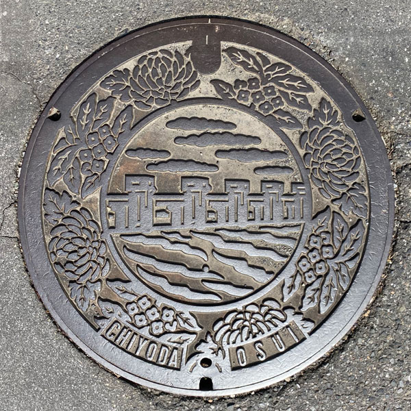
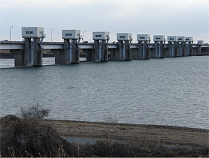
The manhole cover features the town's flower, the chrysanthemum, and its tree, the osmanthus, around the edges, with the Tone River's Tone Ohzeki Weir depicted in the center.
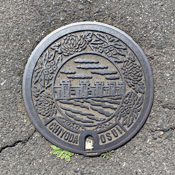
The image above shows a smaller version of the same design.
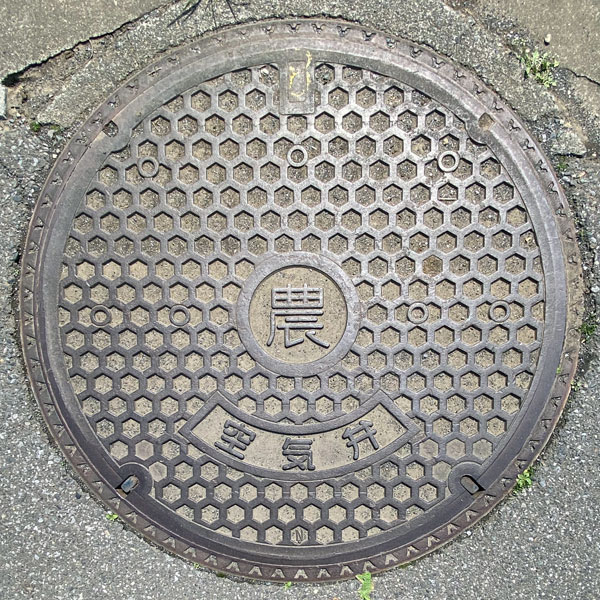
Big cover for an air valve for agricultural water supply.
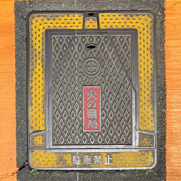
A vertical fire hydrant cover featuring the town emblem and the words "Beware of Fire."
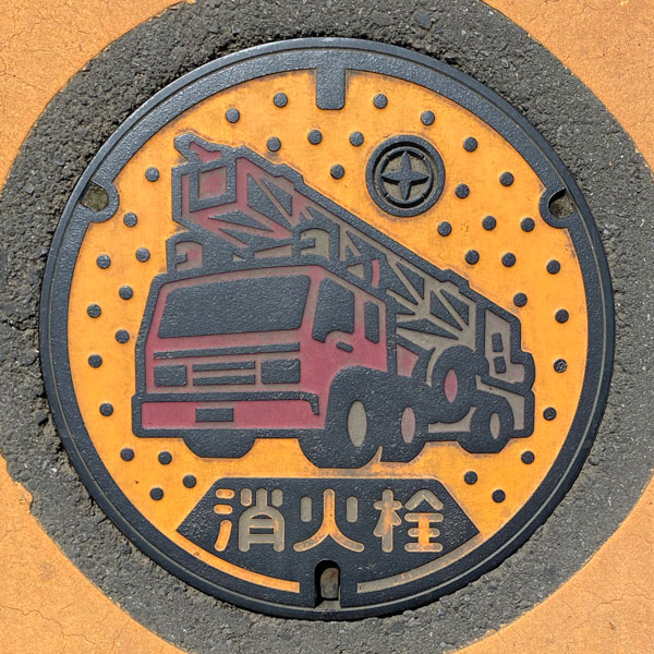
A round fire hydrant cover with a fire truck depicted on it. It also features the town emblem and the words "Fire Hydrant".
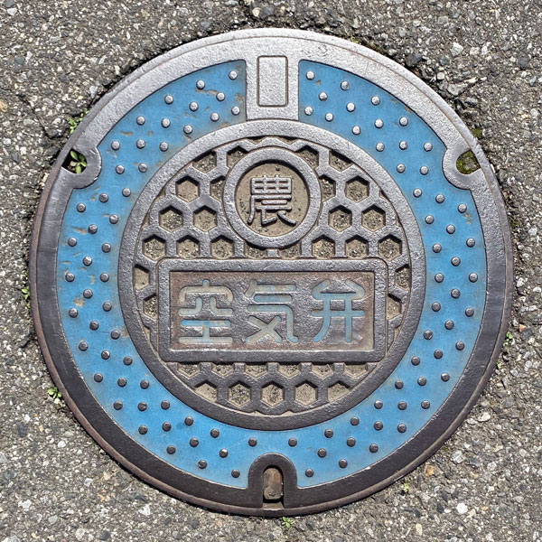
Cover for an air valve for agricultural water supply.
Itakura 板倉町
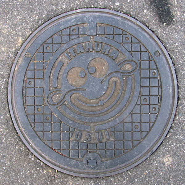
Itakura Town prides itself on being "Gunma's Water Town." River fish dishes, especially catfish dishes, are apparently a local specialty, hence the catfish design (which also looks somewhat like a human face...).
The outside of the catfish appears to be the town emblem, designed as the Japanese character "i." Inside are the catfish and the word "ITAKURA." Below the emblem are the words "OSUI."
Meiwa 明和町
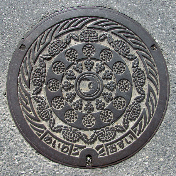
This wastewater dispenser features the town's flower, the chrysanthemum, with the local specialty, the pear, and another local specialty, the Kyoho grape, arranged inside. At the center is the town emblem, which is a stylized representation of the character "明" (bright) combined with the characters for "moon" and "sun."
A smaller version with the same design as above.
Kanna 神流町
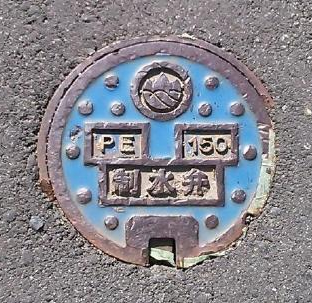
Blue background with polka dots. Features the Kanna Town emblem and the markings "PE 150" and "Water Control Valve".
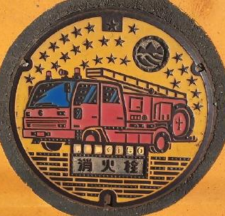
Design featuring a yellow background with a star pattern and town emblem, a red fire truck (Φ150), the words "Fire Hydrant," and a dashed line pattern.
Katashina 片品村
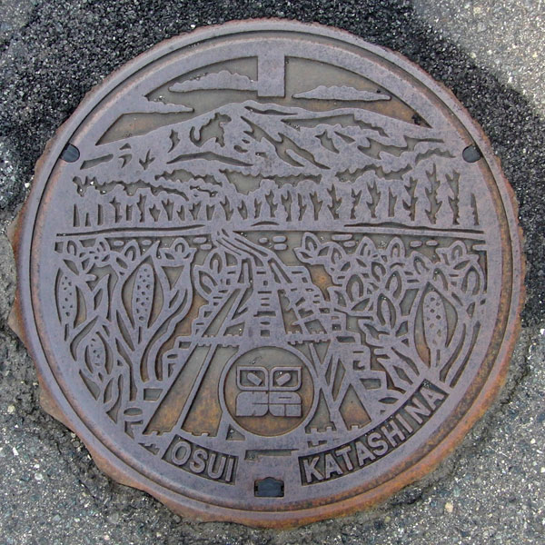
A manhole cover for wastewater in a designated environmentally protected public sewer system, depicting the scenery of Oze. The village flower, the skunk cabbage (Mizubasho), is depicted on both sides of the two wooden walkways leading to Mt. Shibutsu.
The village emblem, a combination of the characters "Katashina" and the skunk cabbage, is located at the bottom.
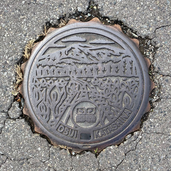
A smaller version with the same design as above.
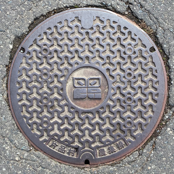
A manhole cover for a farm drain. The village emblem is in the center, and the words "Katashina Village" and "Farm Drain" are at the bottom.
Kawaba 川場村
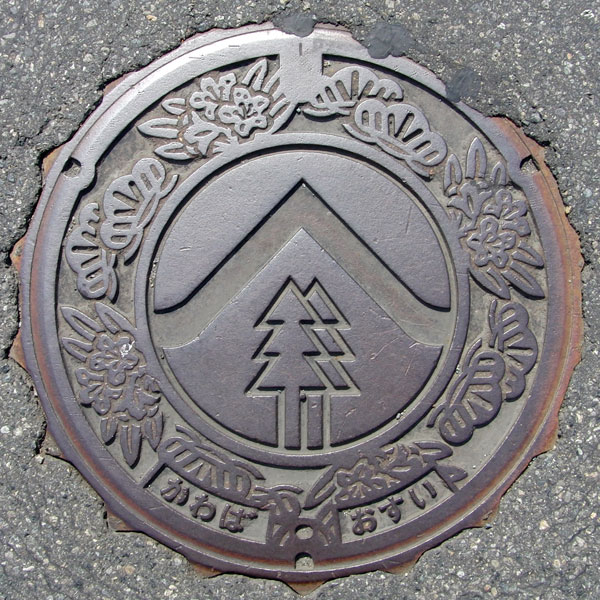
A manhole cover for a designated environmentally protected public sewer system, depicting the village tree, the Japanese white pine (Pinus parviflora), and the village flower, the rhododendron. The band in the center appears to represent Mount Hotaka.
Tsumagoi 嬬恋村
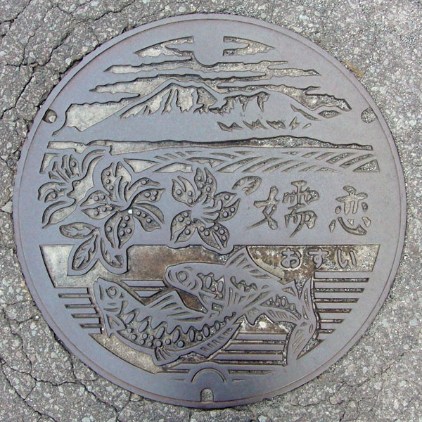
A manhole cover for the designated environmentally protected public sewer system, depicting azaleas and the village's fish, the "yamame" trout, with Mount Asama in the background. The village flower is the "gentian," but it is not depicted.
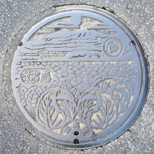
This manhole cover for the Handeki district agricultural settlement depicts a landscape of cabbage fields with Mount Asama in the background. Highland cabbage is a specialty product of Tsumagoi Village.
Takayama 高山村
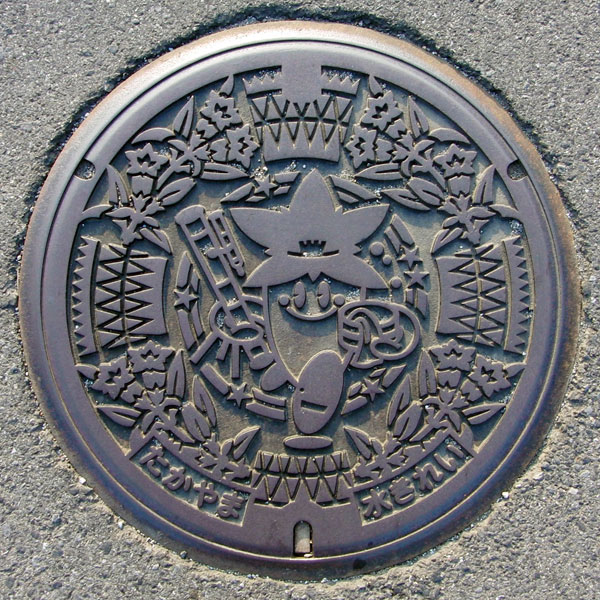
A manhole cover for agricultural village drainage.
The village flower is the gentian. The mascot character, "Hikaru-kun," wears a gentian on his head. As his catchphrase is "Yuboshi no Mori / Joshu Takayama Village," he holds a hot water bucket in his left hand and a telescope in his right. On the village's official website, "Hikaru-kun" is shown holding a hot water bucket and a lifebuoy.
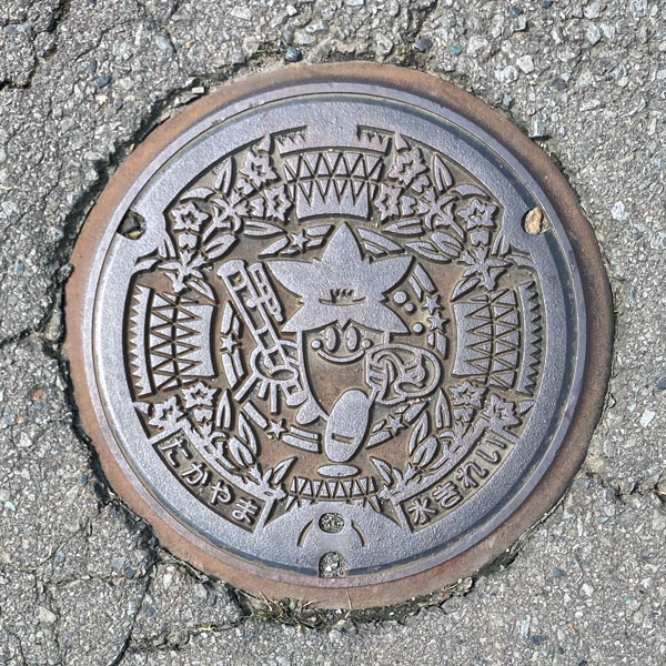
A smaller version with the same design as above.
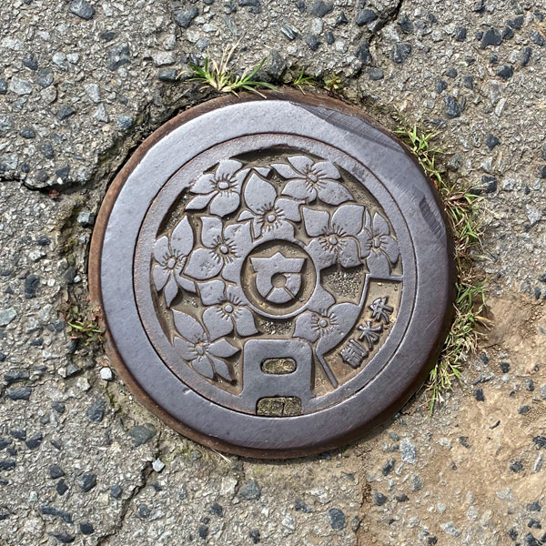
The cover of a handhole-sized water control valve was located very close to the small plate shown above. The village emblem was in the center. The flower does not appear to be a gentian.
Showa 昭和村
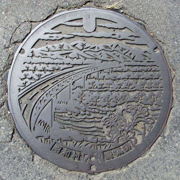
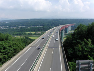
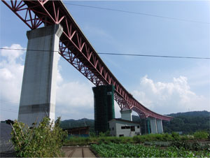
The mountain in the distance is Mount Akagi. The gently curving bridge is the Katashina River Bridge, where the Kan-Etsu Expressway crosses the Katashina River. In the lower right is the village flower, the cherry blossom. Agricultural wastewater treatment plant.
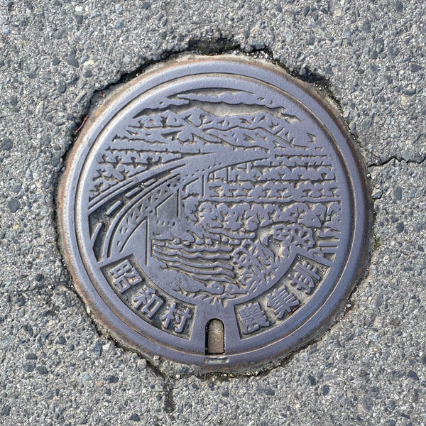
A smaller version with the same design as above.
Shinto 榛東村
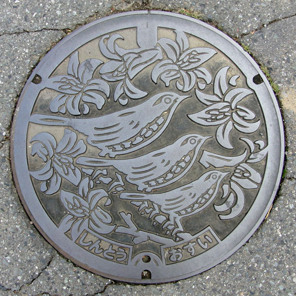
A manhole cover for sewage featuring the village flower, the mountain lily, and the village bird, the Japanese bush warbler.
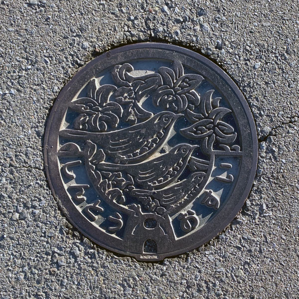
A smaller version with the same design as above.
Nammoku 南牧村
No Unique Manholes
Ueno 上野村
No Unique Manholes
Gunma Prefecture 群馬県
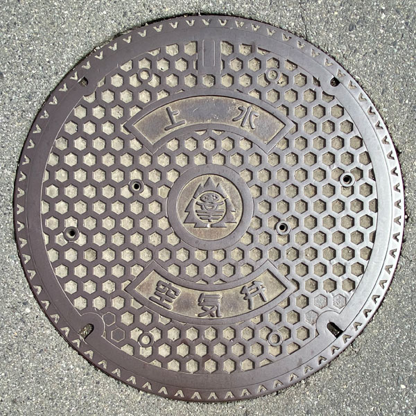
The Gunma Prefecture emblem is in the center of a tortoiseshell pattern background, with the words "Water Supply" and "Air Valve" above and below it. It's a fairly large cover.
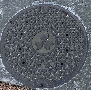
Gunma Prefecture flag and the characters for "rainwater" are included.
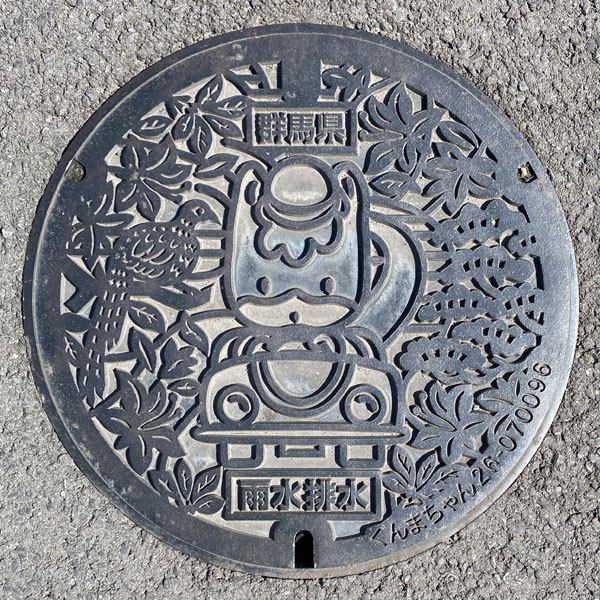
A manhole cover for rainwater drainage featuring Gunma Prefecture's mascot character, "Gunma-chan."
Gunma-chan is depicted riding in a car, flanked by the prefecture's tree, the Japanese black pine; the prefecture's flower, the Rhododendron molle; and the prefecture's bird, the Japanese pheasant. The words "Gunma Prefecture" are at the top, "Rainwater Drainage" at the bottom.
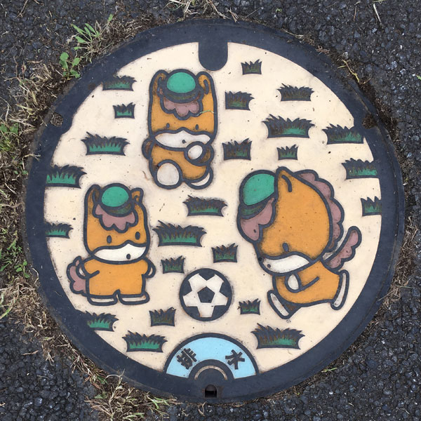
A manhole cover from Gunma Prefecture. It depicts Gunma Prefecture's mascot character, "Gunma-chan," enjoying a soccer game.
Tone River Upper Basin Sewerage System 利根川上流流域下水道
The municipalities involved in the Central Treatment Area are Maebashi City (formerly Ogo Town, Miyagi Village, Fujimi Village), Takasaki City (formerly Gunma Town, Shinmachi, Misato Town, Haruna Town, Yoshii Town), Shibukawa City (formerly Kitatachibana Village), Fujioka City, Tomioka City, Annaka City, Tamamura Town, Kanra Town, Yoshioka Town, and Shinto Village—a total of 10 municipalities.
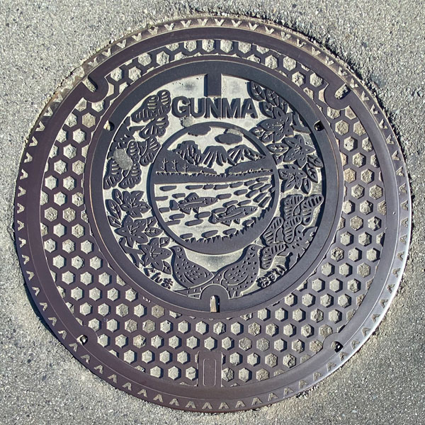
This is a parent-child manhole cover from the Tone River Upper Basin Sewerage System (Central Treatment Area), one of Gunma Prefecture's basin-wide sewerage systems. The parent cover has a tortoiseshell pattern.
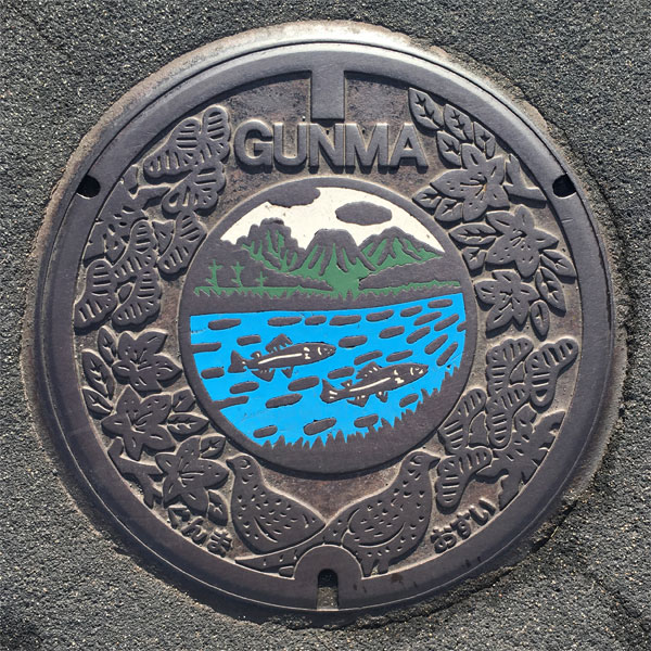
This is a manhole cover from the Tone River Upper Basin Sewerage System (Okutone Treatment Area), one of Gunma Prefecture's basin-wide sewerage systems. While there is also the Higashi-Mo Basin Sewerage System within the prefecture, the design is the same.
The inner colored section, surrounded by the prefecture's tree (Japanese black pine), flower (Rhododendron molle), and bird (Japanese pheasant), depicts mountains (probably the three mountains of Jomo: Akagi, Haruna, and Myogi, representative of Gunma) and the prefecture's fish (ayu). The words "GUNMA" are at the top, and "Gunma" and "Osui" (sewage) at the bottom.
Tomo Basin Sewerage System 東毛流域下水道
The municipalities involved are Isesaki City (including the former Sakai Town, Higashi Village, and Akabori Town) and Ota City (the former Ojima Town).
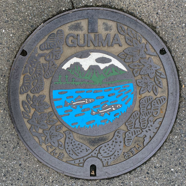
The design is the same as the Tone River Upper Basin Sewerage System. The words "GUNMA" are at the top, and "Gunma" and "Osui" (sewage) are at the bottom, but the name of the basin-wide sewerage system and the treatment area are not included.