Akita 秋田県
Akita 秋田県
Akita 秋田市
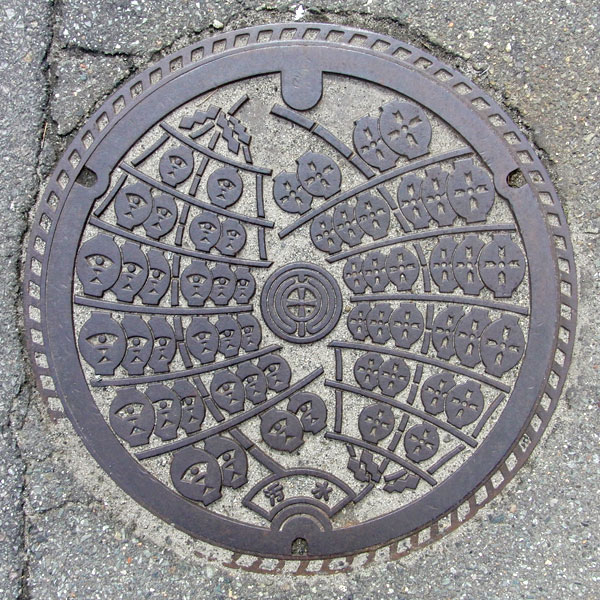
The design is from the Akita Kanto Festival.
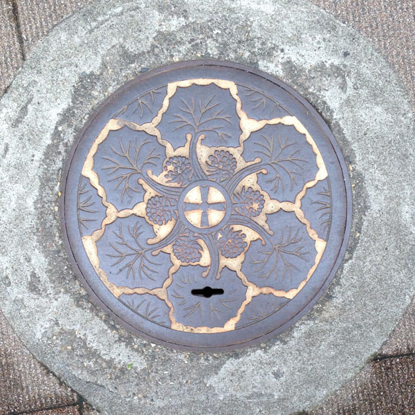
A sewage manhole with butterbur painted on it.
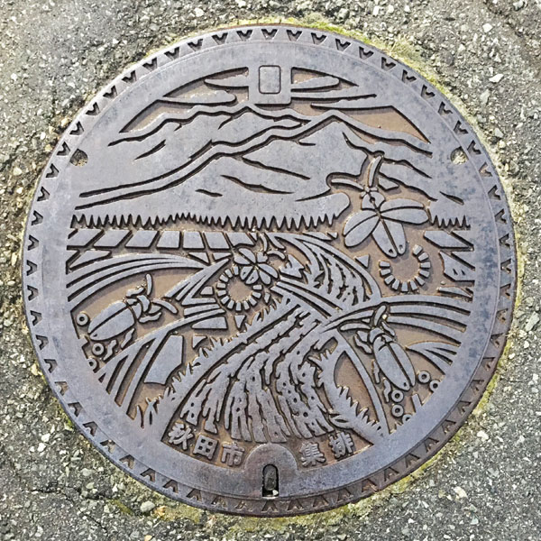
With Mount Ohira in the background, swarms of fireflies fly over the river flowing through the countryside. The drainage lid of the northern agricultural village of Shimoshinjo.
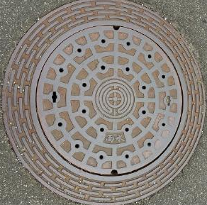
Akita city emblem in the center.
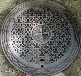
Former emblem in the center.
Kawabe 河辺町
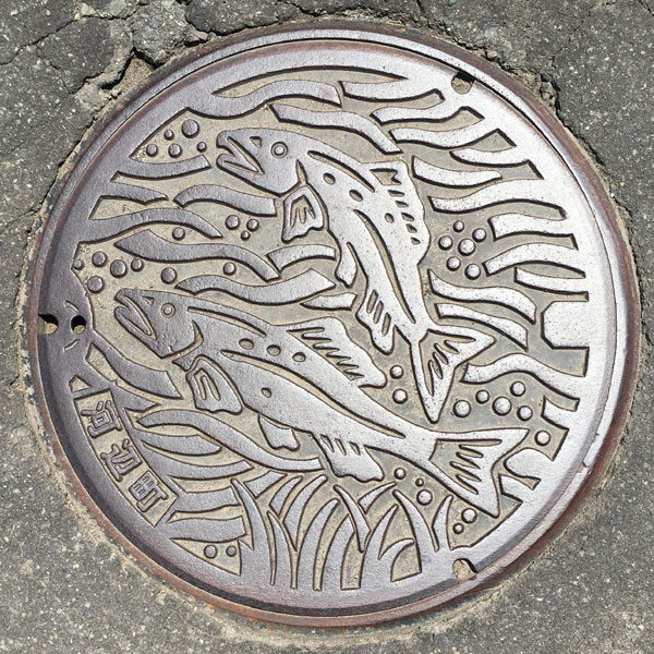
Yuuwa 雄和町
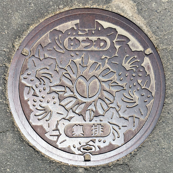
A sewage manhole cover with the town flower, the azalea, painted on it. The town emblem is in the center, and the characters "Yuwa" and "Osui" are written above and below.
Odate 大館市
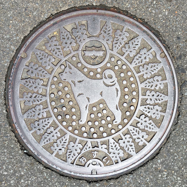
A sewage manhole cover with a depiction of an adult Akita dog and Akita cedar. The city emblem is on the top, and the word "Osui" is written on the bottom.
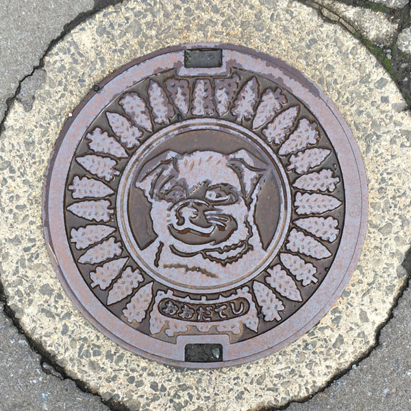
The surrounding Akita cedar trees are the same, but the dog in the center is a close-up of its face.
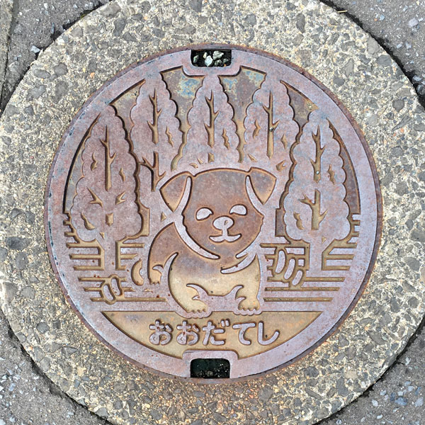
The manhole cover is designed to look like an adult dog and Akita cedar, but the cover of the small sewage manhole has been reduced to look like a dog.
A sewage manhole cover that uses the design of the former Tashiro town, with the town emblem replaced with the Odate city emblem.
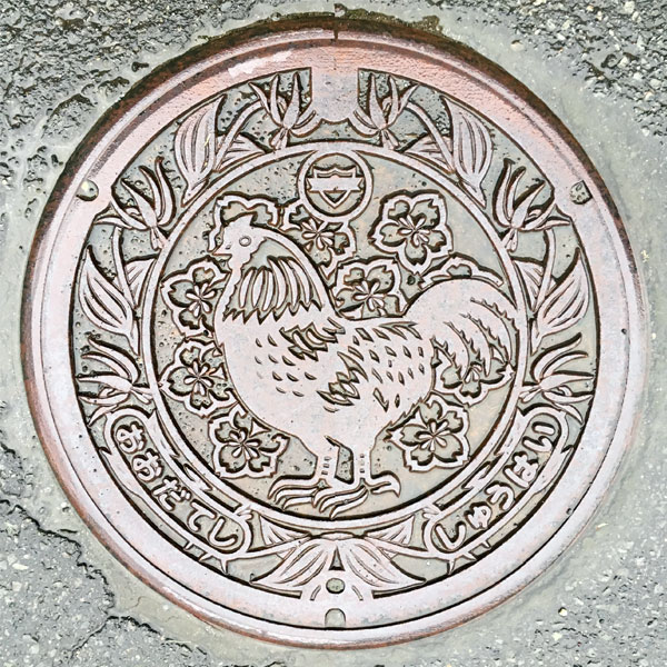
The design is based on the Hinai chicken of the former Hinai town, and is surrounded by dogtooth violets, the flower of the former town. The Odate city emblem is placed above the Hinai chicken, and the words "Odate city" and "Shuhai" are written on the left and right sides of the bottom.
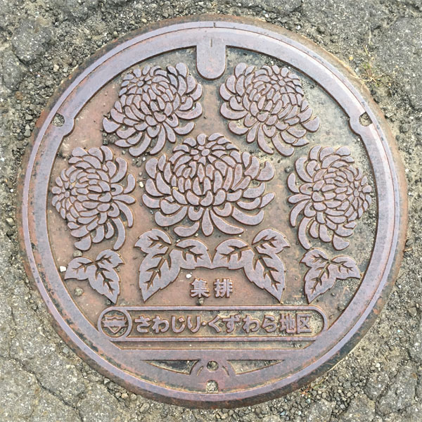
The lid of an agricultural drainage system in the Sawajiri-Kuzuhara district features the city's flower, the chrysanthemum. The characters for "shuhai" (collection and drainage) are written at the bottom. Further below, in an oval circle, the characters for "Sawajiri-Kuzuhara district" are written, and in a small circle on the left, the city emblem is depicted.
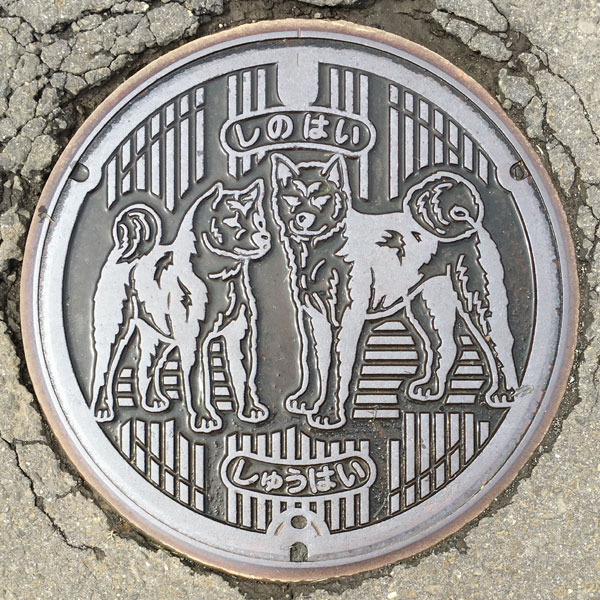
A lid for an agricultural village drainage system in the Shihade district. The characters "Shinohai" are written on top and "Shuhai" on the bottom.
Two Akita dogs are depicted. They have great posture.
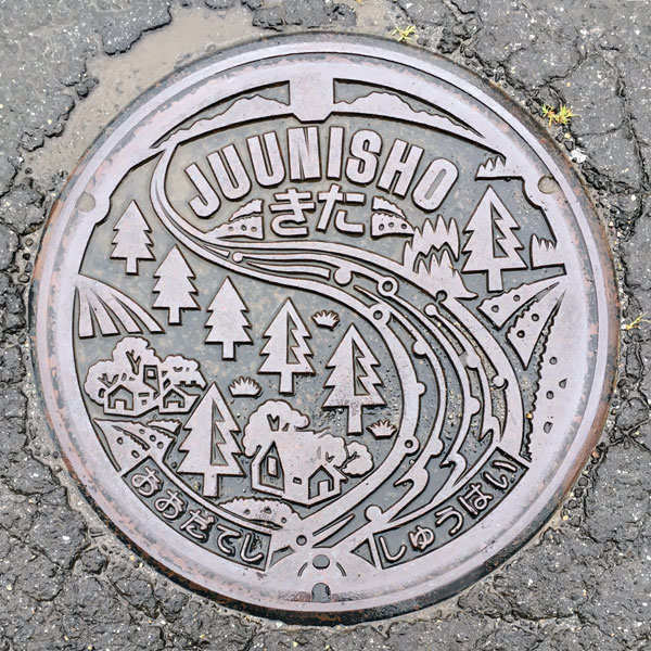
This is a cover for an agricultural village drainage system in the Juunisho Kita district. The characters "JUUNISHO" and "Kita" are written at the top, and "Odateshi" and "Shuhai" are written at the bottom.
Cedar trees and houses are depicted on both banks of the Yoneshiro River, which flows down from the Ou Mountains at the top of the board. The seven districts in the utilization area - Nakamachi, Saruman, Urayayama, Karuizawa, Magata, Michimeki, Kuzuhara, and Sawajiri - are represented by seven cedar trees, typical of Akita.
Tashiro 田代町
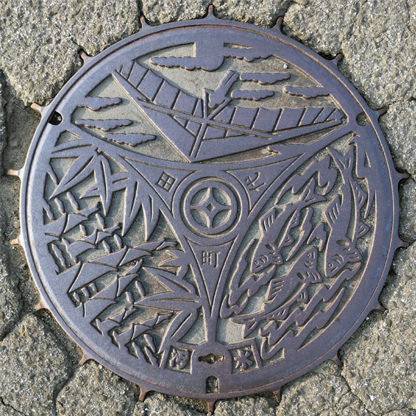
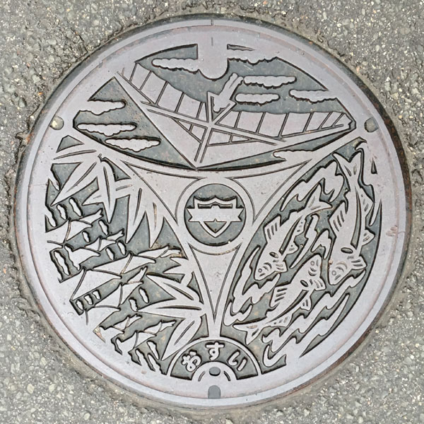
The town emblem and the characters "Tashiro-machi" (Tashiro Town) are in the center. The unusually shaped, three-part manhole cover features a hang glider from Mt. Tonosose in the upper part, a nemagaritake mushroom in the lower left, and a sweetfish from Oayu no Sato in the lower right.
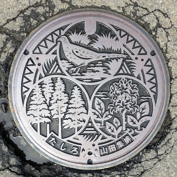
The town's bird, the pheasant, the town's tree, the Akita cedar, and the town's flower, the three-leaved quince, are depicted within the three circles.
Hinai 比内町
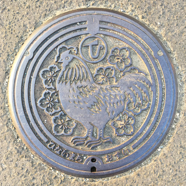
A sewage manhole cover features the town's bird, the Hinai chicken, and the town's tree, the red mountain cherry. The town emblem is at the top, and the characters "Hinaimachi" (Hinai Town) and "Osui" (Osui) are written at the bottom.
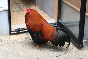
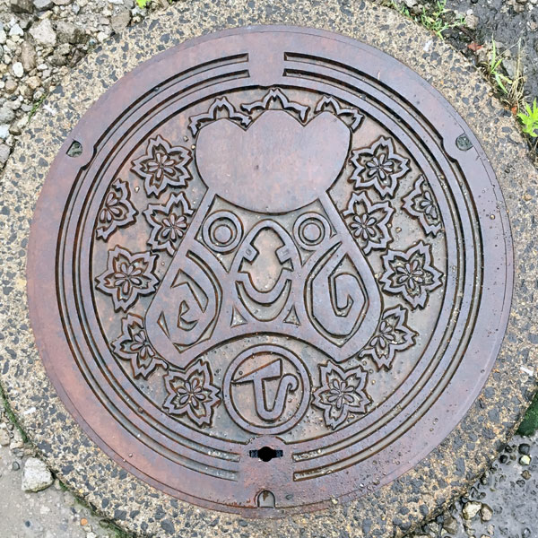
It has the same motif as the lid above, but features a close-up of a Hinai chicken's face. Since it was located within a residential area, it is thought to be a sewage manhole.
Kitaakita 北秋田市
Takanosu 鷹巣町
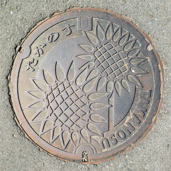
The town's flower, the sunflower, is depicted.
Aikawa 合川町
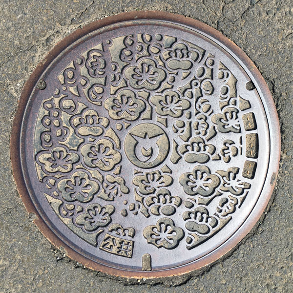
The town's tree, the plum tree, is depicted.
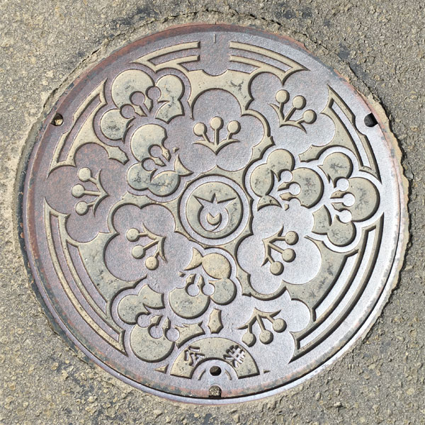
The flowers of the town's tree, the plum tree, are depicted.
Town emblem in middle.
Moriyoshi 森吉町
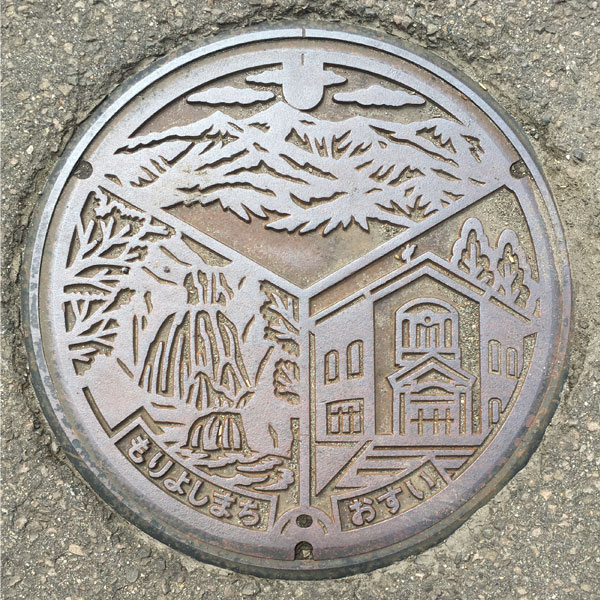
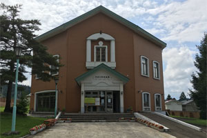
The design, going clockwise from top to bottom, features Mt. Moriyoshi, which is 1,454.2m above sea level, Hamabe no Uta Ongakukan, and Komatakyo Sankai Falls.
Ani 阿仁町
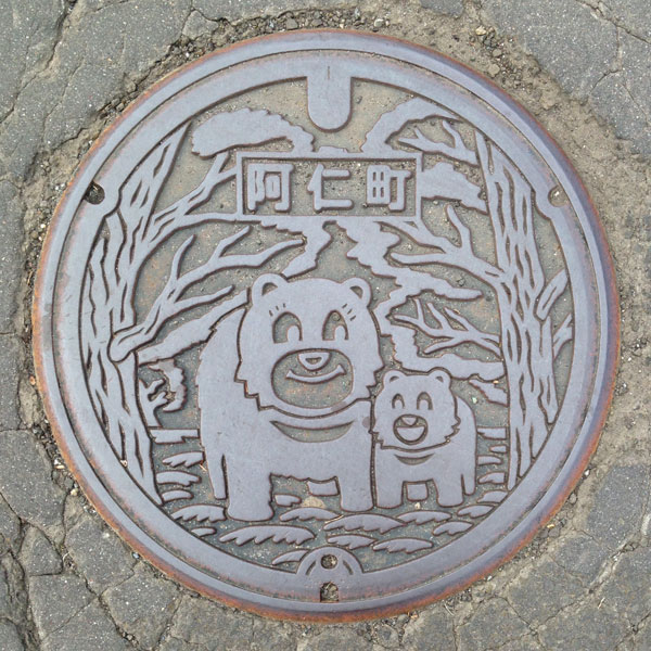
When you think of Ani, you think of Matagi. When you think of Matagi, you think of bears. A mother and baby Asiatic black bear are smiling.
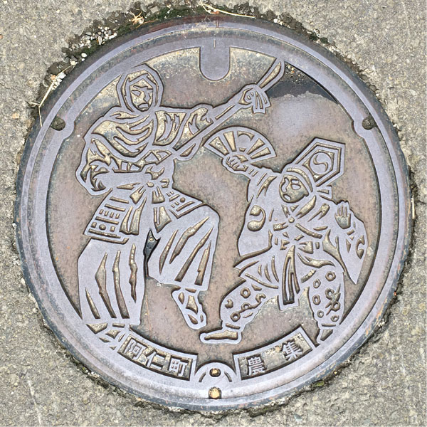
This is a drainage cover for an agricultural village in the Neko area.
It depicts "Nekobangaku," a type of kagura (sacred dance) performed by mountain ascetics of Shugendo (mountain monks). The "Nekobangaku Tradition Museum" is located in this area.
Noshiro 能代市
Noshiro 能代市
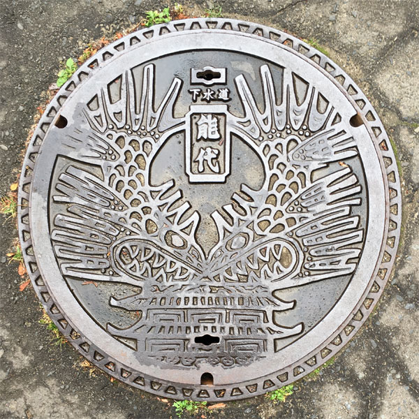
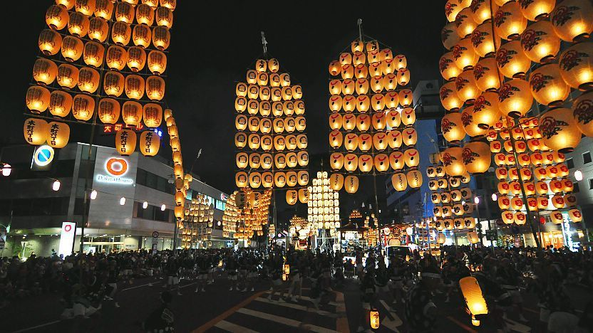
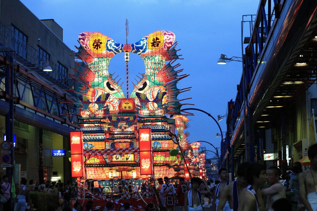
Noshiro Nebunagashi is a parade of large castle-shaped lanterns with over a thousand years of history. The lid of the lantern is decorated with a castle said to be modeled after Nagoya Castle and a giant killer whale lantern.
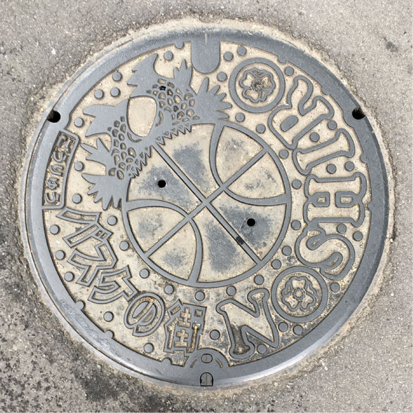
There is a basketball in the center. It appears to have a killer whale riding on it. The words "Basketball Town" are written in the bottom left, and the word "NOSHIRO" is written in large letters on the right. Inside the "O" in "NOSHIRO" is the rosehip flower, the flower of the former Noshiro city.
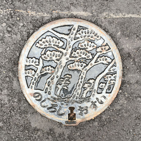
The sewage manhole cover features a design of the Japanese black pine, the tree of the former Noshiro city.
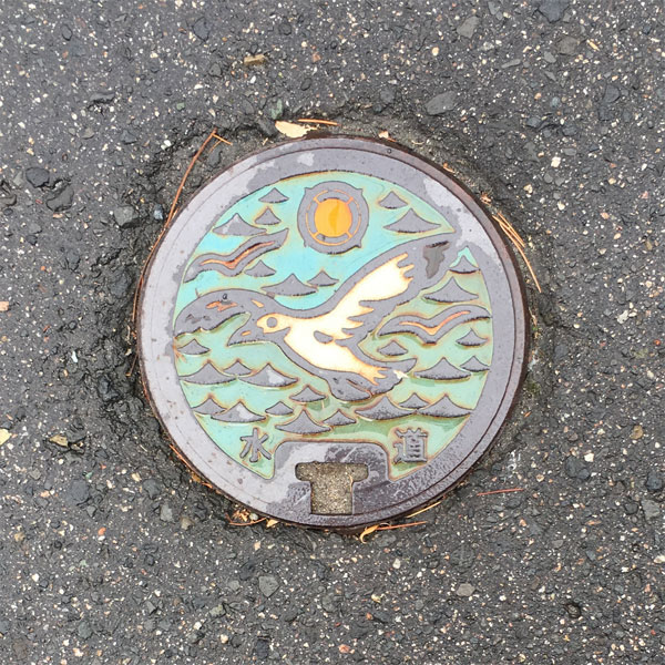
The lid features the bird of the former Noshiro city, the "seagull," and the old city emblem.
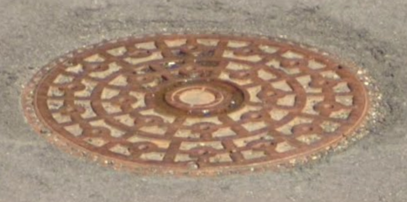
Manhole with city emblem in the center
Oga 男鹿市
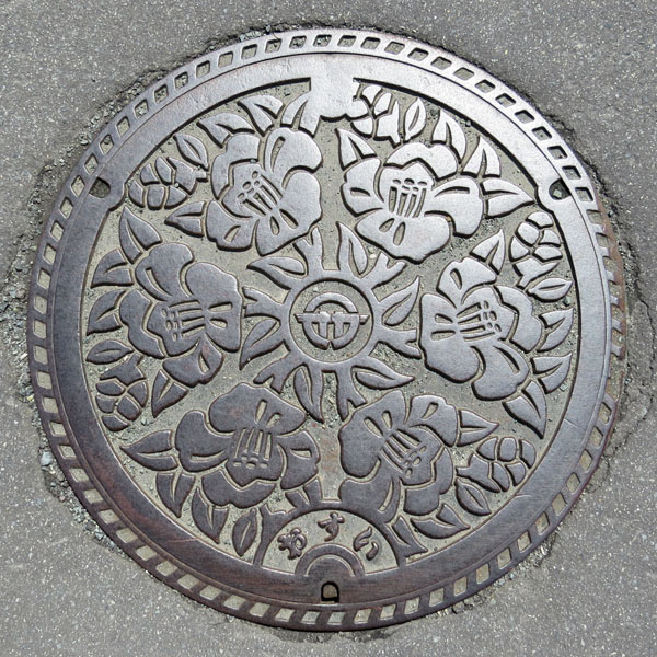
The design is of Oga city's flower, the camellia.
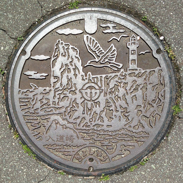
This fishing culvert cover from the Nyudozaki area depicts the Nyudozaki Lighthouse at the northern tip of the Oga Peninsula. The lighthouse is characterized by its striped pattern.
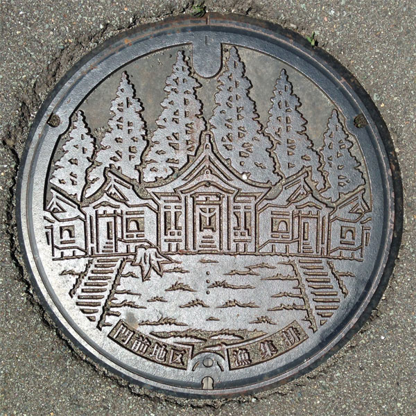
This fishing bin lid in the area around the shrine depicts the Goshado Hall of Akagami Shrine, a nationally designated Important Cultural Property.
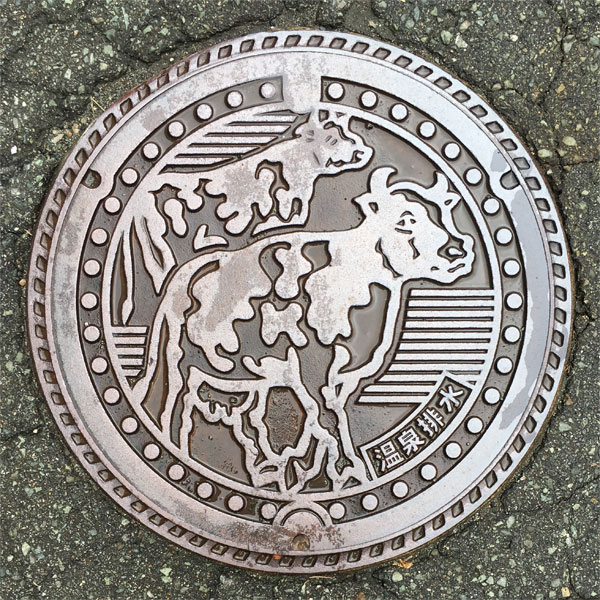
A hot spring drainage lid with two cows painted on it.
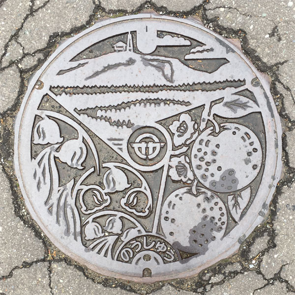
A drainage lid for the agricultural community in the Iriai district of Oga City.
The city emblem is in the center, depicting "Kanpuzan," the local specialty "Japanese pear," and lily of the valley. The Iriai Chuishi district of Oga City is famous for cultivating the northernmost Japanese pear, the "Oga pear."
Wakami 若美町
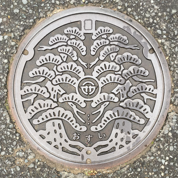
The Oga City emblem is in the center. The lid after the merger features the town's tree, the black pine.
Kazuno 鹿角市
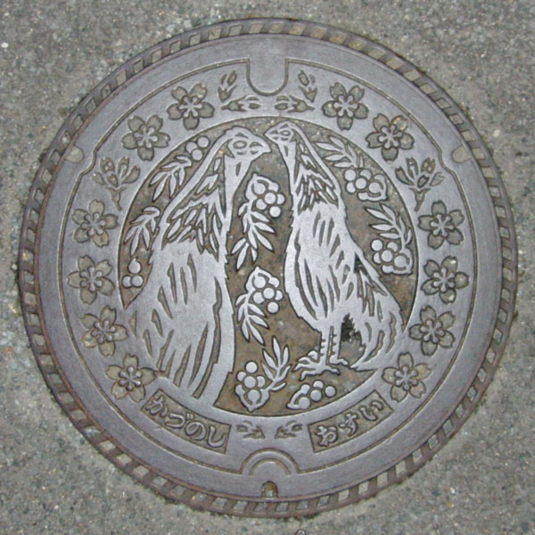
The design features the Kazuno City bird, the "Koeyoshidori" (fowl), the city tree, the rowan, and the city flower, the red mountain cherry. The "Koeyoshidori" is one of Japan's three longest-crowing chickens, along with the Totenko of Kochi Prefecture and the Karamaru of Niigata Prefecture.
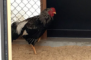
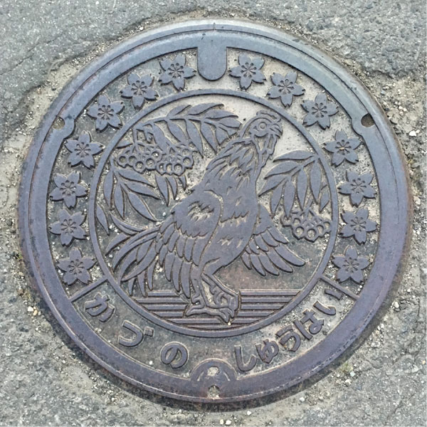
The flower and tree are the same, but there's only one Koe Ryo chicken left. This is the drainage cover for an agricultural village in the Nagata district of Yachi.
Katagami 潟上市
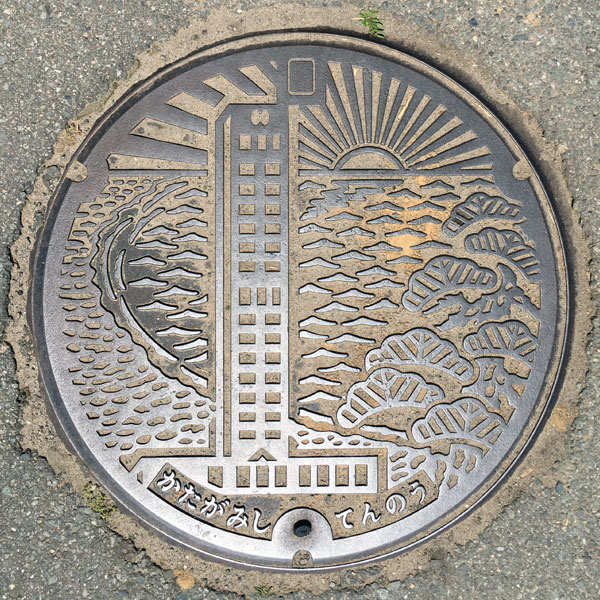
The lid depicts the 59.8m-tall observation tower "Tenno Sky Tower," which opened in 1991, as well as the town's tree, a black pine, and a sunset.
The lid dates from after the merger, and uses the design of the old Tenno Town, with the characters "Katagami-shi" and "Tennou" changed to read "Katagami-shi" and "Tennou" at the bottom.
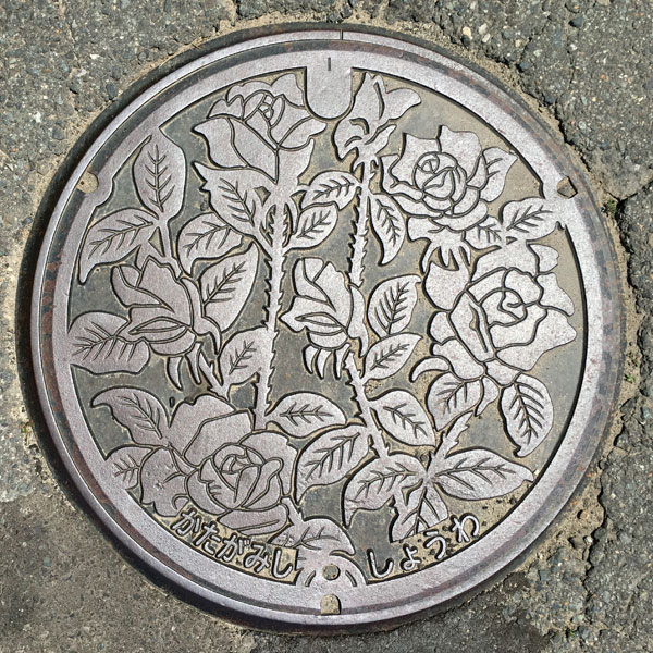
A sewage manhole cover featuring the rose, the flower of the former Showa Town and the new city.
The characters "Katagami City" and "Showa" are written at the bottom.
Tennou 天王町
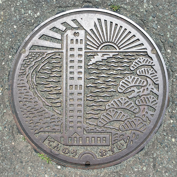
A manhole cover for sewage featuring the 59.8m-tall observation tower "Tenno Sky Tower," which opened in 1991, the town's tree, a black pine, and a sunset.
The characters "Tennou" and "Osui" are written at the bottom.
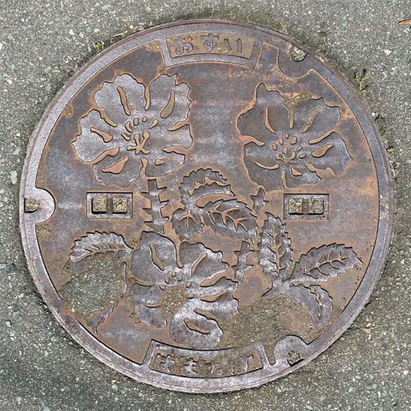
The sewage manhole cover features a depiction of the former Tennomachi flower, the rosehip.
Iitagawa 飯田川町
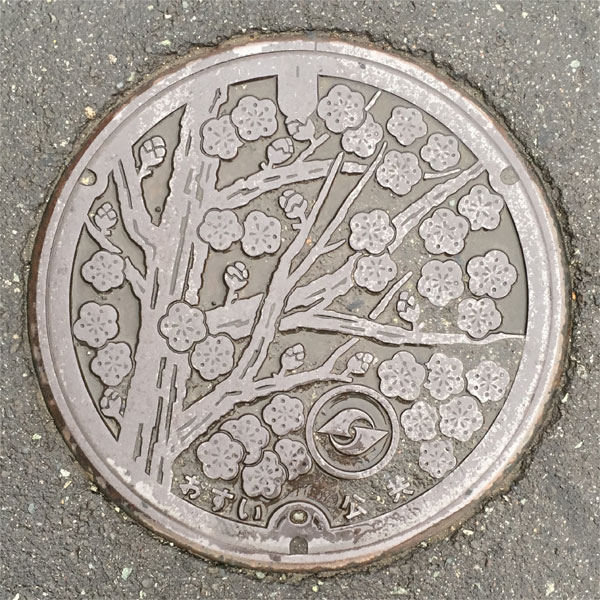
It depicts the town's flower, the plum tree.
Showa 昭和町
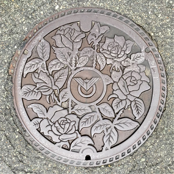
The town flower, the rose, is depicted on the lid. This is from before the merger, and the town emblem is in the center.
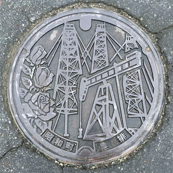
The Showa Toyokawa District Agricultural Community Sewerage Cover features the Toyokawa Oil Fields and the town flower, the rose, which was designated as a "Modern Industrial Heritage Site" by the Ministry of Economy, Trade and Industry (2007) as one of the "Modern Industrial Heritage Sites that tell the story of Japan's modern oil industry, which began in the Kanto-Koshinetsu region, including Niigata."
Semboku 仙北市
Kakunodate 角館町
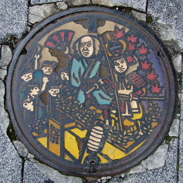
This lid depicts the floats of the 350-year-old Kakunodate Festival. It was probably in fairly good condition when it was first installed, but of all the lids installed in front of Kakunodate Station, this one is in such bad condition that it is the least peeling, and it is even impossible to tell what is depicted on some of them.
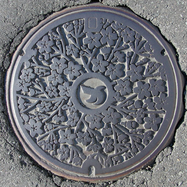
Kakunodate is known for its samurai residences, rows of cherry blossom trees, and birch crafts.
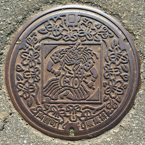
The lid of a farmer's festival offering from the Maego district features the Shiraiwa Sasara, a traditional folk art passed down in the Shiraiwa area for 400 years, and a cherry blossom design. The characters "Kakunodate Town" and "Farmer's Festival" are written at the bottom.
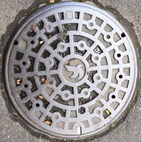
Town emblem in the center.
Tazawako 田沢湖町
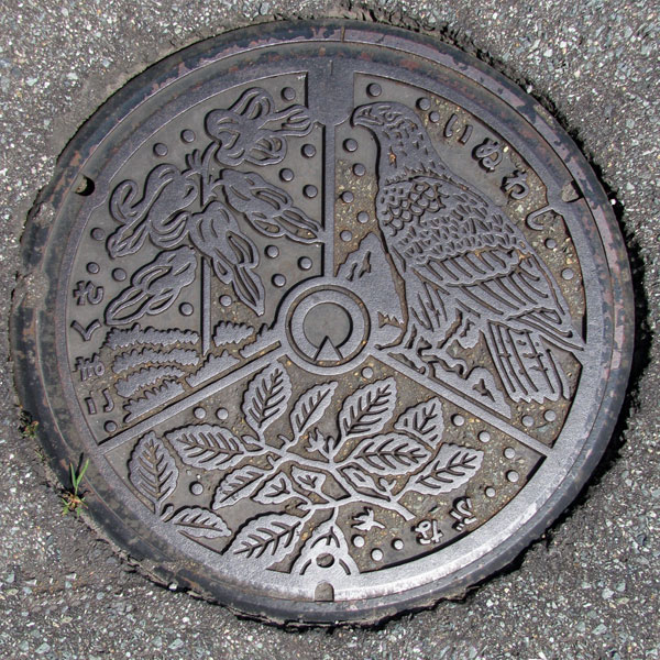
The design features the town flower of Tazawako Town at the time, the dicentra, the town tree, the beech, and the town bird, the golden eagle, all arranged together with the town emblem in the center. The town emblem is a simple design of Lake Tazawa and Mount Akita-Komagatake.
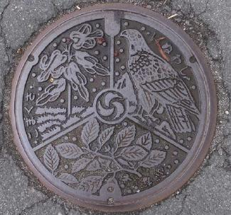
Same as above but with the new town emblem.
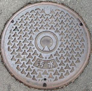
Town emblem in the center.
Town emblem in the center.
Nishiki 西木村
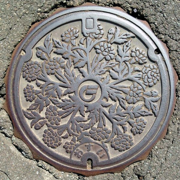
The village flower, the marigold, is depicted.
Indeed, marigolds are planted endlessly along the national highway in this area.
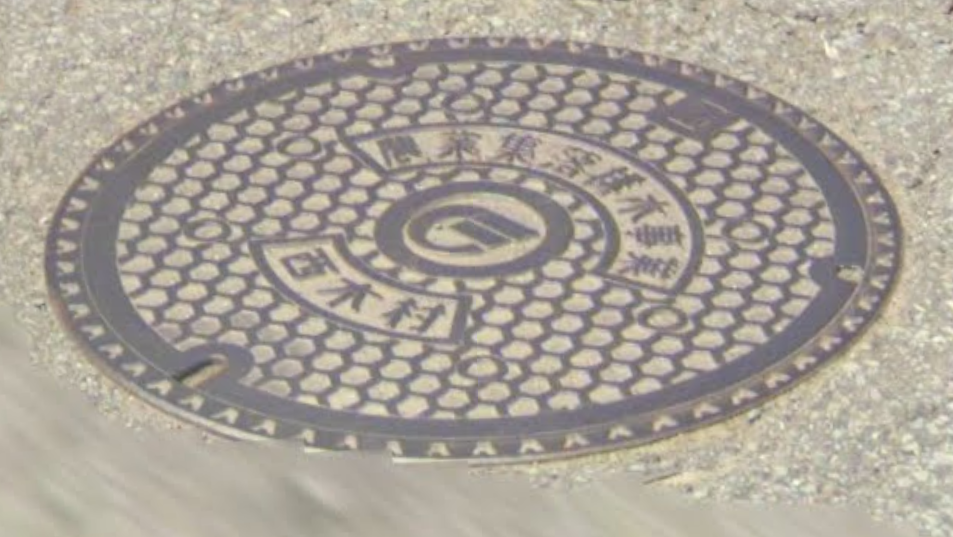
Town emblem in the middle
Daisen 大仙市
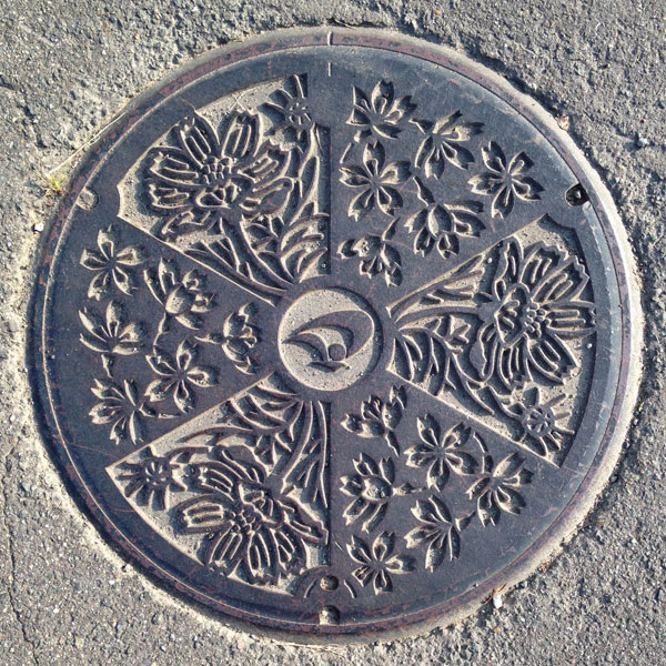
The Daisen City emblem is centered in a design featuring cosmos and Somei Yoshino cherry blossoms from the former Nakasen Town.
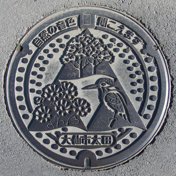
The design features zelkova trees, cosmos, and kingfishers. The words "Ota, Daisen City" are written at the bottom. This means the lid was made after the merger.
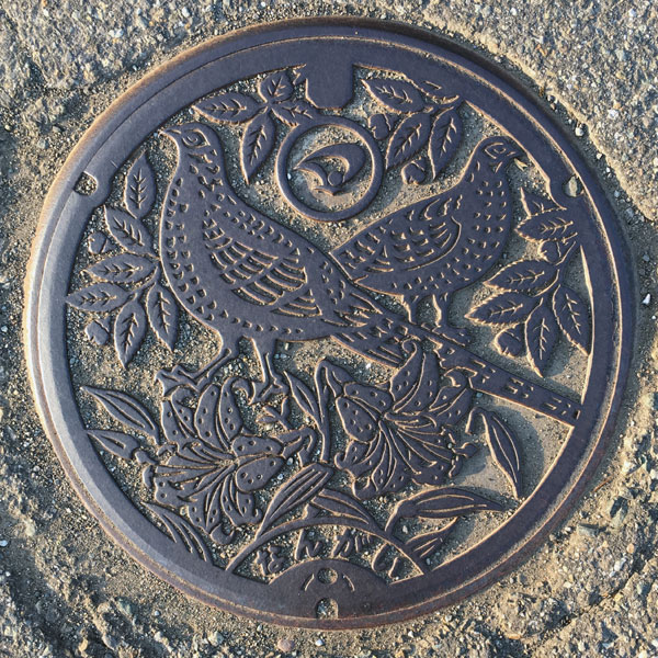
This public sewer cover in the Nangai district depicts the former Nangai village tree, the zelkova (Japanese zelkova), flower, and bird, the mountain lily. The Daisen City emblem is at the top, and the word "Nangai" (meaning "city") is written at the bottom.
Omagari 大曲町
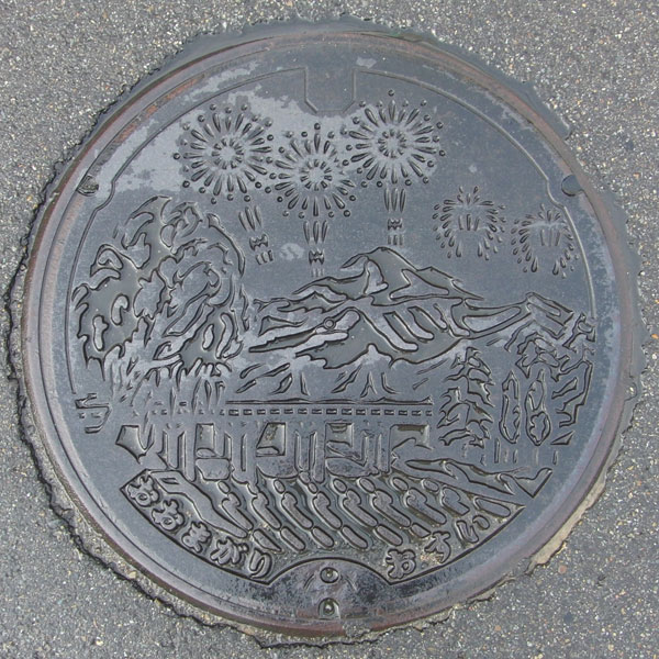
The design shows Omagari fireworks rising above the Maruko River.
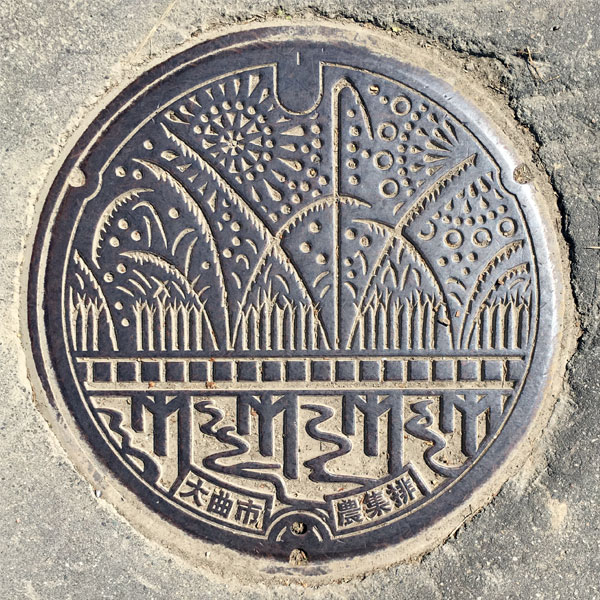
A farm waste collection and disposal lid from the Nakata Miyabayashi area depicting "Omagari Fireworks."
Kamioka 神岡町
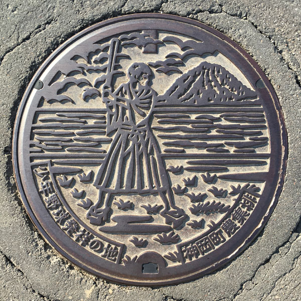
Agricultural collection and distribution lid from the eastern Kamioka district. The words "Birthplace of Youth Baseball" and "Kamioka Town Agricultural Collection and Distribution" are written at the bottom.
Nishisenboku 西仙北町
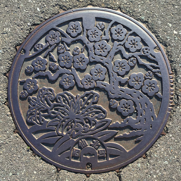
A sewage manhole cover decorated with the town's tree, the plum tree, and its flower, the mountain lily.
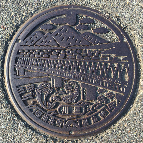
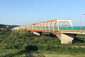
This agricultural waste collection and disposal canal cover in the Kawasato area depicts the "Kariwano Bridge," where Prefectural Route 10 crosses the Omono River.
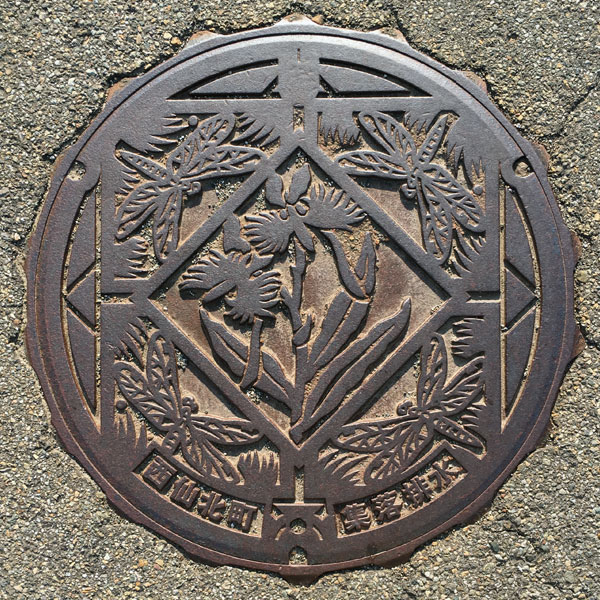
Agricultural drainage lid in the Ueno district. The words "Nishisenboku Town" and "Community Drainage" are written at the bottom.
The lid depicts an egret flower and a dragonfly from the Yunodai-Okata Tsunozawa Natural Environment Conservation Area, a designated wildlife conservation area in the prefecture.
Nakasen 中仙町
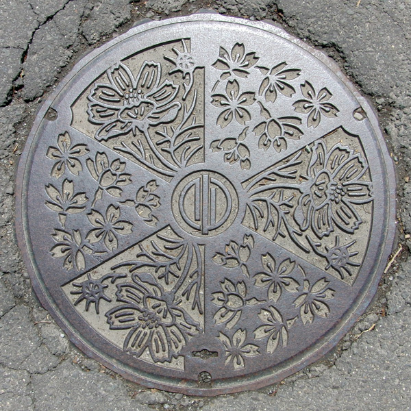
The design features cosmos and Somei-Yoshino cherry blossoms, with the Nakasen town emblem in the center.
Kyouwa 協和町
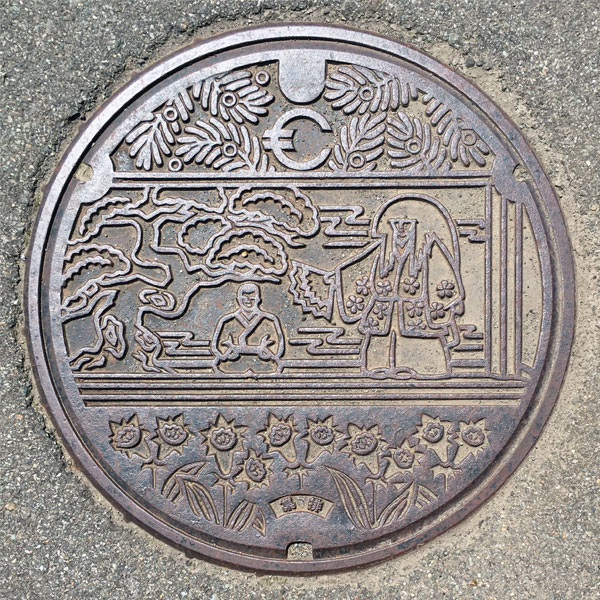
Sandwiched between the former Kyowa Town town tree, the "Onko" (Japanese anemone), and the town flower, the "Gentiana" (gentian), is the cover of the agricultural collection and distribution gate in the Kotane district, depicting the "Mahoroba Karamatsu Noh Theater," the only full-scale Noh stage in Akita Prefecture. The former Kyowa Town emblem is on top of the theater, and the characters "Collection and Distribution" are written at the bottom.
Senboku 仙北町
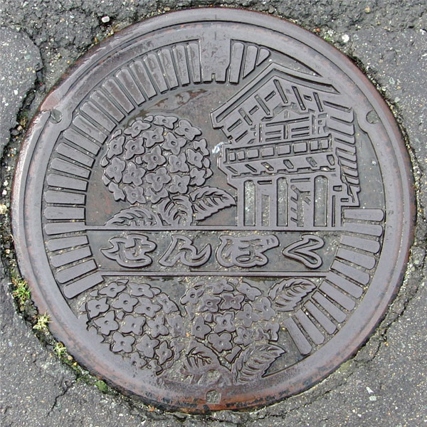
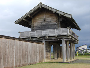
The design depicts the south outer gate, fence posts, and hydrangeas of the "Hotta Fortress" site.
Ota 太田村
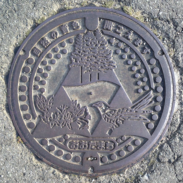
These are the symbols of the former Ota town: the red pine, the Japanese azalea, and the cuckoo.
Yokote 横手市
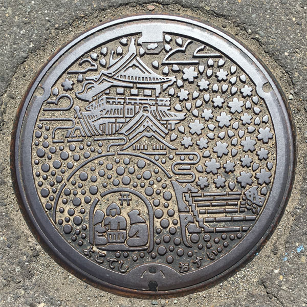
The design features a replica Yokote Castle tower, a snow pillow, and the city's flower, the cherry blossom.
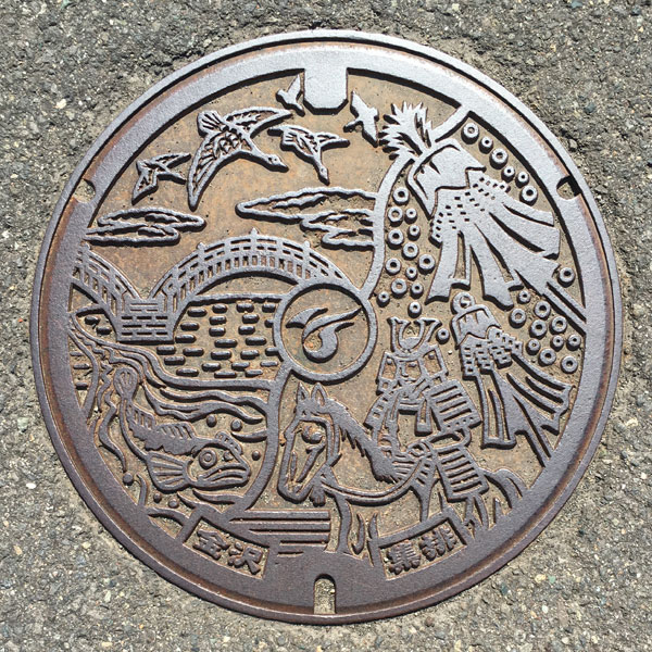
On the left side of the board, the "Wild Geese Bridge" and wild geese found in the park are depicted, and below that is the legendary "One-eyed Kajika." The warlord in the bottom right is probably Minamoto no Yoshiie. Above that, a "bonden" is depicted, competing to be the vanguard at Asahiokayama Shrine on Little New Year's Day, competing to be the vanguard in the most splendid head decorations.
Hiraka 平鹿町
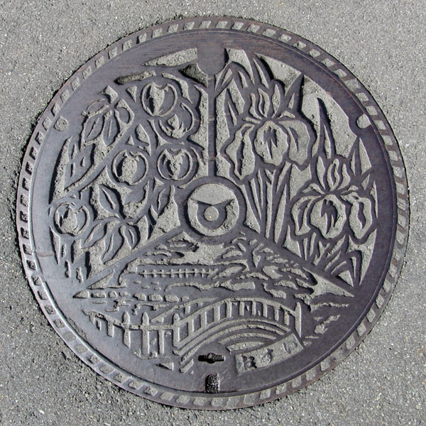
The design features the town's local specialty, apples, in the upper left, the town's flower, iris, in the upper right, and Asamai Park, where irises bloom, at the bottom.
Omonogawa 雄物川町
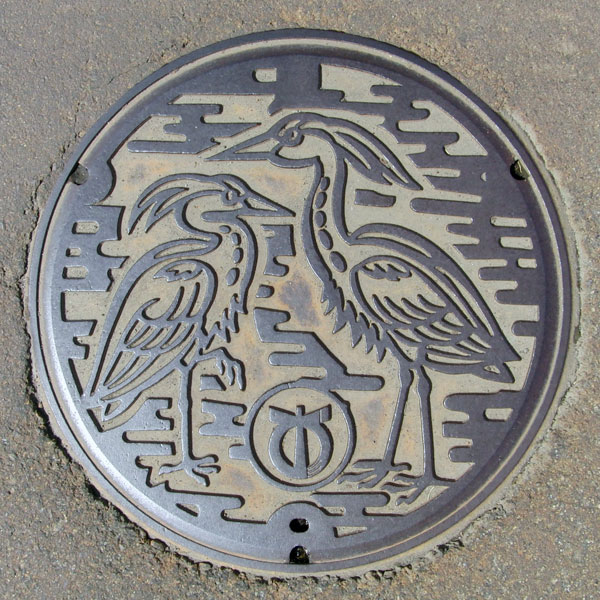
This is likely a Grey Heron.
Omori 大森町
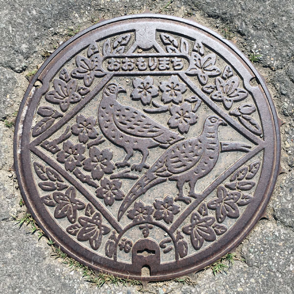
The Kawanishi Treatment District's agricultural waste collection and disposal lid features the town's bird, the pheasant, the town's tree, the cherry blossom, and the town's flower, the mountain azalea.
Jumonji 十文字町
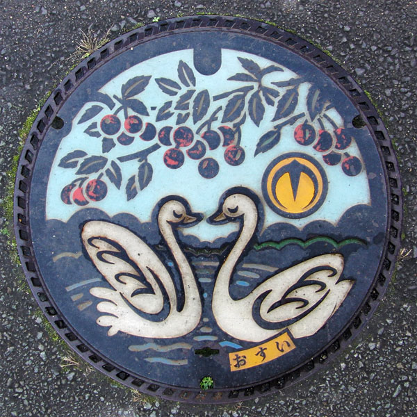
The design features cherries, a local specialty, and swans.
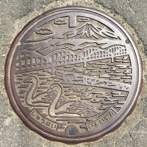
Agricultural collection and drainage lid in the Imaizumi area.
The "Imaizumi Bridge" crossing the Omono River and a swan are depicted. The mountain in the distance appears to be Mount Chokai. The characters "Shuhai" and "Imaizumi" are written at the bottom.
Sannai 山内村
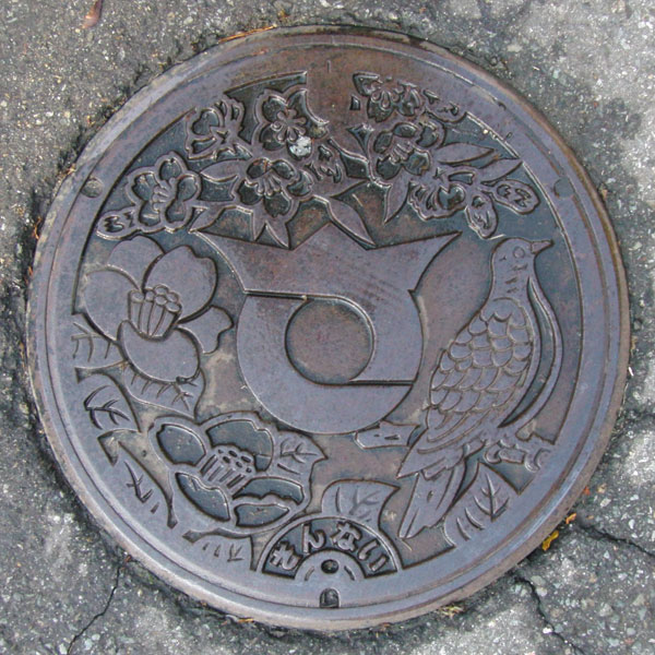
The design features the village flower, the snow camellia, the village tree, the red mountain cherry, and the village bird, the turtle dove (Japanese turtle dove). The village emblem features a large stylized "sa" character in the center.
Taiyu 大雄村
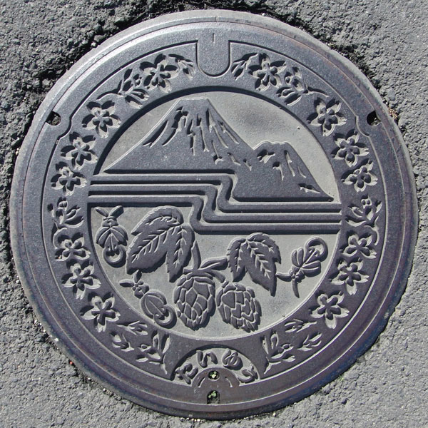
The design depicts Mt. Chokai, the Omono River, and the village flower, the hop. Three fireflies fly next to the hops. The village tree is apparently the Japanese red pine, but the surrounding area is likely covered in cherry blossoms.
Yurihonjo 由利本荘市
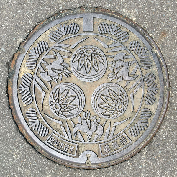
The lid of the agricultural distribution box has the old Honjo City's city flower "Iris" and folk craft "Honjo Gotenmari" on the inside of the circle, and "Japanese black pine" on the outside. The characters "Yurihonjo City" and "Agricultural distribution" are written on the bottom.
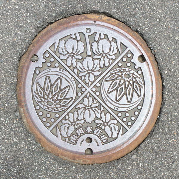
This small board is divided into four sections, alternating between the flower of the former Honjo City, the iris, and the folk craft "Honjo Gotenmari." The words "Yurihonjo City" are written at the bottom.
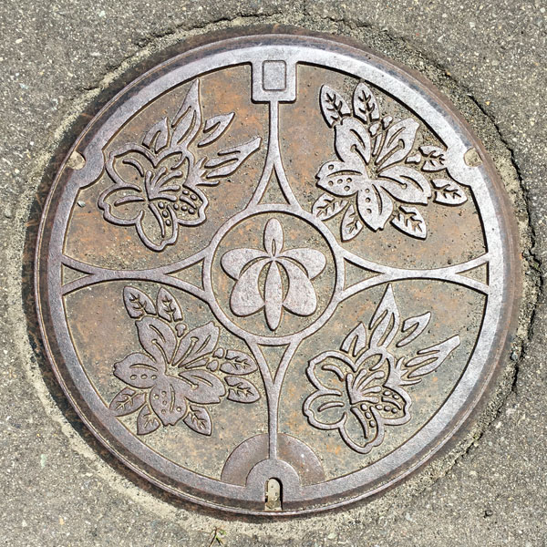
The lid has been updated from the former Ouchi Town design to the Yurihonjo City emblem.
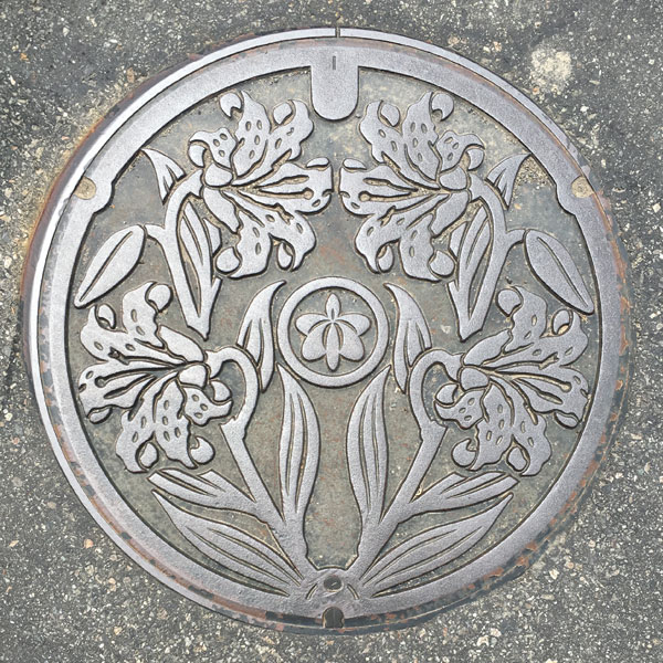
The Kubota Wastewater Treatment District's agricultural waste collection and disposal lid, with the former Yuri Town emblem replaced with the Yurihonjo City emblem.
Honjo 本庄市
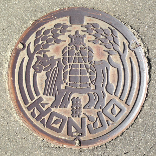
A cow carrying a sack of rice is depicted among the ears of rice. On top of the sack of rice is the old Honjo City emblem. Below the cow is the word "shuhai." "HONJO" letters at the bottom.
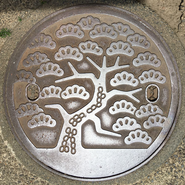
An extra-large sewage manhole cover with a design of the city's tree, the Japanese black pine.
This cover is almost identical to the cover in Murata Town, Miyagi. The difference is this cover does not have an inscription at the bottom.
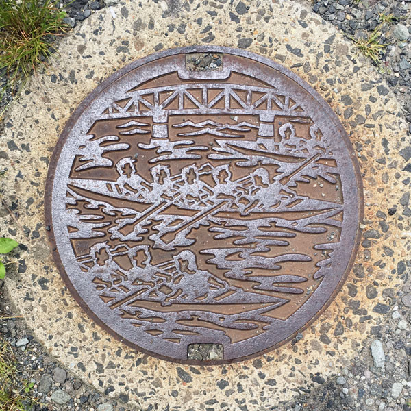
A sewage manhole cover depicts a boat being rowed on the Koyoshi River upstream of Honjo Bridge.
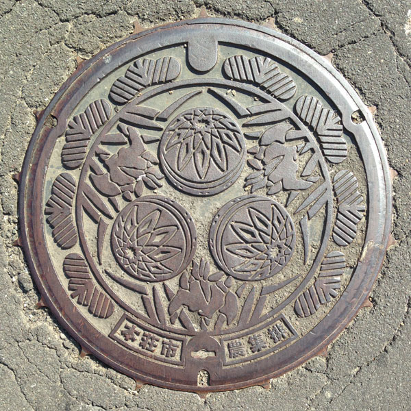
This agricultural waste collection and disposal lid in Ishizawa District 2 features the city's flower, the iris, the folk craft "Honjo Gotenmari," and the city's tree, the black pine, around the perimeter.
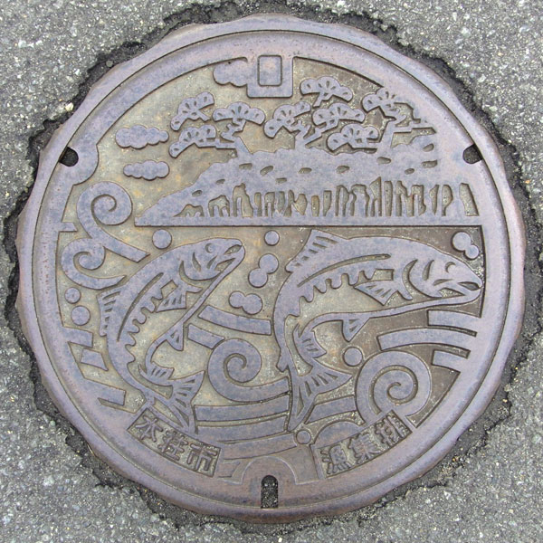
A fishing waste bin cover in Matsugazaki District 1 depicts cherry salmon swimming up the Koyoshi River and the city's tree, the Japanese black pine.
Yashima 矢島町
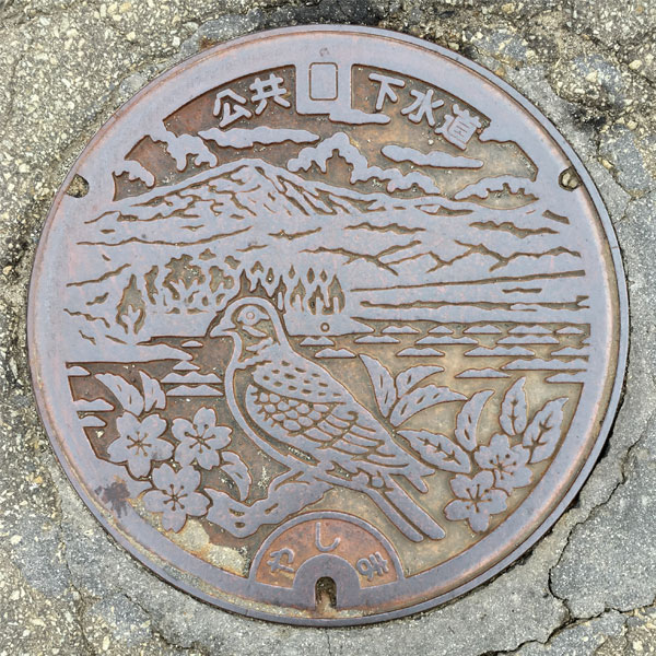
The town's flower, the mountain cherry, and its bird, the turtle dove, are depicted with Mount Chokai in the background. Behind the dove's head is likely the town's tree, the Chokai Murasugi.
Iwaki 岩城町
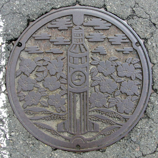
The "Pencil Rocket" is a small rocket that was researched and developed in the early days of Japanese space development. The "Akita Rocket Test Site," where launch experiments were conducted, was apparently located on Michikawa Beach in the former town of Iwaki.
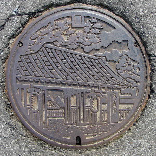
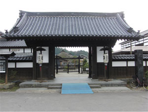
It depicts the gate of "Amasagi Village," a village that preserves historical sites and traditions.
Yuri 由利町
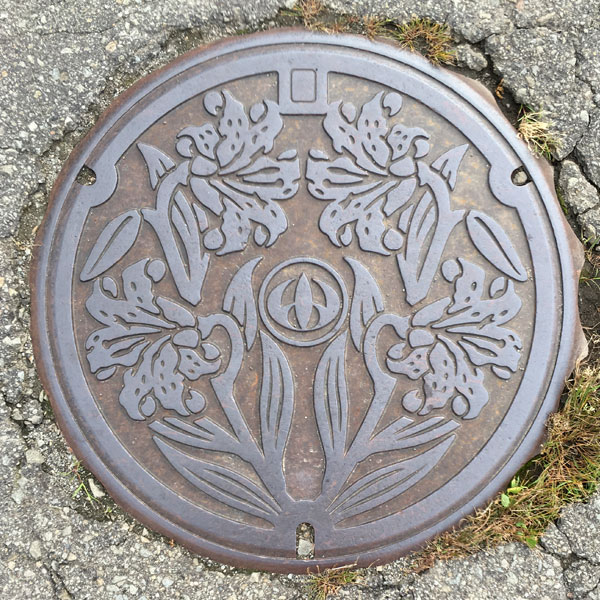
For sewage. The town flower, the lily, is painted symmetrically on both sides.
Nishime 西目町
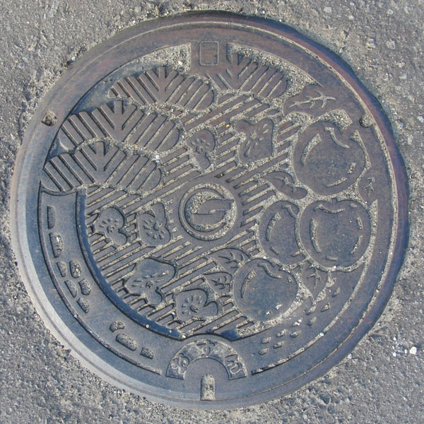
For wastewater treatment. The design features the town's tree, a black pine, as well as local specialties like apples and mushrooms.
Shiitake mushrooms have been cultivated in the Nishime area since the 1940s, and in recent years, bunashimeji mushrooms have been cultivated.
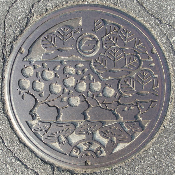
This rainwater canister features various designs of the town's tree, the black pine, and local specialties, apples and mushrooms.
Choukai 鳥海町
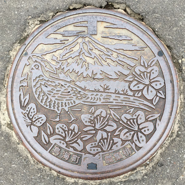
This agricultural waste disposal cover in the Fushimi-Kamikawauchi area features the town's bird, the pheasant, and the town's flower, the azalea, with Mount Chokai in the background. Incidentally, the town's tree is the beech.
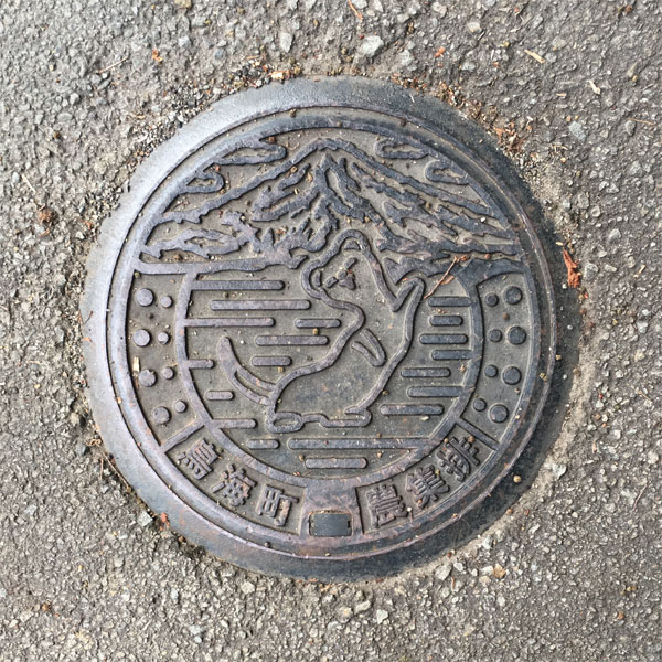
Posing with Mt. Chokai in the background is likely a stoat.
A small drainage system for agricultural communities in the Sasago area.
Town emblem in the center
Higashiyuri 東由利町
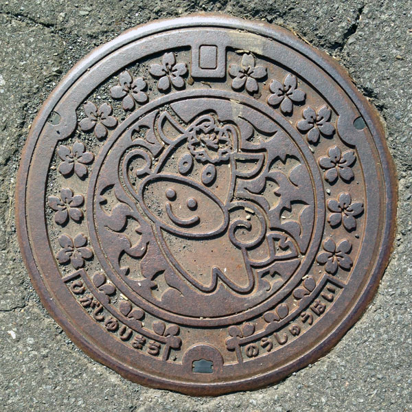
This is the cover of the agricultural waste collection bin in the Ogoto area. It's the image character of the former Higashiyuri town, "Mouta-kun." The same "Yellow Cherry Blossom" adorning the area around it shines on its forehead. For some reason, its tail is a ginkgo leaf.
Ouchi 大内町
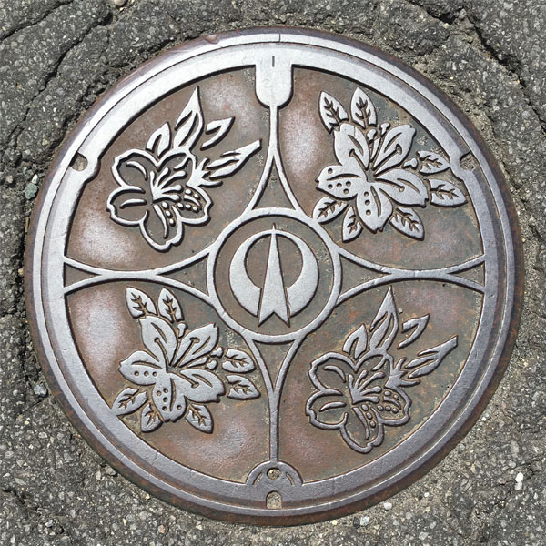
A sewage manhole cover featuring the town flower, the azalea, with the town emblem in the center.
Nikaho にかほ市
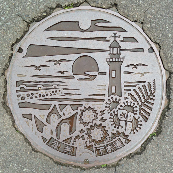
This manhole cover depicts a sunset over the Sea of Japan, a lighthouse, a breakwater, the flower of the former Nikaho town, the flower of Kanaura town, the flower of the Japanese quince, and the flower of Kisakata town, the Japanese nemu.
Nikaho 仁賀保町
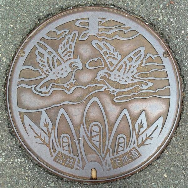
The design features the former Nikaho town flower, the skunk cabbage, and the town bird, the skylark.
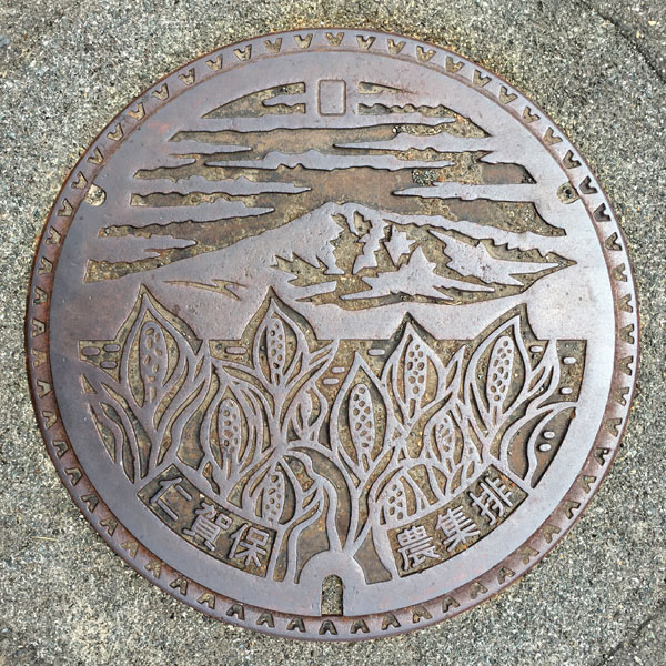
A lid for agricultural collection and distribution in the Domeki area, depicting Mount Chokai and Asian skunk cabbage. The words "Nikaho" and "Agricultural Collection and Distribution" are written at the bottom.
Konoura 金浦町
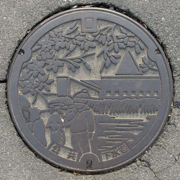
The single-coloured cover features the "Shirase Antarctic Expedition Memorial Museum", the Hanging Fish Festival and the cherry blossoms of the Cherry Blossom Viewing Party.
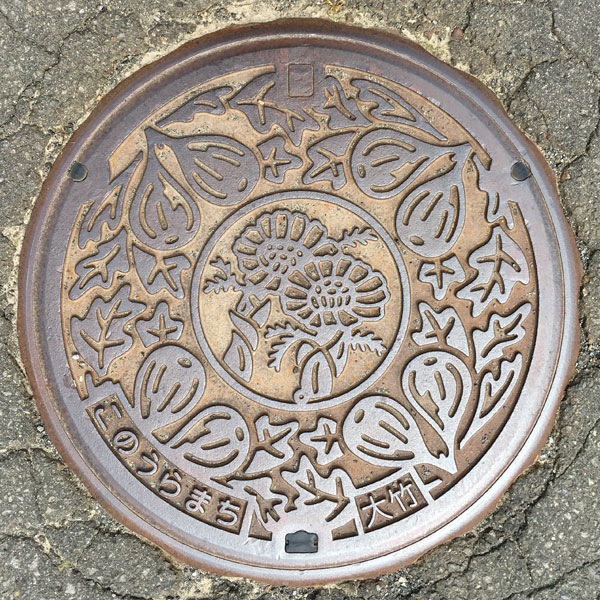
Agricultural collection and discharge lid for the Otake district. The characters "Konouramachi" and "Otake" are written at the bottom.
The "northernmost fig" grown in the Otake district and the town flower, the ambrosia, are depicted.
Kisakata 象潟町
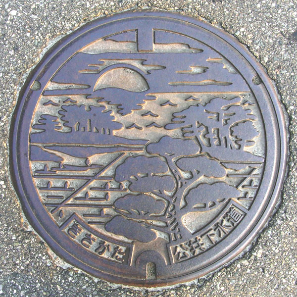
It depicts the scenery of Kisakata (Kujukushima and the Sea of Japan).
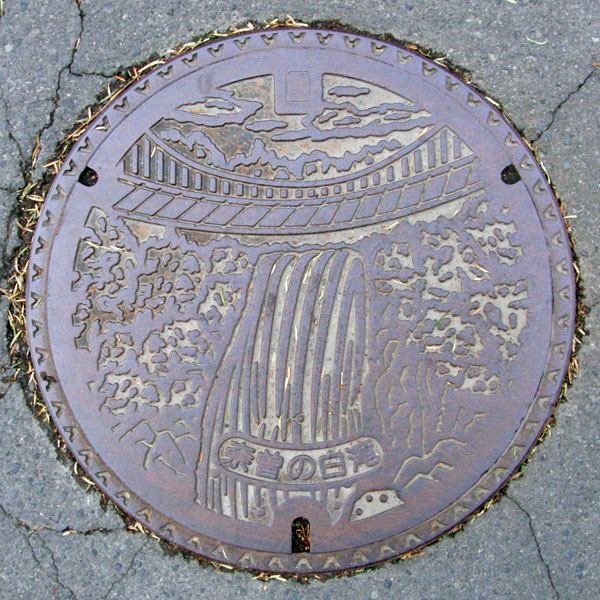
A lid for agricultural waste collection in the Kotaki area, depicting the Shirataki waterfalls of Naso.
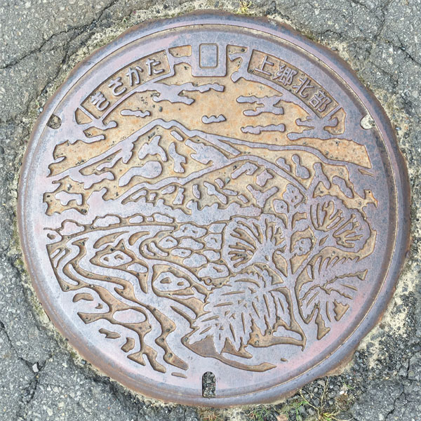
A lid for agricultural collection and discharge in the Kamigo Kita district. The characters "Kisakata" and "Kamigo Kita" are written at the top.
The mountain is Mount Chokai. The river is likely the Akaishi River that flows through this area. The town flower, the silk tree, is also depicted.
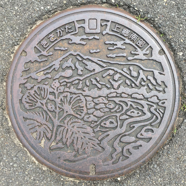
A lid for agricultural collection and discharge in the Kamigo Minami district. The characters "Kisakata" and "Kamigo Minami" are written at the top.
Like the lid above, Mount Chokai is depicted, but the river and silk trees are reversed. This may be because the Naso River flows through this area.
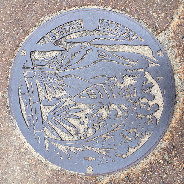
Agricultural collection and discharge lid from the Nishinakanosawa area. The characters "Kisakata" and "Nishinakanosawa" are written on the top.
Mt. Chokai and bamboo are clearly visible, but it's difficult to make out.
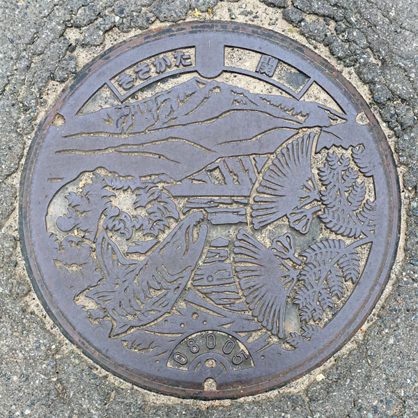
Agricultural waste collection and disposal lid from the Seki area. The characters "Kisakata" and "Seki" are written on the top.
The lid depicts Mount Chokai, the town's flower, the silk tree, and salmon swimming up the Naso River.
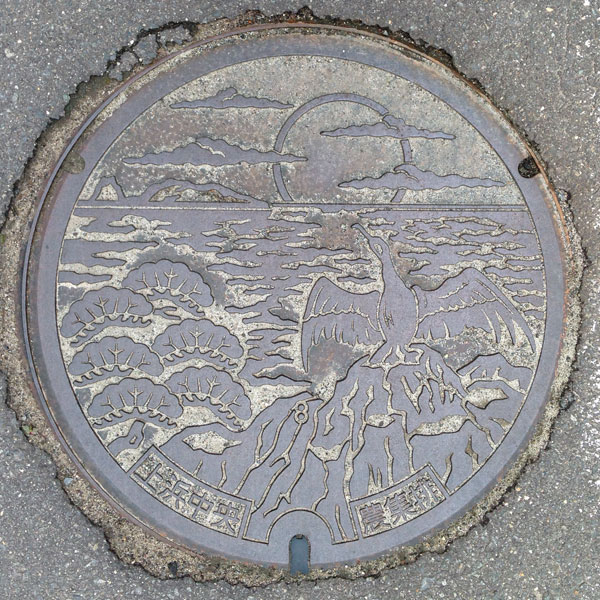
The agricultural waste collection and disposal lid in the Kamihama Central district depicts the former town tree, a black pine, and the former town bird, a Japanese cormorant, against the backdrop of a sunset over the Sea of Japan.
Yuzawa 湯沢市
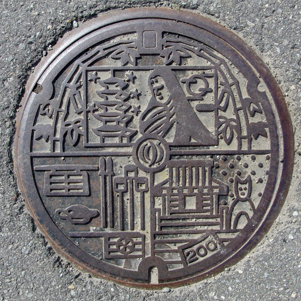
The design is from the old Yuzawa City, with the city emblem in the center being the new city emblem after the merger.
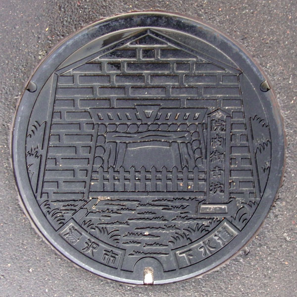
The design is of the Miyuki Mine at the Innai Silver Mine.
After looking at the photo, I noticed that "Yuzawa City" was written on the bottom left. It was the cover of the public sewer for the Innai Treatment District (Innai was formerly Ogatsu Town) after it merged with Yuzawa City.
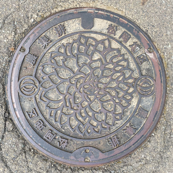
The Matsuoka district agricultural settlement drainage lid has the new city emblem on both sides. The words "Agricultural drainage" and "Matsuoka district" are written on the top and bottom. A large dahlia flower is painted in the centre.
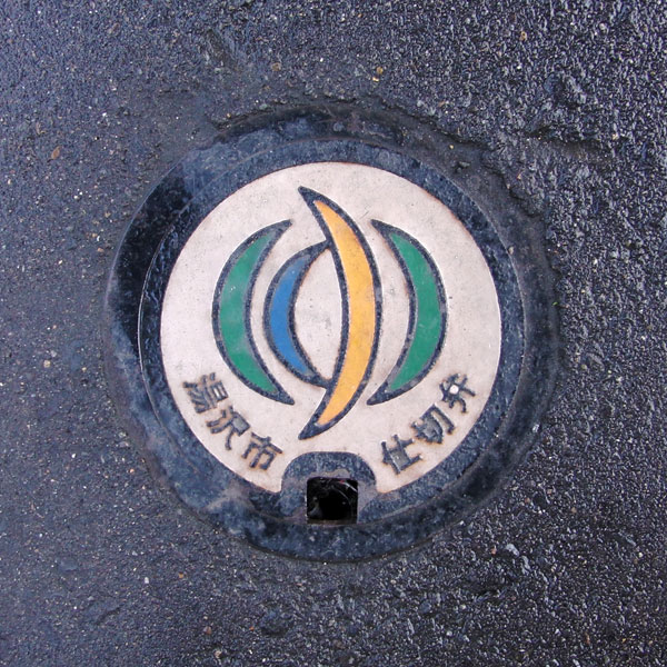
The old city emblem also featured the character "Yu," but this valve features the new city emblem (enacted on July 18, 2005), which uses curves and is more colorful. It is quite small.
Yuzawa 湯沢市
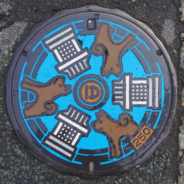
The design is of the Dog Festival, one of Yuzawa's three major festivals.
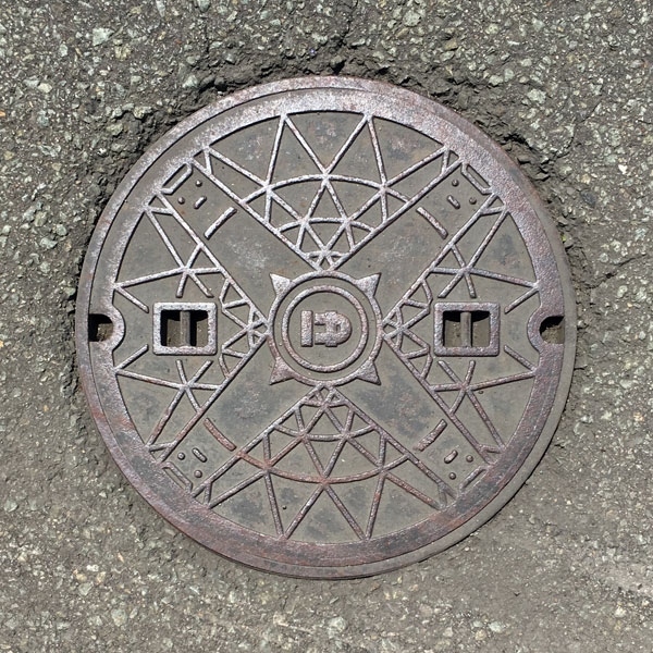
It looks like a geometric pattern, but on closer inspection you can see the face of a dog. Perhaps it's the cover of a sewage manhole.
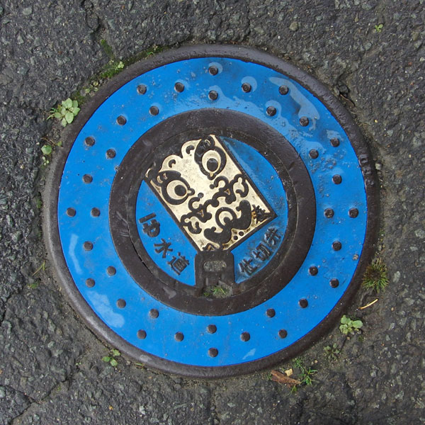
A valve with a "Yuzawa Kite" design.
Inakawa 稲川町
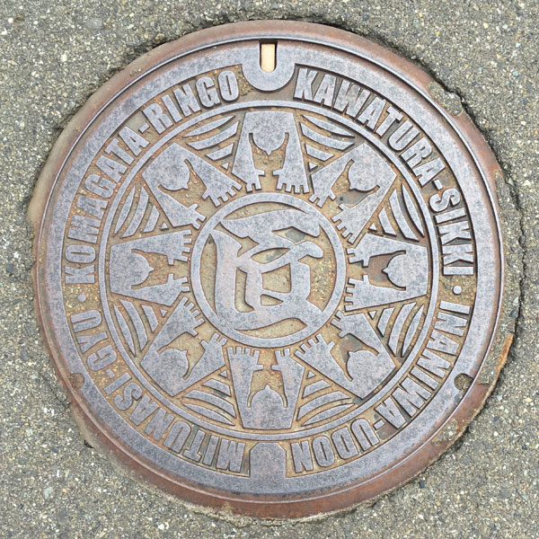
The surrounding text is written in Roman letters and reads "Kawatsura Lacquerware," "Inaniwa Udon," "Mitsunashi Beef," and "Komagata Apples." All of these are local specialties and famous products of the former Inagawa town, and the character "Takumi" (artisan), which means that these techniques and traditions are supported by human hands, is a message that we will protect and nurture them with everyone's hands.
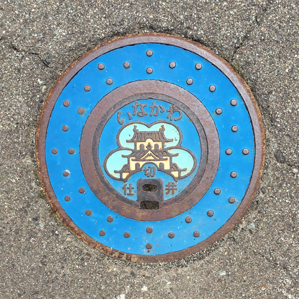
The cover of the valve depicts Onodera's Inaniwa Castle in the center.
Minase 皆瀬村
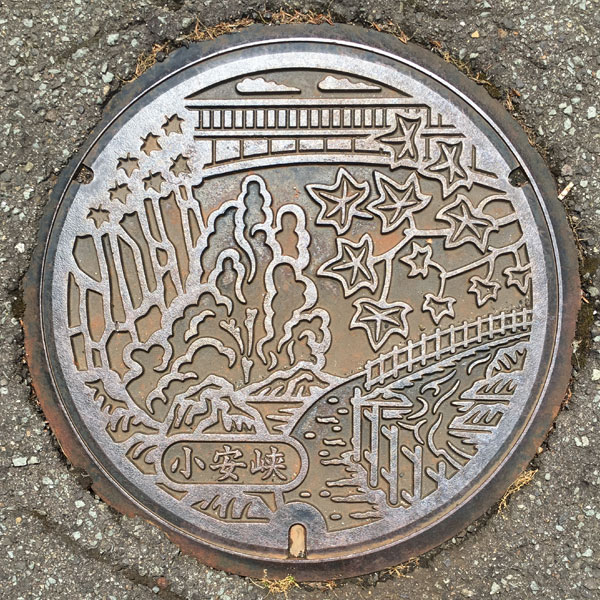
Looking up from the promenade that passes by the steaming hot spring, you can see Kawarayu Bridge. In autumn, the town's tree, the "sugar maple," adds a touch of color. The text "Oyasu Gorge" appears on the bottom left.
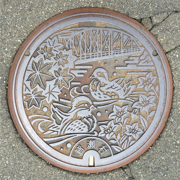
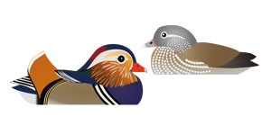
In the background is the Sugao Bridge, a prefecturally designated structure that crosses the Minase River at Minase in Yuzawa City. The village bird, a mandarin duck, is depicted between the village tree, the Sue maple, and the village flower, the bellflower. The bird in the background is thought to be a female, as there are spots visible on its chest, while the bird in the foreground has ginkgo feathers, suggesting it is a male.
Fujisato 藤里町
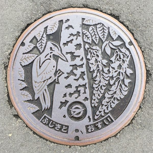
A sewage manhole cover with a design of the town's tree, the beech, the town's flower, the wisteria, and the town's bird, the black woodpecker.
Happo 八峰町
Hachimori 八森町
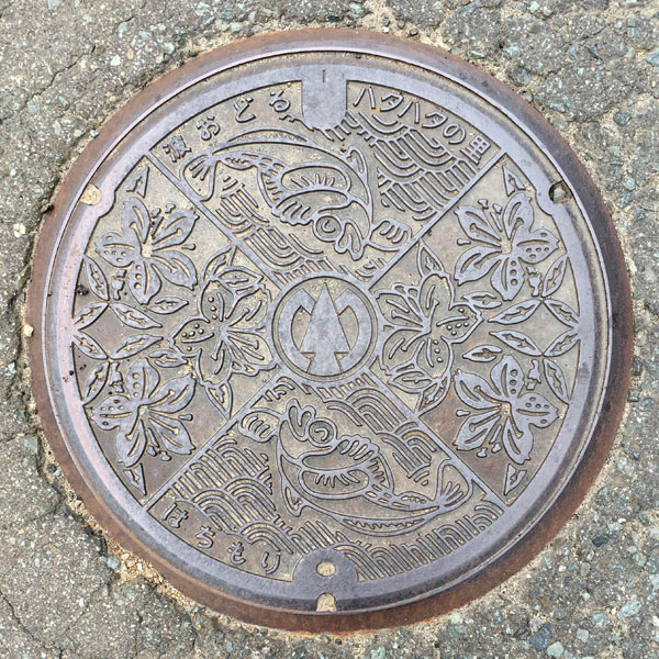
The town emblem is in the center, the town's fish, the sandfish, is depicted point-symmetrically above and below, and the town's flower, the azalea, is depicted line-symmetrically on the left and right. The top part reads "The Village of Dancing Sandfish," and the bottom part reads "Hachimori."
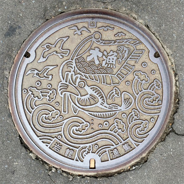
The Iwadate Fishing Village drainage lid features a smiling sandfish waving a fishing flag, whether aware of the misfortune that befalls it or not. Flying above the churning waves is likely a seagull. The seagull is the official bird of Happo Town.
Minehama 峰浜村
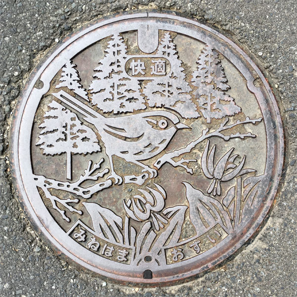
A manhole cover for sewage treatment features the village tree, the Japanese cedar, the village bird, the Japanese bush warbler, and the village flower, the dogtooth violet. What does "comfort" mean?
Kosaka 小坂町
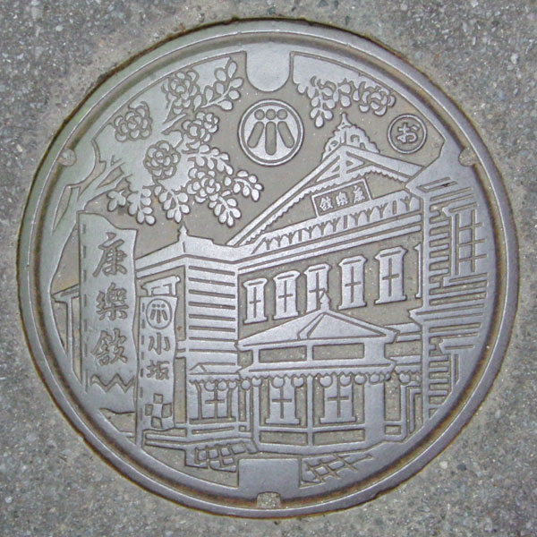
The design is of the Korakukan, one of Japan's oldest theaters. It opened in 1910 and was temporarily closed, but is still in operation today. It was designated an Important Cultural Property of Japan in 2002.
Mitane 三種町
Kotooka 琴丘町
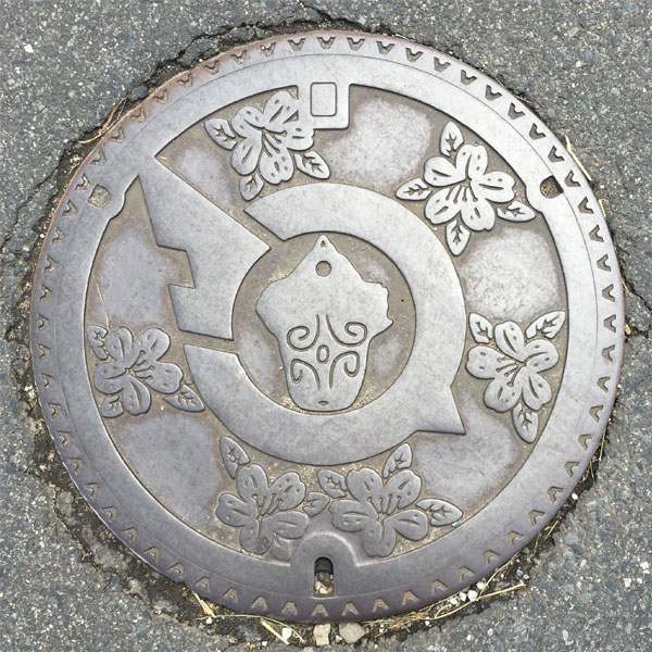
The town emblem features a "seal-shaped clay whistle" excavated at the Takaishino ruins, and a manhole cover surrounded by the town flower, the mountain azalea.
Yamamoto 山本町
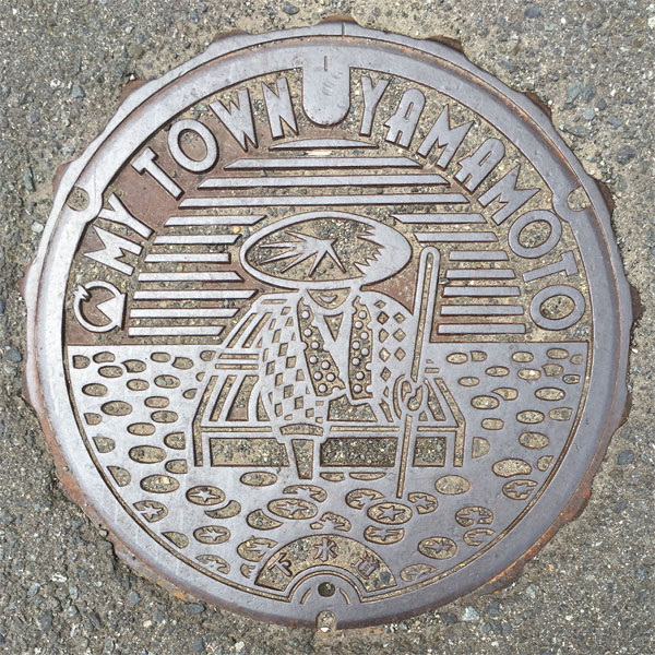
The town emblem and the words "MY TOWN YAMAMOTO" are displayed alongside a scene of people picking Junsai, Japan's largest producer of Junsai. At the bottom, the word "sewer" is written.
Hachiryou 八竜町
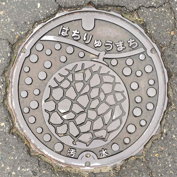
A sewage manhole cover with a picture of the local specialty melon.
Gojome 五城目町
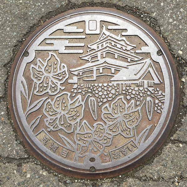
A sewage manhole cover with a picture of Gojome Castle and the town flower, the mountain lily.
Hachirogata 八郎潟町
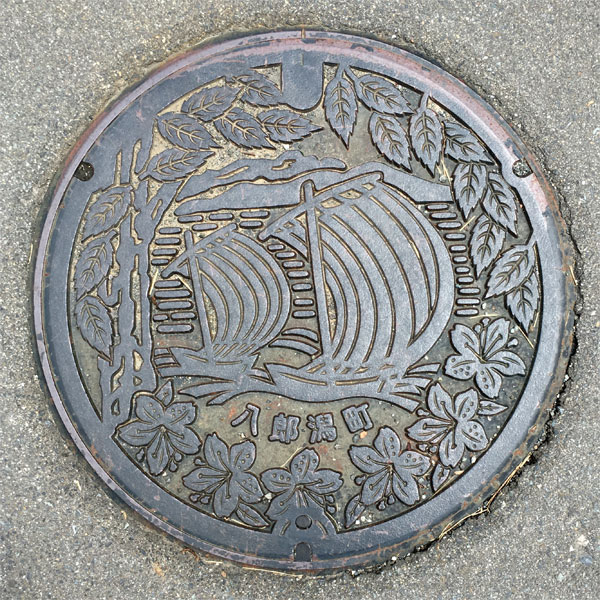
The town's tree, the zelkova, and the town's flower, the azalea, are around the perimeter, with a scene of floating "utasebune" boats on the inside and the words "Hachirogata Town" at the bottom.
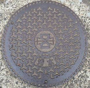
Town emblem in the middle
Ikawa 井川町
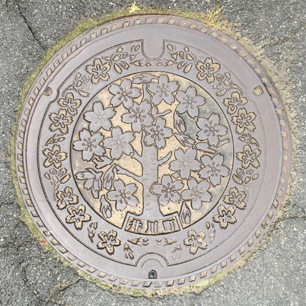
There are cherry blossoms all around and inside too. There is the Japan National Flower Garden, where 2,000 cherry trees of 200 different species are planted, and the town flower is also the cherry blossom.
Misato 美郷町
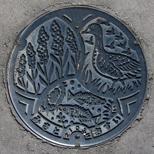
This is a lid from Misato Town after the merger. It features the town's flower, lavender, bird, wild goose, and fish, the Japanese name for the 'Ibaratomiyo' (sparrow-eared geese). Although not depicted on the lid, the town's tree is the Japanese red pine. Apparently, there are many Japanese red pines lining the streets of the town.
Senhata 千畑町
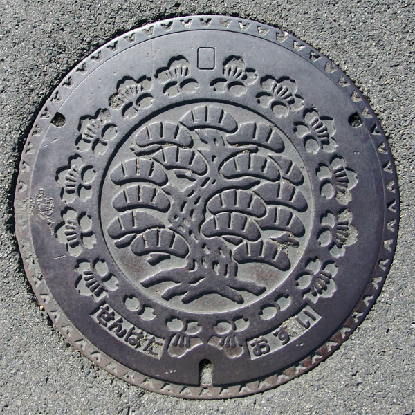
In the center is a red pine, which is also the tree of Misato town today. Surrounded by blossoms of the town's tree, the red mountain cherry.
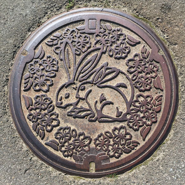
The cover of the agricultural waste collection bin in the Kamihataya district features the "Hatayama Rabbit," a rabbit that has been bred and raised in the Hataya district, in the center, surrounded by the old town tree, the "Beniyama Cherry."
Rokugou 六郷町
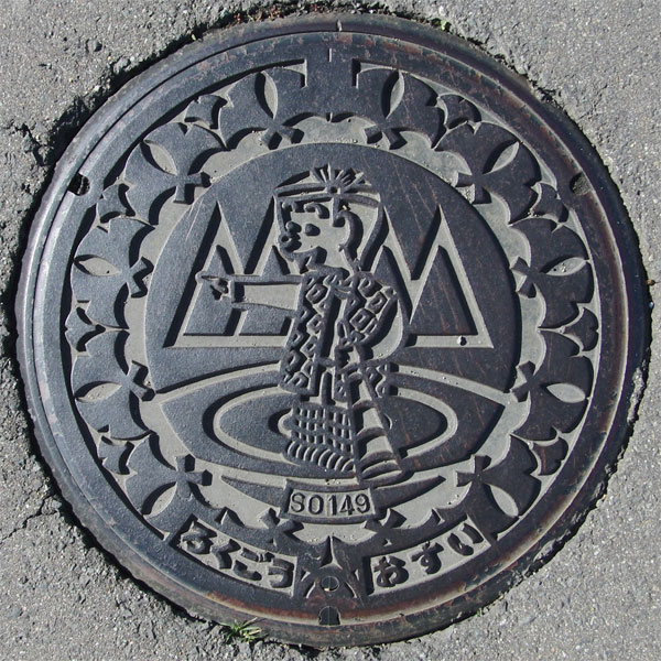
"Yu-chan" is a town character similar to the protagonist of Masashi Ueda's four-panel comic "Kobo-chan." Considering Rokugo, a town of springs, "Yu" likely refers to "spring." The town is also home to a famous spring water market called "Yutaro" and a handmade workshop called "Yuko-chan." There's a theory that this character is a paternal relative of Kobo-chan, but no research has revealed anything definite.
Sennan 仙南村
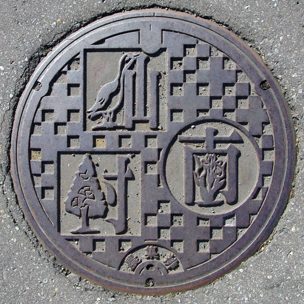
This design, combining letters and pictures, looks like something you might see in a junior high school art class. The character for "sen" (female character) is a wild goose, the village bird; the character for "minami" (southern character) is a Japanese iris, the village flower; and the character for "ki" (village character) is a ginkgo, the village tree. It's a very detailed piece.
Ugo 羽後町
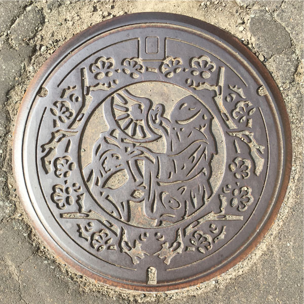
The painting depicts the blossoms of the town's plum tree, and the Nishimonai Bon Odori dance, one of Japan's three major Bon Odori festivals, on the inside.
The Nishimonai Bon Odori dance is famous for its "Osha-odori" (Dance of the Dead), in which participants hide their faces with straw hats or black Hikozukin (hoods worn over the head with only eye holes cut out). It has been designated a National Important Intangible Folk Cultural Property.
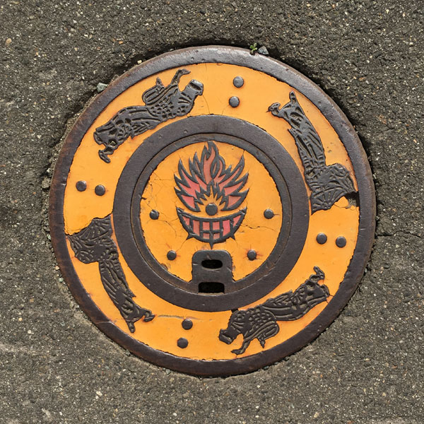
A hand-hole cover with Bon Odori dances on all four sides and a bonfire in the center.
Ogata 大潟村
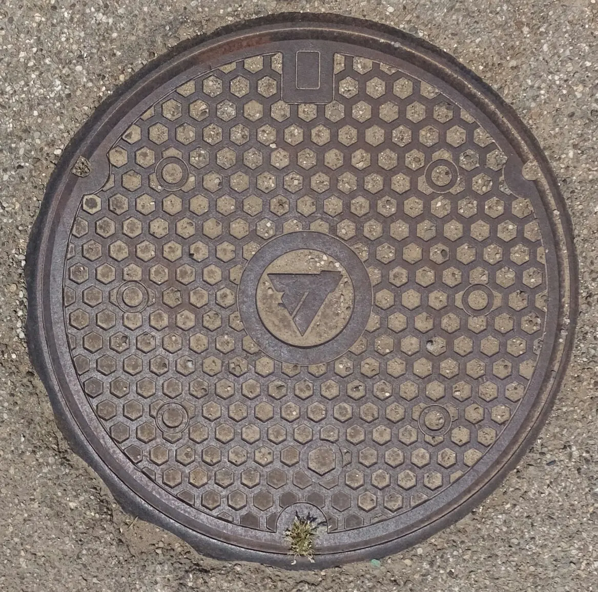
Village emblem in the middle.
Kamikoani 上小阿仁村
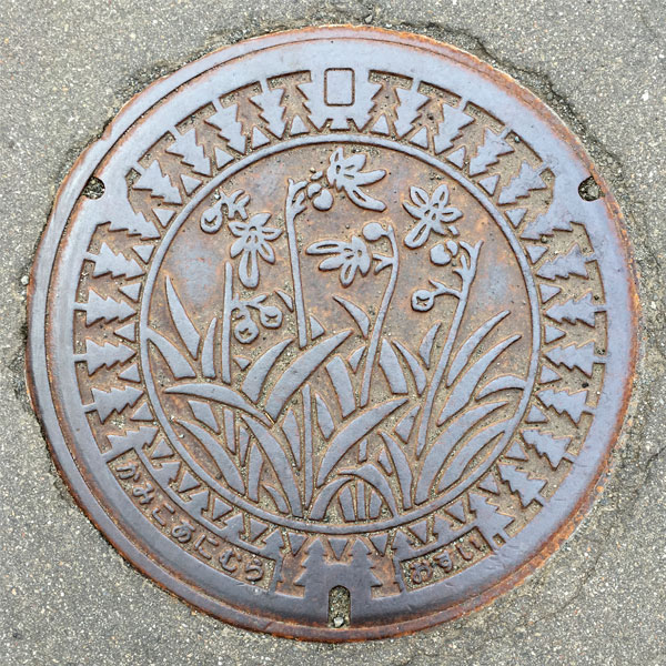
A sewage manhole cover with the village tree, the knotty cedar, around it and the town flower, the dwarf plover, painted on the inside.
Higashinaruse 東成瀬村
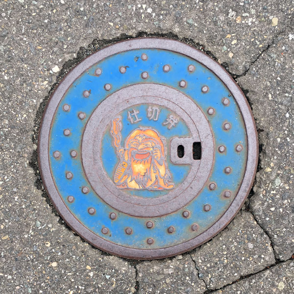
The catchphrase is "A refreshing village of hermits," so even the signboards feature hermits.
Akita Prefecture 秋田県
Yoneshiro River Basin Sewerage System 米代川流域下水道
This is the cover for Akita Prefecture's Yoneshiro River Basin Sewerage System.
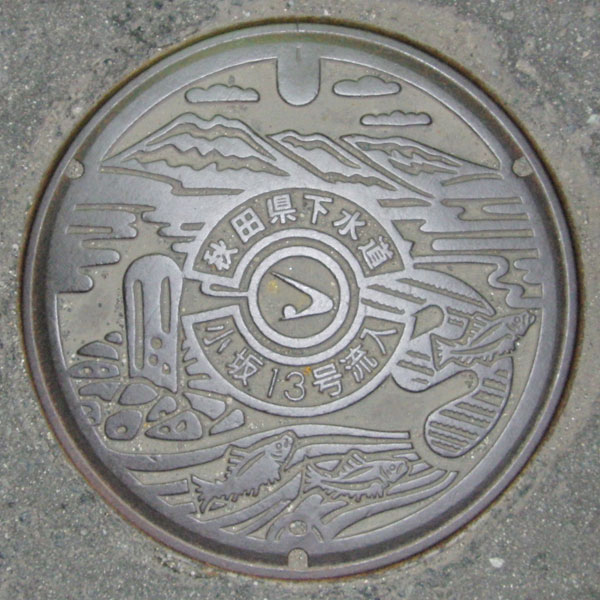
In the center is the Akita Prefecture emblem. Above and below it are the words "Akita Prefecture Sewerage System" and "Kosaka Route 13 Flow."
The mountain is likely the Ou Mountains. The image on the right may be Lake Towada. The Oyu Stone Circle is depicted on the left, and a fish is depicted in the lower right.